TopoQuest Logo
Do you find TopoQuest useful?
Help keep TopoQuest running and adding new maps/features by donating!
Bitcoin:  19c7KJd3qBynnjoSw5npx9KScwjBe4ifkT
Litecoin:  LXs6TkuXGGXo1vDsWCkWVdjQX94eUKd6ui
Home View Maps Find Maps Find Places Resources & Links


East Troy, Pennsylvania Topographic Map

USGS Map Title: East Troy, PA
USGS Map MRC: 41076G6
DRG (GeoTIFF) Download: o41076g6.tif


Neighboring USGS Topographic Map Quads:


  Gillett, PA  
41076H7
 

  Bentley Creek, PA  
41076H6
 

  Sayre, PA  
41076H5
 

  Troy, PA  
41076G7
 

  East Troy, PA  
41076G6
 

  Ulster, PA  
41076G5
 

  Canton, PA  
41076F7
 

  Leroy, PA  
41076F6
 

  Powell, PA  
41076F5


Map MRC Location:

N42°
W77°
N42°
W76°
H8 H7 H6 H5 H4 H3 H2 H1
G8 G7 G6 G5 G4 G3 G2 G1
F8 F7 F6 F5 F4 F3 F2 F1
E8 E7 E6 E5 E4 E3 E2 E1
D8 D7 D6 D5 D4 D3 D2 D1
C8 C7 C6 C5 C4 C3 C2 C1
B8 B7 B6 B5 B4 B3 B2 B1
A8 A7 A6 A5 A4 A3 A2 A1
N41°
W77°
N41°
W76°

East Troy, PA USGS 1:24K Topographic Map Preview:
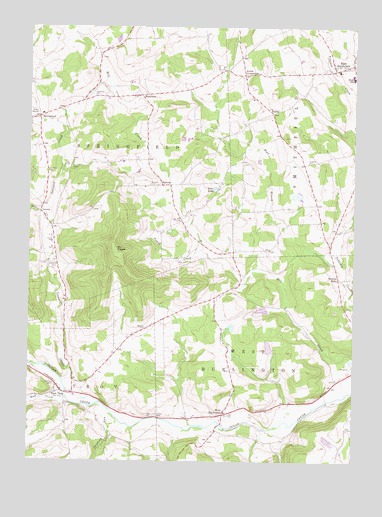
East Troy, PA USGS Topographic Map
Click on map above to begin viewing in our Map Viewer.

This topographic map contains these locations and features:
Feature Name Type Latitude Longitude GNIS ID View Map
AKM AirfieldAirportN41.8387°W76.7455°2442975View Map
Allen CemeteryCemeteryN41.8727°W76.6553°2776399View Map
Ayers CrossroadsPopulated PlaceN41.8615°W76.6669°1203003View Map
Ballard CemeteryCemeteryN41.7882°W76.7049°1168667View Map
Bourne MillsPopulated PlaceN41.8026°W76.6302°1198226View Map
Brace CreekStreamN41.8190°W76.7419°1170109View Map
Canfield RunStreamN41.7634°W76.7177°1192237View Map
East SmithfieldPopulated PlaceN41.8645°W76.6255°1173875View Map
East Smithfield CemeteryCemeteryN41.8647°W76.6252°2776422View Map
East Smithfield Post OfficePost OfficeN41.8633°W76.6264°2777462View Map
East TroyPopulated PlaceN41.7701°W76.7372°1173887View Map
East Troy CemeteryCemeteryN41.7721°W76.7396°1173889View Map
HarknessPopulated PlaceN41.8554°W76.7069°1203749View Map
Harkness CemeteryCemeteryN41.8552°W76.7234°1176527View Map
Harkness School (historical)SchoolN41.8573°W76.7088°1197327View Map
Hilton CemeteryCemeteryN41.7632°W76.6999°1177131View Map
HobletPopulated PlaceN41.8506°W76.6561°1203821View Map
LeonaPopulated PlaceN41.8217°W76.7452°1204012View Map
Leona CemeteryCemeteryN41.8133°W76.7405°1179204View Map
Leonard CemeteryCemeteryN41.8070°W76.7397°1179205View Map
Leonard CreekStreamN41.7729°W76.7358°1179206View Map
Mount PisgahSummitN41.8104°W76.7161°1183968View Map
Mount Pisgah State ParkParkN41.8084°W76.6680°1213434View Map
Mud CreekStreamN41.7681°W76.7355°1181998View Map
Old Methodist Church CemeteryCemeteryN41.7737°W76.6314°2776448View Map
Phillips Family CemeteryCemeteryN41.8411°W76.6445°2776479View Map
Pine LakeLakeN41.8285°W76.6782°1183856View Map
Pisgah CreekStreamN41.8112°W76.6827°1183965View Map
Rice Family CemeteryCemeteryN41.8401°W76.6776°2776482View Map
Smithfield Township Volunteer Fire DepartmentBuildingN41.8634°W76.6265°2652601View Map
SpringfieldPopulated PlaceN41.8492°W76.7458°1204706View Map
State Game Lands Number 289ParkN41.7834°W76.6497°1208386View Map
Stephen Foster DamDamN41.8051°W76.6580°1195796View Map
Stephen Foster LakeReservoirN41.8039°W76.6642°2749016View Map
Township of SpringfieldCivilN41.8535°W76.7323°1215994View Map
Township of West BurlingtonCivilN41.7692°W76.6522°1216004View Map
Turnpike CemeteryCemeteryN41.8362°W76.6426°1189969View Map
Utter Edger Family CemeteryCemeteryN41.8517°W76.6502°2776515View Map
West BurlingtonPopulated PlaceN41.7637°W76.6747°1204926View Map
Westbrook CemeteryCemeteryN41.8334°W76.7432°1191139View Map
WetonaPopulated PlaceN41.8295°W76.6986°1204938View Map
Wetona CemeteryCemeteryN41.8296°W76.7034°1191194View Map
William Pierce Family CemeteryCemeteryN41.8622°W76.6702°2776523View Map

Note: Coordinates in the location and feature list above are referenced to NAD83 datum.


Copyright (C) 2008-2024 Ryan Niemi / Sunset Dynamics ... All Rights Reserved