TopoQuest Logo
Do you find TopoQuest useful?
Help keep TopoQuest running and adding new maps/features by donating!
Bitcoin:  19c7KJd3qBynnjoSw5npx9KScwjBe4ifkT
Litecoin:  LXs6TkuXGGXo1vDsWCkWVdjQX94eUKd6ui
Home View Maps Find Maps Find Places Resources & Links


Troy, Pennsylvania Topographic Map

USGS Map Title: Troy, PA
USGS Map MRC: 41076G7
DRG (GeoTIFF) Download: o41076g7.tif


Neighboring USGS Topographic Map Quads:


  Millerton, PA  
41076H8
 

  Gillett, PA  
41076H7
 

  Bentley Creek, PA  
41076H6
 

  Roseville, PA  
41076G8
 

  Troy, PA  
41076G7
 

  East Troy, PA  
41076G6
 

  Gleason, PA  
41076F8
 

  Canton, PA  
41076F7
 

  Leroy, PA  
41076F6


Map MRC Location:

N42°
W77°
N42°
W76°
H8 H7 H6 H5 H4 H3 H2 H1
G8 G7 G6 G5 G4 G3 G2 G1
F8 F7 F6 F5 F4 F3 F2 F1
E8 E7 E6 E5 E4 E3 E2 E1
D8 D7 D6 D5 D4 D3 D2 D1
C8 C7 C6 C5 C4 C3 C2 C1
B8 B7 B6 B5 B4 B3 B2 B1
A8 A7 A6 A5 A4 A3 A2 A1
N41°
W77°
N41°
W76°

Troy, PA USGS 1:24K Topographic Map Preview:
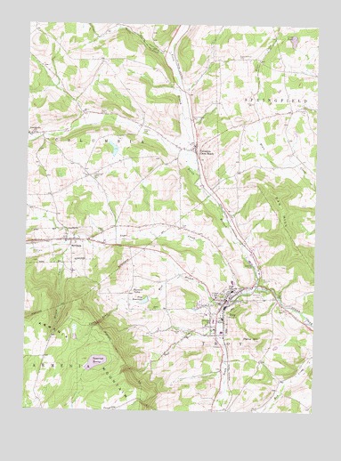
Troy, PA USGS Topographic Map
Click on map above to begin viewing in our Map Viewer.

This topographic map contains these locations and features:
Feature Name Type Latitude Longitude GNIS ID View Map
Alparon ParkParkN41.7987°W76.7761°1168219View Map
AustinvillePopulated PlaceN41.8390°W76.8738°1168517View Map
Besley CemeteryCemeteryN41.8462°W76.8438°1169324View Map
Borough of SylvaniaCivilN41.8029°W76.8608°1214958View Map
Borough of TroyCivilN41.7840°W76.7898°1214960View Map
Brace CemeteryCemeteryN41.8496°W76.7778°1170108View Map
Burnham CemeteryCemeteryN41.7519°W76.8317°2776409View Map
Card CemeteryCemeteryN41.8078°W76.8418°1171194View Map
Case CemeteryCemeteryN41.7756°W76.8036°1171299View Map
Case GlenValleyN41.7853°W76.8343°1171300View Map
Chase - Newbury CemeteryCemeteryN41.8643°W76.7829°1171610View Map
Columbia Cross RoadsPopulated PlaceN41.8359°W76.8019°1172245View Map
Columbia Cross Roads Post OfficePost OfficeN41.8355°W76.8029°2773104View Map
Covert CemeteryCemeteryN41.7517°W76.8596°2776414View Map
Croman SchoolSchoolN41.7792°W76.7930°1172709View Map
Fall BrookStreamN41.7781°W76.7900°1174574View Map
Farmers ValleyPopulated PlaceN41.7881°W76.8300°1203555View Map
Fries CemeteryCemeteryN41.8406°W76.8222°1175272View Map
Gladding / Sylvan Hill CemeteryCemeteryN41.8261°W76.8457°1175650View Map
Glenwood CemeteryCemeteryN41.7880°W76.7713°1175743View Map
Granite - Pierson CemeteryCemeteryN41.8446°W76.8022°1175958View Map
Grover Hill CemeteryCemeteryN41.8480°W76.7545°1176285View Map
Hunt CemeteryCemeteryN41.8097°W76.8077°1177603View Map
Little PondReservoirN41.8704°W76.7603°1179649View Map
Lloyd SchoolSchoolN41.7879°W76.7908°1997758View Map
McClure Airport (historical)AirportN41.8280°W76.8570°1194295View Map
Morgan CreekStreamN41.8040°W76.8572°1181546View Map
North Branch Sugar CreekStreamN41.7906°W76.7747°1182553View Map
Oak HillSummitN41.8204°W76.7675°1182767View Map
Oak Hill CemeteryCemeteryN41.7920°W76.7727°1997759View Map
Paine HillSummitN41.7734°W76.7752°1183194View Map
Pomery Memorial DamDamN41.7864°W76.8216°1195789View Map
Railroad SpringsSpringN41.7754°W76.8033°1202441View Map
Saint Johns CemeteryCemeteryN41.7877°W76.7898°2776492View Map
South Branch Sugar CreekStreamN41.7845°W76.7891°1188040View Map
Spring CreekStreamN41.8020°W76.8741°1197990View Map
SylvaniaPopulated PlaceN41.8051°W76.8569°1193509View Map
Sylvania CemeteryCemeteryN41.8012°W76.8709°1189222View Map
Sylvania Post OfficePost OfficeN41.8055°W76.8564°2773269View Map
Tamarack SwampSwampN41.7662°W76.8425°1189250View Map
Taylor School (historical)SchoolN41.8092°W76.8355°1197657View Map
Township of ColumbiaCivilN41.8471°W76.8525°1215978View Map
Township of TroyCivilN41.7666°W76.7746°1215999View Map
TroyPopulated PlaceN41.7859°W76.7880°1189878View Map
Troy Community HospitalHospitalN41.7935°W76.7944°2718082View Map
Troy Post OfficePost OfficeN41.7808°W76.7913°2773277View Map
Troy ReservoirReservoirN41.7857°W76.8230°1189881View Map
Troy Volunteer Fire Department Station 16BuildingN41.7917°W76.7750°2653346View Map
West Branch Sugar CreekStreamN41.7845°W76.7888°1190934View Map
Western Alliance Emergency Services Station 16BuildingN41.7769°W76.7926°2722266View Map
WJOZ-AM (Troy)TowerN41.7809°W76.8188°1200515View Map
Wolfe CreekStreamN41.8581°W76.8097°1191693View Map
Wolfe HollowValleyN41.8660°W76.8172°1191696View Map

Note: Coordinates in the location and feature list above are referenced to NAD83 datum.


Copyright (C) 2008-2025 Ryan Niemi / Sunset Dynamics ... All Rights Reserved