TopoQuest Logo
Do you find TopoQuest useful?
Help keep TopoQuest running and adding new maps/features by donating!
Bitcoin:  19c7KJd3qBynnjoSw5npx9KScwjBe4ifkT
Litecoin:  LXs6TkuXGGXo1vDsWCkWVdjQX94eUKd6ui
Home View Maps Find Maps Find Places Resources & Links


Eau Claire, Pennsylvania Topographic Map

USGS Map Title: Eau Claire, PA
USGS Map MRC: 41079B7
DRG (GeoTIFF) Download: o41079b7.tif


Neighboring USGS Topographic Map Quads:


  Polk, PA  
41079C8
 

  Kennerdell, PA  
41079C7
 

  Cranberry, PA  
41079C6
 

  Barkeyville, PA  
41079B8
 

  Eau Claire, PA  
41079B7
 

  Emlenton, PA  
41079B6
 

  West Sunbury, PA  
41079A8
 

  Hilliards, PA  
41079A7
 

  Parker, PA  
41079A6


Map MRC Location:

N42°
W80°
N42°
W79°
H8 H7 H6 H5 H4 H3 H2 H1
G8 G7 G6 G5 G4 G3 G2 G1
F8 F7 F6 F5 F4 F3 F2 F1
E8 E7 E6 E5 E4 E3 E2 E1
D8 D7 D6 D5 D4 D3 D2 D1
C8 C7 C6 C5 C4 C3 C2 C1
B8 B7 B6 B5 B4 B3 B2 B1
A8 A7 A6 A5 A4 A3 A2 A1
N41°
W80°
N41°
W79°

Eau Claire, PA USGS 1:24K Topographic Map Preview:
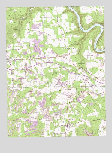
Eau Claire, PA USGS Topographic Map
Click on map above to begin viewing in our Map Viewer.

This topographic map contains these locations and features:
Feature Name Type Latitude Longitude GNIS ID View Map
Anderson Stone HouseBuildingN41.2064°W79.8223°1168291View Map
Annandale Sandstone QuarryMineN41.1261°W79.8739°2516134View Map
BlacksPopulated PlaceN41.2081°W79.7578°1169767View Map
Borough of Cherry ValleyCivilN41.1594°W79.8012°1214987View Map
Borough of ClintonvilleCivilN41.2016°W79.8748°1215636View Map
Borough of Eau ClaireCivilN41.1368°W79.7985°1214991View Map
Carrs RunStreamN41.1598°W79.7903°1171267View Map
Cherry ValleyPopulated PlaceN41.1570°W79.7989°1171679View Map
Cherry Valley School (historical)SchoolN41.1576°W79.7987°1206689View Map
ClintonvillePopulated PlaceN41.1992°W79.8728°1172020View Map
Clintonville Post OfficePost OfficeN41.2001°W79.8718°2773100View Map
Clintonville Volunteer Fire and Relief AssociationBuildingN41.1998°W79.8689°2644763View Map
Coal Valley SchoolSchoolN41.1909°W79.8437°1206073View Map
Crawford CornersPopulated PlaceN41.1728°W79.7673°1172649View Map
CyrusPopulated PlaceN41.2398°W79.8092°1203385View Map
De SalePopulated PlaceN41.1406°W79.8248°1173009View Map
Downing SchoolSchoolN41.2095°W79.7706°1206078View Map
Eakin CornerPopulated PlaceN41.1734°W79.8134°1203467View Map
Eakin HillSummitN41.2345°W79.8653°1173705View Map
Eakin KnobSummitN41.1701°W79.8053°1173706View Map
East Unity ChurchChurchN41.1692°W79.7967°1173894View Map
Eau ClairePopulated PlaceN41.1362°W79.7981°1173941View Map
Eau Claire CemeteryCemeteryN41.1288°W79.8050°1173942View Map
Eau Claire Post OfficePost OfficeN41.1352°W79.7987°2779957View Map
Eau Claire Volunteer Fire Department and Relief Association Station 32BuildingN41.1382°W79.7983°2645496View Map
Humphreys CornerPopulated PlaceN41.2467°W79.8098°1203857View Map
Johnston DamDamN41.1551°W79.7698°1195309View Map
Kennerdale School (historical)SchoolN41.2481°W79.8442°1206075View Map
Kohlmeyer CornerPopulated PlaceN41.1437°W79.8459°1203959View Map
Lake JohnstonReservoirN41.1551°W79.7698°1195308View Map
LisbonPopulated PlaceN41.1973°W79.7942°1179447View Map
Little Scrubgrass CreekStreamN41.2251°W79.7720°1179673View Map
Lockard RunStreamN41.2145°W79.7806°1179756View Map
Lovell SchoolSchoolN41.2198°W79.8009°1206079View Map
Maitland School (historical)SchoolN41.2492°W79.7639°1206080View Map
McCoy SchoolSchoolN41.1845°W79.7664°1206076View Map
North Fork Little Scrubgrass CreekStreamN41.1889°W79.7887°1182583View Map
Perry RunStreamN41.2481°W79.7937°1183602View Map
Pine GrovePopulated PlaceN41.1876°W79.7737°1212711View Map
Pine HillSummitN41.2353°W79.8464°1183828View Map
Pine Hill SchoolSchoolN41.2251°W79.8448°1206074View Map
Pisgah School (historical)SchoolN41.1528°W79.8342°1206071View Map
Rankin ChapelChurchN41.2181°W79.8073°1184651View Map
Riddle CrossroadsPopulated PlaceN41.2003°W79.8442°1185027View Map
Rock SchoolSchoolN41.1528°W79.8678°1206072View Map
Rockdale SchoolSchoolN41.1909°W79.8084°1206077View Map
RocklandPopulated PlaceN41.2323°W79.7517°1185311View Map
Sandy PointPopulated PlaceN41.1648°W79.7631°1186954View Map
Scrubgrass ChurchChurchN41.1748°W79.7753°1187184View Map
Sedwicks MillPopulated PlaceN41.1648°W79.7848°1204601View Map
Shull RunStreamN41.2309°W79.7528°1187628View Map
Six PointsPopulated PlaceN41.1406°W79.7548°1204658View Map
Smith CornersPopulated PlaceN41.1809°W79.8676°1187865View Map
South Fork Little Scrubgrass CreekStreamN41.1892°W79.7853°1188064View Map
Summit HillSummitN41.2453°W79.8573°1189045View Map
Sutton MillPopulated PlaceN41.1903°W79.7817°1189117View Map
Township of ClintonCivilN41.2241°W79.8682°1217141View Map
Township of ScrubgrassCivilN41.2119°W79.7797°1217155View Map
Township of VenangoCivilN41.1341°W79.8421°1216068View Map
Trout RunStreamN41.2376°W79.8556°1189867View Map
Westminster Highlands CampLocaleN41.1951°W79.7737°1191167View Map
Whann RunStreamN41.2259°W79.7756°1191201View Map
Wood HillSummitN41.2184°W79.7545°1191716View Map

Note: Coordinates in the location and feature list above are referenced to NAD83 datum.


Copyright (C) 2008-2025 Ryan Niemi / Sunset Dynamics ... All Rights Reserved