TopoQuest Logo
Do you find TopoQuest useful?
Help keep TopoQuest running and adding new maps/features by donating!
Bitcoin:  19c7KJd3qBynnjoSw5npx9KScwjBe4ifkT
Litecoin:  LXs6TkuXGGXo1vDsWCkWVdjQX94eUKd6ui
Home View Maps Find Maps Find Places Resources & Links


Barkeyville, Pennsylvania Topographic Map

USGS Map Title: Barkeyville, PA
USGS Map MRC: 41079B8
DRG (GeoTIFF) Download: o41079b8.tif


Neighboring USGS Topographic Map Quads:


  Sandy Lake, PA  
41080C1
 

  Polk, PA  
41079C8
 

  Kennerdell, PA  
41079C7
 

  Grove City, PA  
41080B1
 

  Barkeyville, PA  
41079B8
 

  Eau Claire, PA  
41079B7
 

  Slippery Rock, PA  
41080A1
 

  West Sunbury, PA  
41079A8
 

  Hilliards, PA  
41079A7


Map MRC Location:

N42°
W80°
N42°
W79°
H8 H7 H6 H5 H4 H3 H2 H1
G8 G7 G6 G5 G4 G3 G2 G1
F8 F7 F6 F5 F4 F3 F2 F1
E8 E7 E6 E5 E4 E3 E2 E1
D8 D7 D6 D5 D4 D3 D2 D1
C8 C7 C6 C5 C4 C3 C2 C1
B8 B7 B6 B5 B4 B3 B2 B1
A8 A7 A6 A5 A4 A3 A2 A1
N41°
W80°
N41°
W79°

Barkeyville, PA USGS 1:24K Topographic Map Preview:
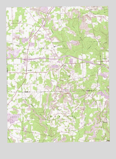
Barkeyville, PA USGS Topographic Map
Click on map above to begin viewing in our Map Viewer.

This topographic map contains these locations and features:
Feature Name Type Latitude Longitude GNIS ID View Map
Allen CornersLocaleN41.2434°W79.9698°1212727View Map
Amity ChurchChurchN41.2356°W79.9837°1168266View Map
BarkeyvillePopulated PlaceN41.1920°W79.9756°1168713View Map
Borough of BarkeyvilleCivilN41.1955°W79.9821°1215635View Map
Brush Hill SchoolSchoolN41.2184°W79.8864°1206182View Map
BullionPopulated PlaceN41.2464°W79.8976°1170657View Map
DeeganPopulated PlaceN41.1253°W79.8789°1213190View Map
Eakin SchoolSchoolN41.2109°W79.9770°1206185View Map
Gillmans MillLocaleN41.2173°W79.9326°1206176View Map
Gilmore RunStreamN41.2101°W79.9037°1175624View Map
Harrisville QuarryMineN41.1464°W79.9939°2709871View Map
Jones School (historical)SchoolN41.1895°W79.9523°1206184View Map
Kimes School (historical)SchoolN41.1667°W79.8987°1206179View Map
Mount Irwin CemeteryCemeteryN41.2378°W79.9842°1181723View Map
MurrinsvillePopulated PlaceN41.1434°W79.8839°1182108View Map
NectarinePopulated PlaceN41.1959°W79.9314°1182206View Map
Peters ChapelChurchN41.1862°W79.9220°1183622View Map
Pike SchoolSchoolN41.2384°W79.9334°1206174View Map
Pleasant View ChurchChurchN41.2389°W79.9528°1184091View Map
Pleasantview CemeteryCemeteryN41.2389°W79.9528°2504746View Map
Rocky Springs ChurchChurchN41.1545°W79.9376°1185375View Map
Surrena School (historical)SchoolN41.1878°W79.8889°1206180View Map
Township of IrwinCivilN41.2254°W79.9513°1217145View Map
Township of MarionCivilN41.1357°W79.9324°1216060View Map
Van Dyke School (historical)SchoolN41.1517°W79.9331°1206178View Map
Victory Joint SchoolSchoolN41.2131°W79.9409°1190404View Map
Victory SchoolSchoolN41.2351°W79.9837°1206175View Map
Walters SchoolSchoolN41.1889°W79.9237°1206181View Map
WesleyPopulated PlaceN41.2281°W79.9612°1190851View Map
Wesley Post Office (historical)Post OfficeN41.2262°W79.9631°1214307View Map
Whiteoak SchoolSchoolN41.1606°W79.9989°1206183View Map
Yard SchoolSchoolN41.2167°W79.9442°1206177View Map

Note: Coordinates in the location and feature list above are referenced to NAD83 datum.


Copyright (C) 2008-2025 Ryan Niemi / Sunset Dynamics ... All Rights Reserved