TopoQuest Logo
Do you find TopoQuest useful?
Help keep TopoQuest running and adding new maps/features by donating!
Bitcoin:  19c7KJd3qBynnjoSw5npx9KScwjBe4ifkT
Litecoin:  LXs6TkuXGGXo1vDsWCkWVdjQX94eUKd6ui
Home View Maps Find Maps Find Places Resources & Links


Kennerdell, Pennsylvania Topographic Map

USGS Map Title: Kennerdell, PA
USGS Map MRC: 41079C7
DRG (GeoTIFF) Download: o41079c7.tif


Neighboring USGS Topographic Map Quads:


  Utica, PA  
41079D8
 

  Franklin, PA  
41079D7
 

  Oil City, PA  
41079D6
 

  Polk, PA  
41079C8
 

  Kennerdell, PA  
41079C7
 

  Cranberry, PA  
41079C6
 

  Barkeyville, PA  
41079B8
 

  Eau Claire, PA  
41079B7
 

  Emlenton, PA  
41079B6


Map MRC Location:

N42°
W80°
N42°
W79°
H8 H7 H6 H5 H4 H3 H2 H1
G8 G7 G6 G5 G4 G3 G2 G1
F8 F7 F6 F5 F4 F3 F2 F1
E8 E7 E6 E5 E4 E3 E2 E1
D8 D7 D6 D5 D4 D3 D2 D1
C8 C7 C6 C5 C4 C3 C2 C1
B8 B7 B6 B5 B4 B3 B2 B1
A8 A7 A6 A5 A4 A3 A2 A1
N41°
W80°
N41°
W79°

Kennerdell, PA USGS 1:24K Topographic Map Preview:
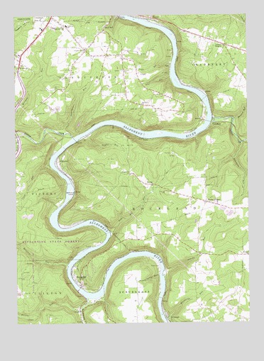
Kennerdell, PA USGS Topographic Map
Click on map above to begin viewing in our Map Viewer.

This topographic map contains these locations and features:
Feature Name Type Latitude Longitude GNIS ID View Map
AjaxPopulated PlaceN41.3545°W79.7906°1202952View Map
Ajax RunStreamN41.3503°W79.7901°1168103View Map
AstralPopulated PlaceN41.3439°W79.7720°1202994View Map
BelmarPopulated PlaceN41.3331°W79.7748°1203058View Map
BrandonPopulated PlaceN41.3162°W79.8506°1203139View Map
Bullion RunStreamN41.2551°W79.8409°1170658View Map
Bully HillPopulated PlaceN41.3689°W79.8262°1198499View Map
Burford RunStreamN41.3326°W79.7567°1170707View Map
Clark RunStreamN41.3142°W79.8562°1171919View Map
Clear Creek State Forest Kennerdell TractForestN41.2814°W79.8532°2352303View Map
Coal CityPopulated PlaceN41.3109°W79.8131°1172050View Map
Congress Hill ChurchChurchN41.3614°W79.8362°1172329View Map
Congress Hill SchoolSchoolN41.3451°W79.8478°1200650View Map
Dennison RunStreamN41.2737°W79.8476°1173160View Map
Ditzenberger RunStreamN41.3276°W79.8473°1173307View Map
Domer ChurchChurchN41.3056°W79.7723°1173361View Map
East Grove ChurchChurchN41.3389°W79.8059°1173817View Map
East SandyPopulated PlaceN41.3312°W79.7687°1203481View Map
East Sandy CreekStreamN41.3331°W79.7687°1192413View Map
Falling Spring RunStreamN41.2692°W79.7976°1174593View Map
FosterPopulated PlaceN41.3251°W79.8053°1203611View Map
Franklin Area High SchoolSchoolN41.3703°W79.8481°1175140View Map
Franklin Area Middle SchoolSchoolN41.3703°W79.8495°1205655View Map
GrahamLocaleN41.3526°W79.8181°1214192View Map
Graham CemeteryCemeteryN41.3526°W79.8170°1175922View Map
Graham ChurchChurchN41.3531°W79.8167°1200644View Map
Grove City College Outting ClubLocaleN41.2695°W79.8698°1208080View Map
Indian God RockPillarN41.3301°W79.8242°1201318View Map
KennerdellPopulated PlaceN41.2664°W79.8406°1178374View Map
Kennerdell Census Designated PlaceCensusN41.2787°W79.8219°2584474View Map
Kennerdell Post OfficePost OfficeN41.2686°W79.8436°2779939View Map
Lower Twomile RunStreamN41.3723°W79.8012°1199093View Map
Melat CemeteryCemeteryN41.3187°W79.7903°1180876View Map
Morrison CemeteryCemeteryN41.3464°W79.8534°1181582View Map
Mount Carmel ChurchChurchN41.3545°W79.8723°1181674View Map
Pine Hill CemeteryCemeteryN41.3034°W79.7942°1183836View Map
Pine Hill ChurchChurchN41.3067°W79.8006°1183838View Map
Pine Hill RunStreamN41.2876°W79.8242°1183839View Map
Porcupine RunStreamN41.3231°W79.7531°1184273View Map
Roberts RunStreamN41.2717°W79.7948°1185212View Map
Rockland ChurchChurchN41.2778°W79.7506°1185314View Map
Saint GeorgePopulated PlaceN41.2520°W79.7937°1185972View Map
Sandy CreekStreamN41.3253°W79.8434°1199957View Map
Sandycreek Elementary SchoolSchoolN41.3726°W79.8467°1205654View Map
Sandycreek Township Volunteer Fire DepartmentBuildingN41.3557°W79.8434°2644788View Map
Scrubgrass CreekStreamN41.2603°W79.8378°1187187View Map
Shaffer CemeteryCemeteryN41.2734°W79.7981°1187324View Map
Siefer RunStreamN41.3553°W79.7895°1187657View Map
Smiths CornersPopulated PlaceN41.2992°W79.7720°1187902View Map
Snyder RunStreamN41.3264°W79.8362°1187959View Map
Township of SandycreekCivilN41.3505°W79.8375°1217154View Map
Twin ChurchsPopulated PlaceN41.3609°W79.8364°1212806View Map
VenangoPopulated PlaceN41.3742°W79.8006°1204869View Map
Victory HeightsPopulated PlaceN41.3631°W79.7620°1190402View Map
Victory RunStreamN41.3278°W79.8731°1190407View Map
Whitherup IslandIslandN41.3023°W79.8453°1191349View Map
Whitherup RunStreamN41.2512°W79.7945°1191350View Map
Witherup BridgeBridgeN41.2551°W79.8408°2743287View Map

Note: Coordinates in the location and feature list above are referenced to NAD83 datum.


Copyright (C) 2008-2024 Ryan Niemi / Sunset Dynamics ... All Rights Reserved