TopoQuest Logo
Do you find TopoQuest useful?
Help keep TopoQuest running and adding new maps/features by donating!
Bitcoin:  19c7KJd3qBynnjoSw5npx9KScwjBe4ifkT
Litecoin:  LXs6TkuXGGXo1vDsWCkWVdjQX94eUKd6ui
Home View Maps Find Maps Find Places Resources & Links


Hilliards, Pennsylvania Topographic Map

USGS Map Title: Hilliards, PA
USGS Map MRC: 41079A7
DRG (GeoTIFF) Download: o41079a7.tif


Neighboring USGS Topographic Map Quads:


  Barkeyville, PA  
41079B8
 

  Eau Claire, PA  
41079B7
 

  Emlenton, PA  
41079B6
 

  West Sunbury, PA  
41079A8
 

  Hilliards, PA  
41079A7
 

  Parker, PA  
41079A6
 

  Mount Chestnut, PA  
40079H8
 

  East Butler, PA  
40079H7
 

  Chicora, PA  
40079H6


Map MRC Location:

N42°
W80°
N42°
W79°
H8 H7 H6 H5 H4 H3 H2 H1
G8 G7 G6 G5 G4 G3 G2 G1
F8 F7 F6 F5 F4 F3 F2 F1
E8 E7 E6 E5 E4 E3 E2 E1
D8 D7 D6 D5 D4 D3 D2 D1
C8 C7 C6 C5 C4 C3 C2 C1
B8 B7 B6 B5 B4 B3 B2 B1
A8 A7 A6 A5 A4 A3 A2 A1
N41°
W80°
N41°
W79°

Hilliards, PA USGS 1:24K Topographic Map Preview:
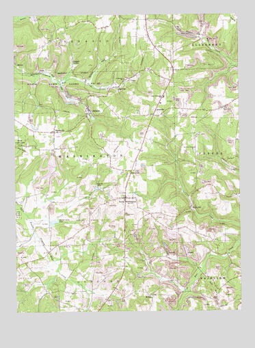
Hilliards, PA USGS Topographic Map
Click on map above to begin viewing in our Map Viewer.

This topographic map contains these locations and features:
Feature Name Type Latitude Longitude GNIS ID View Map
AnnisvillePopulated PlaceN41.0826°W79.7970°1168322View Map
ArgentinePopulated PlaceN41.0942°W79.8192°1168384View Map
Blair SchoolSchoolN41.1234°W79.8056°1206088View Map
Campbell SchoolSchoolN41.1109°W79.7712°1206091View Map
Christy RunStreamN41.0406°W79.8684°1171832View Map
Cochran SchoolSchoolN41.1178°W79.8292°1206089View Map
Daubenspeck School (historical)SchoolN41.0412°W79.7656°1206081View Map
Emery School (historical)SchoolN41.0417°W79.7973°1206082View Map
FerrisPopulated PlaceN41.1012°W79.8603°1203565View Map
Glenn School (historical)SchoolN41.0095°W79.8587°1206084View Map
Harbar Acres LakeLakeN41.0377°W79.8537°1201885View Map
Higgins CornerPopulated PlaceN41.1051°W79.8417°1176999View Map
HilldalePopulated PlaceN41.0067°W79.7989°1177098View Map
HilliardsPopulated PlaceN41.0859°W79.8334°1217354View Map
Hilliards Post OfficePost OfficeN41.0861°W79.8338°2779722View Map
KeenanPopulated PlaceN41.1042°W79.8731°1203918View Map
Mount Vernon ChurchChurchN41.0590°W79.8139°1206092View Map
North WashingtonPopulated PlaceN41.0478°W79.8134°1182650View Map
North Washington Post OfficePost OfficeN41.0481°W79.8118°2779986View Map
North Washington SchoolSchoolN41.0901°W79.7914°1182651View Map
North Washington Volunteer Fire Department Station 30BuildingN41.0481°W79.8120°2645042View Map
Oak Dell School (historical)SchoolN41.0462°W79.8334°1206087View Map
ParsonvillePopulated PlaceN41.0595°W79.8095°1183349View Map
Peaceful ValleyPopulated PlaceN41.0528°W79.8298°1204369View Map
Pisor School (historical)SchoolN41.0459°W79.8542°1206086View Map
Rays RunStreamN41.0170°W79.7709°1184730View Map
Saint Paschals ChurchChurchN41.0976°W79.8128°1186528View Map
Seaton School (historical)SchoolN41.1173°W79.8581°1206090View Map
Smith School (historical)SchoolN41.0628°W79.7626°1206083View Map
Township of WashingtonCivilN41.0646°W79.8331°1216069View Map
Walley MillPopulated PlaceN41.0437°W79.7770°1204891View Map
WhiskervillePopulated PlaceN41.0756°W79.8526°1191235View Map
Woodlawn School (historical)SchoolN41.0145°W79.8314°1206085View Map

Note: Coordinates in the location and feature list above are referenced to NAD83 datum.


Copyright (C) 2008-2025 Ryan Niemi / Sunset Dynamics ... All Rights Reserved