TopoQuest Logo
Do you find TopoQuest useful?
Help keep TopoQuest running and adding new maps/features by donating!
Bitcoin:  19c7KJd3qBynnjoSw5npx9KScwjBe4ifkT
Litecoin:  LXs6TkuXGGXo1vDsWCkWVdjQX94eUKd6ui
Home View Maps Find Maps Find Places Resources & Links


Ebenezer, Mississippi Topographic Map

USGS Map Title: Ebenezer, MS
USGS Map MRC: 32090H1
DRG (GeoTIFF) Download: o32090h1.tif


Neighboring USGS Topographic Map Quads:


  Howard, MS  
33090A2
 

  Lexington South, MS  
33090A1
 

  Owens Wells, MS  
33089A8
 

  Zeiglerville, MS  
32090H2
 

  Ebenezer, MS  
32090H1
 

  Goodman, MS  
32089H8
 

  Linwood, MS  
32090G2
 

  Vaughan, MS  
32090G1
 

  Cameron, MS  
32089G8


Map MRC Location:

N33°
W91°
N33°
W90°
H8 H7 H6 H5 H4 H3 H2 H1
G8 G7 G6 G5 G4 G3 G2 G1
F8 F7 F6 F5 F4 F3 F2 F1
E8 E7 E6 E5 E4 E3 E2 E1
D8 D7 D6 D5 D4 D3 D2 D1
C8 C7 C6 C5 C4 C3 C2 C1
B8 B7 B6 B5 B4 B3 B2 B1
A8 A7 A6 A5 A4 A3 A2 A1
N32°
W91°
N32°
W90°

Ebenezer, MS USGS 1:24K Topographic Map Preview:
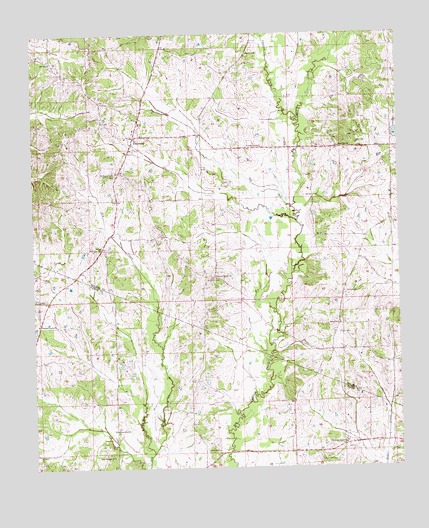
Ebenezer, MS USGS Topographic Map
Click on map above to begin viewing in our Map Viewer.

This topographic map contains these locations and features:
Feature Name Type Latitude Longitude GNIS ID View Map
Anderson CemeteryCemeteryN32.8801°W90.0670°666257View Map
Bisland BayouLakeN32.9701°W90.0062°667189View Map
Bryan Swilley Pond DamDamN32.9385°W90.0468°690416View Map
Central Baptist Church (historical)ChurchN32.9251°W90.0190°706598View Map
Central CemeteryCemeteryN32.9254°W90.0190°668274View Map
Christian Grove ChurchChurchN32.8818°W90.0190°668422View Map
Cypress ChapelChurchN32.9676°W90.0476°669044View Map
Cypress CreekStreamN32.9746°W90.0340°669051View Map
Cypress Creek Campgrounds (historical)LocaleN32.9724°W90.0390°684289View Map
E F Crenshaw Junior Pond DamDamN32.9868°W90.0934°690419View Map
EbenezerPopulated PlaceN32.9707°W90.0909°669637View Map
Ebenezer Baptist ChurchChurchN32.9757°W90.0890°706617View Map
Ebenezer Baptist Church CemeteryCemeteryN32.9755°W90.0894°706619View Map
Ebenezer Methodist ChurchChurchN32.9746°W90.0884°706620View Map
Ebenezer Methodist Church CemeteryCemeteryN32.9746°W90.0876°706618View Map
Hart Town CemeteryCemeteryN32.8771°W90.0276°670989View Map
Holy City ChurchChurchN32.9385°W90.1023°671365View Map
Hoover CemeteryCemeteryN32.9276°W90.1167°707870View Map
Hopewell CemeteryCemeteryN32.9296°W90.0626°671408View Map
Interchange 139CrossingN32.8796°W90.0259°691440View Map
New Canaan ChurchChurchN32.8785°W90.0987°674599View Map
Newport ChurchChurchN32.9943°W90.0531°674908View Map
Pleasant Green ChurchChurchN32.9299°W90.0637°675970View Map
Pleasant Grove ChurchChurchN32.9168°W90.1234°676019View Map
Rogers CemeteryCemeteryN32.9898°W90.0581°706687View Map
Rule CemeteryCemeteryN32.9682°W90.0695°706689View Map
Saint Peters Rock ChurchChurchN32.9593°W90.0979°677249View Map
Salem SchoolSchoolN32.9162°W90.0206°677298View Map
Sanctified ChurchChurchN32.8860°W90.0973°677319View Map
Smith CemeteryCemeteryN32.9504°W90.0987°706693View Map
Supervisor District 3CivilN32.9647°W90.0731°711882View Map
Tackett Watershed 11 DamDamN32.9718°W90.0018°681768View Map
Truly CemeteryCemeteryN32.9785°W90.0665°706702View Map
Twin Lakes Subdivision Lake DamDamN32.9435°W90.0884°690418View Map
W H Austin Pond DamDamN32.9401°W90.0851°690417View Map
Zion City ChurchChurchN32.9674°W90.0206°680002View Map

Note: Coordinates in the location and feature list above are referenced to NAD83 datum.


Copyright (C) 2008-2024 Ryan Niemi / Sunset Dynamics ... All Rights Reserved