TopoQuest Logo
Do you find TopoQuest useful?
Help keep TopoQuest running and adding new maps/features by donating!
Bitcoin:  19c7KJd3qBynnjoSw5npx9KScwjBe4ifkT
Litecoin:  LXs6TkuXGGXo1vDsWCkWVdjQX94eUKd6ui
Home View Maps Find Maps Find Places Resources & Links


Zeiglerville, Mississippi Topographic Map

USGS Map Title: Zeiglerville, MS
USGS Map MRC: 32090H2
DRG (GeoTIFF) Download: o32090h2.tif


Neighboring USGS Topographic Map Quads:


  Thornton, MS  
33090A3
 

  Howard, MS  
33090A2
 

  Lexington South, MS  
33090A1
 

  Eden, MS  
32090H3
 

  Zeiglerville, MS  
32090H2
 

  Ebenezer, MS  
32090H1
 

  Benton, MS  
32090G3
 

  Linwood, MS  
32090G2
 

  Vaughan, MS  
32090G1


Map MRC Location:

N33°
W91°
N33°
W90°
H8 H7 H6 H5 H4 H3 H2 H1
G8 G7 G6 G5 G4 G3 G2 G1
F8 F7 F6 F5 F4 F3 F2 F1
E8 E7 E6 E5 E4 E3 E2 E1
D8 D7 D6 D5 D4 D3 D2 D1
C8 C7 C6 C5 C4 C3 C2 C1
B8 B7 B6 B5 B4 B3 B2 B1
A8 A7 A6 A5 A4 A3 A2 A1
N32°
W91°
N32°
W90°

Zeiglerville, MS USGS 1:24K Topographic Map Preview:
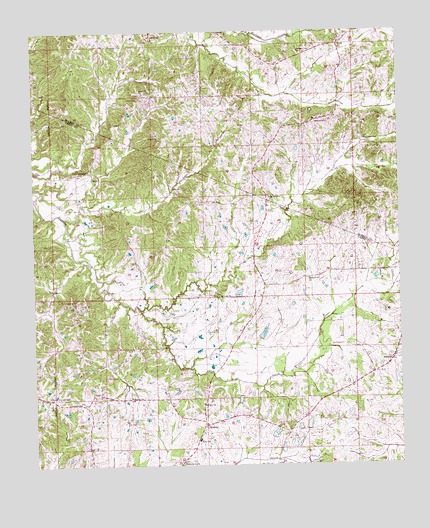
Zeiglerville, MS USGS Topographic Map
Click on map above to begin viewing in our Map Viewer.

This topographic map contains these locations and features:
Feature Name Type Latitude Longitude GNIS ID View Map
Antioch ChurchChurchN32.9285°W90.1562°666316View Map
Brantley CemeteryCemeteryN32.9943°W90.1740°706589View Map
CoxburgPopulated PlaceN32.9985°W90.2101°691789View Map
Coxburg CemeteryCemeteryN32.9993°W90.2101°706605View Map
Crossroads ChurchChurchN32.8932°W90.2348°668980View Map
Dula (historical)LocaleN32.9724°W90.1643°706611View Map
FordykePopulated PlaceN32.9051°W90.1276°691865View Map
Harland Creek ChurchChurchN32.9935°W90.1584°670918View Map
Harlands Creek CemeteryCemeteryN32.9940°W90.1592°706635View Map
King SchoolSchoolN32.8826°W90.1943°672163View Map
Locust Grove CemeteryCemeteryN32.9510°W90.1948°672749View Map
Macedonia ChurchChurchN32.9740°W90.1490°673008View Map
MidwayPopulated PlaceN32.8865°W90.1923°673541View Map
Midway ChurchChurchN32.8926°W90.1926°673549View Map
Midway ChurchChurchN32.8946°W90.2173°673550View Map
North Central Volunteer Fire DepartmentBuildingN32.8865°W90.1932°2665825View Map
O Reilly Pond DamDamN32.9035°W90.1884°681733View Map
Pierce CrossroadPopulated PlaceN32.8943°W90.2456°675720View Map
Piney Springs Baptist ChurchChurchN32.9601°W90.2309°675907View Map
Piney Springs CemeteryCemeteryN32.9604°W90.2301°1959755View Map
Riley CemeteryCemeteryN32.9135°W90.1881°676665View Map
Saint Luke ChurchChurchN32.9237°W90.1862°677111View Map
Shiloh ChurchChurchN32.8960°W90.2304°677687View Map
Shipp Lake DamDamN32.9101°W90.1718°681736View Map
Swayze Lake DamDamN32.8751°W90.1568°681719View Map
Swayze Lake DamDamN32.8818°W90.1701°681722View Map
Swayze Lake DamDamN32.8851°W90.1601°681724View Map
Swayze Lake DamDamN32.8868°W90.1568°681726View Map
Swayze Pond DamDamN32.8751°W90.1668°681720View Map
Tolar CemeteryCemeteryN32.9629°W90.1567°706701View Map
Water Grove ChurchChurchN32.8762°W90.2001°679364View Map
ZeiglervillePopulated PlaceN32.9504°W90.1701°679979View Map

Note: Coordinates in the location and feature list above are referenced to NAD83 datum.


Copyright (C) 2008-2024 Ryan Niemi / Sunset Dynamics ... All Rights Reserved