TopoQuest Logo
Do you find TopoQuest useful?
Help keep TopoQuest running and adding new maps/features by donating!
Bitcoin:  19c7KJd3qBynnjoSw5npx9KScwjBe4ifkT
Litecoin:  LXs6TkuXGGXo1vDsWCkWVdjQX94eUKd6ui
Home View Maps Find Maps Find Places Resources & Links


Edgewood, Illinois Topographic Map

USGS Map Title: Edgewood, IL
USGS Map MRC: 38088H6
DRG (GeoTIFF) Download: o38088h6.tif


Neighboring USGS Topographic Map Quads:


  Altamont West, IL  
39088A7
 

  Altamont East, IL  
39088A6
 

  Effingham South, IL  
39088A5
 

  Loogootee, IL  
38088H7
 

  Edgewood, IL  
38088H6
 

  Hord, IL  
38088H5
 

  Kinmundy, IL  
38088G7
 

  Oskaloosa, IL  
38088G6
 

  Louisville West, IL  
38088G5


Map MRC Location:

N39°
W89°
N39°
W88°
H8 H7 H6 H5 H4 H3 H2 H1
G8 G7 G6 G5 G4 G3 G2 G1
F8 F7 F6 F5 F4 F3 F2 F1
E8 E7 E6 E5 E4 E3 E2 E1
D8 D7 D6 D5 D4 D3 D2 D1
C8 C7 C6 C5 C4 C3 C2 C1
B8 B7 B6 B5 B4 B3 B2 B1
A8 A7 A6 A5 A4 A3 A2 A1
N38°
W89°
N38°
W88°

Edgewood, IL USGS 1:24K Topographic Map Preview:
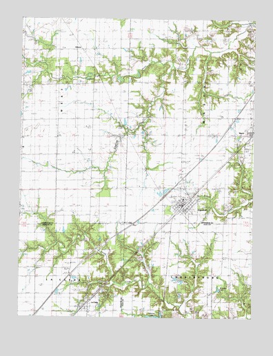
Edgewood, IL USGS Topographic Map
Click on map above to begin viewing in our Map Viewer.

This topographic map contains these locations and features:
Feature Name Type Latitude Longitude GNIS ID View Map
Bailey CemeteryCemeteryN38.9935°W88.6489°403803View Map
Beck William CemeteryCemeteryN38.9888°W88.7340°1930420View Map
Bristol (historical)Populated PlaceN38.9384°W88.6356°1810475View Map
Brockett CemeteryCemeteryN38.9810°W88.6257°406795View Map
Brown CemeteryCemeteryN38.9158°W88.6404°1810476View Map
Davidson CemeteryCemeteryN38.9898°W88.6523°406965View Map
EdgewoodPopulated PlaceN38.9206°W88.6614°407777View Map
Edgewood Bi - County Fire DepartmentBuildingN38.9207°W88.6626°2681838View Map
Edgewood CemeteryCemeteryN38.9256°W88.6551°1810486View Map
Edgewood Grade SchoolSchoolN38.9248°W88.6626°1810487View Map
Edgewood Post OfficePost OfficeN38.9223°W88.6641°1725655View Map
Faulk CemeteryCemeteryN38.9155°W88.7349°408301View Map
GilmorePopulated PlaceN38.9875°W88.7176°409028View Map
Interchange 145CrossingN38.9334°W88.6631°1810511View Map
Kavanaugh CemeteryCemeteryN38.9806°W88.7370°411330View Map
La CledePopulated PlaceN38.8798°W88.7153°411635View Map
Laclede Post OfficePost OfficeN38.8792°W88.7164°1773086View Map
Limestone CreekStreamN38.9803°W88.6695°412104View Map
Locust Grove School (historical)SchoolN38.9000°W88.6364°412488View Map
Mahon CemeteryCemeteryN38.9745°W88.7116°412852View Map
Mason CemeteryCemeteryN38.9456°W88.6289°1810521View Map
McArthur LakeReservoirN38.8868°W88.6432°413174View Map
New Hope CemeteryCemeteryN38.9817°W88.6664°414413View Map
Old Mason CemeteryCemeteryN38.9409°W88.6317°415029View Map
Patterson Lake DamDamN38.8750°W88.6734°1691061View Map
Price CemeteryCemeteryN38.9050°W88.6478°416210View Map
Robinson CemeteryCemeteryN38.9206°W88.6404°416768View Map
Saint Anns Catholic CemeteryCemeteryN38.9512°W88.6839°417150View Map
Town of MasonCivilN38.9537°W88.6259°2396740View Map
Township of MasonCivilN38.9590°W88.6359°429337View Map
Township of WestCivilN38.9570°W88.7496°429910View Map
Village of EdgewoodCivilN38.9222°W88.6641°2398785View Map
Wabash CemeteryCemeteryN38.9744°W88.6615°420346View Map

Note: Coordinates in the location and feature list above are referenced to NAD83 datum.


Copyright (C) 2008-2025 Ryan Niemi / Sunset Dynamics ... All Rights Reserved