TopoQuest Logo
Do you find TopoQuest useful?
Help keep TopoQuest running and adding new maps/features by donating!
Bitcoin:  19c7KJd3qBynnjoSw5npx9KScwjBe4ifkT
Litecoin:  LXs6TkuXGGXo1vDsWCkWVdjQX94eUKd6ui
Home View Maps Find Maps Find Places Resources & Links


Oskaloosa, Illinois Topographic Map

USGS Map Title: Oskaloosa, IL
USGS Map MRC: 38088G6
DRG (GeoTIFF) Download: o38088g6.tif


Neighboring USGS Topographic Map Quads:


  Loogootee, IL  
38088H7
 

  Edgewood, IL  
38088H6
 

  Hord, IL  
38088H5
 

  Kinmundy, IL  
38088G7
 

  Oskaloosa, IL  
38088G6
 

  Louisville West, IL  
38088G5
 

  Omega, IL  
38088F7
 

  Xenia, IL  
38088F6
 

  Xenia NE, IL  
38088F5


Map MRC Location:

N39°
W89°
N39°
W88°
H8 H7 H6 H5 H4 H3 H2 H1
G8 G7 G6 G5 G4 G3 G2 G1
F8 F7 F6 F5 F4 F3 F2 F1
E8 E7 E6 E5 E4 E3 E2 E1
D8 D7 D6 D5 D4 D3 D2 D1
C8 C7 C6 C5 C4 C3 C2 C1
B8 B7 B6 B5 B4 B3 B2 B1
A8 A7 A6 A5 A4 A3 A2 A1
N38°
W89°
N38°
W88°

Oskaloosa, IL USGS 1:24K Topographic Map Preview:
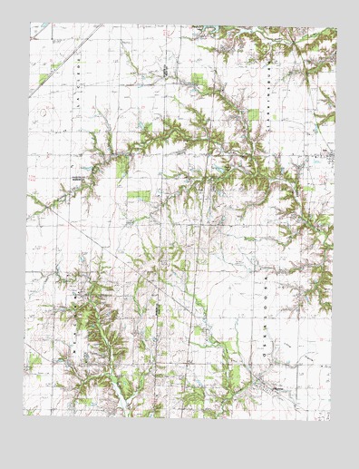
Oskaloosa, IL USGS Topographic Map
Click on map above to begin viewing in our Map Viewer.

This topographic map contains these locations and features:
Feature Name Type Latitude Longitude GNIS ID View Map
Courson CemeteryCemeteryN38.7881°W88.7248°406670View Map
Crooked Creek ChurchChurchN38.8242°W88.6328°406814View Map
CrusePopulated PlaceN38.8217°W88.6778°422593View Map
Elder CemeteryCemeteryN38.7900°W88.7262°407842View Map
Ging LakeReservoirN38.8292°W88.6714°409038View Map
IolaPopulated PlaceN38.8345°W88.6281°410909View Map
Iola CemeteryCemeteryN38.8309°W88.6400°1821630View Map
Iola Post OfficePost OfficeN38.8345°W88.6270°1808572View Map
Keen ChapelChurchN38.8567°W88.6878°411344View Map
Keen Chapel CemeteryCemeteryN38.8567°W88.6892°1821631View Map
Littleton CemeteryCemeteryN38.8714°W88.6798°412444View Map
Lynn Branch ChurchChurchN38.8645°W88.6412°412762View Map
Meacham ChurchChurchN38.7848°W88.7334°413339View Map
Miletus School (historical)SchoolN38.7517°W88.7159°413531View Map
Negro CemeteryCemeteryN38.7706°W88.6925°1952684View Map
OskaloosaPopulated PlaceN38.7598°W88.6489°415195View Map
Oskaloosa CemeteryCemeteryN38.7631°W88.6534°1821635View Map
Oskaloosa School (historical)SchoolN38.7673°W88.6284°415196View Map
Patterson LakeReservoirN38.8749°W88.6765°415445View Map
Pleasant View School (historical)SchoolN38.7825°W88.6770°415923View Map
Shiloh ChurchChurchN38.7664°W88.7012°418412View Map
Township of LarkinsburgCivilN38.8709°W88.6376°429234View Map
Township of OskaloosaCivilN38.7827°W88.6394°429510View Map
Village of IolaCivilN38.8340°W88.6278°2398579View Map

Note: Coordinates in the location and feature list above are referenced to NAD83 datum.


Copyright (C) 2008-2024 Ryan Niemi / Sunset Dynamics ... All Rights Reserved