TopoQuest Logo
Do you find TopoQuest useful?
Help keep TopoQuest running and adding new maps/features by donating!
Bitcoin:  19c7KJd3qBynnjoSw5npx9KScwjBe4ifkT
Litecoin:  LXs6TkuXGGXo1vDsWCkWVdjQX94eUKd6ui
Home View Maps Find Maps Find Places Resources & Links


Kinmundy, Illinois Topographic Map

USGS Map Title: Kinmundy, IL
USGS Map MRC: 38088G7
DRG (GeoTIFF) Download: o38088g7.tif


Neighboring USGS Topographic Map Quads:


  Brownstown, IL  
38088H8
 

  Loogootee, IL  
38088H7
 

  Edgewood, IL  
38088H6
 

  Saint Paul, IL  
38088G8
 

  Kinmundy, IL  
38088G7
 

  Oskaloosa, IL  
38088G6
 

  Salem North, IL  
38088F8
 

  Omega, IL  
38088F7
 

  Xenia, IL  
38088F6


Map MRC Location:

N39°
W89°
N39°
W88°
H8 H7 H6 H5 H4 H3 H2 H1
G8 G7 G6 G5 G4 G3 G2 G1
F8 F7 F6 F5 F4 F3 F2 F1
E8 E7 E6 E5 E4 E3 E2 E1
D8 D7 D6 D5 D4 D3 D2 D1
C8 C7 C6 C5 C4 C3 C2 C1
B8 B7 B6 B5 B4 B3 B2 B1
A8 A7 A6 A5 A4 A3 A2 A1
N38°
W89°
N38°
W88°

Kinmundy, IL USGS 1:24K Topographic Map Preview:
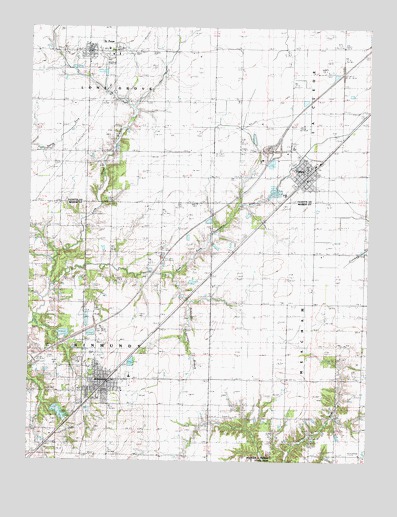
Kinmundy, IL USGS Topographic Map
Click on map above to begin viewing in our Map Viewer.

This topographic map contains these locations and features:
Feature Name Type Latitude Longitude GNIS ID View Map
Ambuehl School (historical)SchoolN38.8678°W88.8078°403480View Map
Booker School (historical)SchoolN38.7525°W88.7514°404694View Map
City of KinmundyCivilN38.7726°W88.8541°2395542View Map
Cockell CemeteryCemeteryN38.7584°W88.7970°1967141View Map
FarinaPopulated PlaceN38.8342°W88.7723°408270View Map
Farina CemeteryCemeteryN38.8398°W88.7925°408271View Map
Farina Fire Protection DistrictBuildingN38.8314°W88.7720°2640454View Map
Farina Post OfficePost OfficeN38.8330°W88.7743°1736946View Map
Farina Village Police DepartmentBuildingN38.8313°W88.7733°2759003View Map
Farina Volunteer Ambulance ServiceBuildingN38.8314°W88.7719°2673832View Map
First Apostolic ChurchChurchN38.8328°W88.7762°1983621View Map
Gray CemeteryCemeteryN38.7942°W88.8501°409348View Map
Interchange 135CrossingN38.8395°W88.7859°1773063View Map
KinmundyPopulated PlaceN38.7734°W88.8467°411525View Map
Kinmundy - Alma Fire Protection District and Ambulance ServiceBuildingN38.7714°W88.8566°2640156View Map
Kinmundy CemeteryCemeteryN38.7787°W88.8567°1821416View Map
Kinmundy First Methodist ChurchChurchN38.7712°W88.8456°1983623View Map
Kinmundy LakeReservoirN38.7640°W88.8638°1691238View Map
Kinmundy Lake DamDamN38.7650°W88.8651°1691237View Map
Kinmundy Post OfficePost OfficeN38.7709°W88.8496°1737064View Map
Lacey School (historical)SchoolN38.8073°W88.7526°411671View Map
Lone Grove BranchStreamN38.8009°W88.8670°412533View Map
Lone Grove School (historical)SchoolN38.8395°W88.8351°412534View Map
New Saint Peter CemeteryCemeteryN38.8675°W88.8300°1802272View Map
Old Saint Peter CemeteryCemeteryN38.8686°W88.8489°1802275View Map
Prairie Grove School (historical)SchoolN38.8062°W88.7898°416142View Map
Rockhold School (historical)SchoolN38.7737°W88.7851°416849View Map
Saint Elizabeth Ann Catholic ChurchChurchN38.7742°W88.8487°1983624View Map
Saint PeterPopulated PlaceN38.8681°W88.8539°417740View Map
Saint Peter Lutheran ChurchChurchN38.8684°W88.8476°1983622View Map
Saint Peter Post OfficePost OfficeN38.8682°W88.8530°1773108View Map
Saint Peter Volunteer Fire DepartmentBuildingN38.8683°W88.8510°2640441View Map
Schneider Springs BranchStreamN38.8037°W88.8223°418097View Map
Shanghai School (historical)SchoolN38.8098°W88.8678°418280View Map
Sherman School (historical)SchoolN38.8059°W88.8356°418367View Map
South Central Elementary School-FarinaSchoolN38.8342°W88.7731°1773116View Map
South Central Elementary School-KinmundySchoolN38.7742°W88.8376°1821456View Map
South Central High SchoolSchoolN38.8409°W88.7781°411645View Map
South Central Middle SchoolSchoolN38.7681°W88.8492°1821457View Map
Township of KinmundyCivilN38.7806°W88.8648°429212View Map
Township of La CledeCivilN38.8693°W88.7507°429215View Map
Township of Lone GroveCivilN38.8680°W88.8640°429276View Map
Township of MeachamCivilN38.7814°W88.7520°429347View Map
Village of FarinaCivilN38.8301°W88.7796°2398860View Map
Village of Saint PeterCivilN38.8676°W88.8504°2399171View Map
Wolf School (historical)SchoolN38.8703°W88.7589°421397View Map
Young School (historical)SchoolN38.7523°W88.8073°421597View Map

Note: Coordinates in the location and feature list above are referenced to NAD83 datum.


Copyright (C) 2008-2025 Ryan Niemi / Sunset Dynamics ... All Rights Reserved