TopoQuest Logo
Do you find TopoQuest useful?
Help keep TopoQuest running and adding new maps/features by donating!
Bitcoin:  19c7KJd3qBynnjoSw5npx9KScwjBe4ifkT
Litecoin:  LXs6TkuXGGXo1vDsWCkWVdjQX94eUKd6ui
Home View Maps Find Maps Find Places Resources & Links


Loogootee, Illinois Topographic Map

USGS Map Title: Loogootee, IL
USGS Map MRC: 38088H7
DRG (GeoTIFF) Download: o38088h7.tif


Neighboring USGS Topographic Map Quads:


  Avena, IL  
39088A8
 

  Altamont West, IL  
39088A7
 

  Altamont East, IL  
39088A6
 

  Brownstown, IL  
38088H8
 

  Loogootee, IL  
38088H7
 

  Edgewood, IL  
38088H6
 

  Saint Paul, IL  
38088G8
 

  Kinmundy, IL  
38088G7
 

  Oskaloosa, IL  
38088G6


Map MRC Location:

N39°
W89°
N39°
W88°
H8 H7 H6 H5 H4 H3 H2 H1
G8 G7 G6 G5 G4 G3 G2 G1
F8 F7 F6 F5 F4 F3 F2 F1
E8 E7 E6 E5 E4 E3 E2 E1
D8 D7 D6 D5 D4 D3 D2 D1
C8 C7 C6 C5 C4 C3 C2 C1
B8 B7 B6 B5 B4 B3 B2 B1
A8 A7 A6 A5 A4 A3 A2 A1
N38°
W89°
N38°
W88°

Loogootee, IL USGS 1:24K Topographic Map Preview:
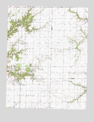
Loogootee, IL USGS Topographic Map
Click on map above to begin viewing in our Map Viewer.

This topographic map contains these locations and features:
Feature Name Type Latitude Longitude GNIS ID View Map
Ambuehl CemeteryCemeteryN38.8811°W88.8078°1802255View Map
Besing CemeteryCemeteryN38.9710°W88.7861°404235View Map
Centerville School (historical)SchoolN38.9839°W88.8639°405844View Map
Eldorado School (historical)SchoolN38.9303°W88.8639°407848View Map
Grieder School (historical)SchoolN38.9428°W88.7781°409498View Map
Harris CemeteryCemeteryN38.9045°W88.8637°409840View Map
LoogooteePopulated PlaceN38.9048°W88.8537°412622View Map
Loogootee Post OfficePost OfficeN38.9048°W88.8539°1773089View Map
Lovett CemeteryCemeteryN38.9690°W88.8394°412698View Map
Macedonia ChurchChurchN38.9303°W88.8492°412794View Map
Maple Grove School (historical)SchoolN38.8912°W88.7776°412928View Map
Nirider School (historical)SchoolN38.9198°W88.7745°414534View Map
Point Pleasant School (historical)SchoolN38.9550°W88.8256°415978View Map
Prairie View School (historical)SchoolN38.9839°W88.8245°416176View Map
Rauchman School (historical)SchoolN38.8903°W88.8262°416412View Map
Roberts LakeReservoirN38.9609°W88.7508°1691737View Map
Roberts Lake DamDamN38.9617°W88.7517°1691736View Map
Rush School (historical)SchoolN38.9270°W88.8248°417054View Map
Saint JamesPopulated PlaceN38.9545°W88.8512°417325View Map
Saint Johns Church (historical)ChurchN38.8817°W88.8076°417398View Map
Stein CemeteryCemeteryN38.9749°W88.8489°419093View Map
Township of WheatlandCivilN38.9553°W88.8631°429925View Map
Voelker School (historical)SchoolN38.9784°W88.7684°420336View Map

Note: Coordinates in the location and feature list above are referenced to NAD83 datum.


Copyright (C) 2008-2025 Ryan Niemi / Sunset Dynamics ... All Rights Reserved