TopoQuest Logo
Do you find TopoQuest useful?
Help keep TopoQuest running and adding new maps/features by donating!
Bitcoin:  19c7KJd3qBynnjoSw5npx9KScwjBe4ifkT
Litecoin:  LXs6TkuXGGXo1vDsWCkWVdjQX94eUKd6ui
Home View Maps Find Maps Find Places Resources & Links


Greenfield, Pennsylvania Topographic Map

USGS Map Title: Greenfield, PA
USGS Map MRC: 41080B3
DRG (GeoTIFF) Download: o41080b3.tif


Neighboring USGS Topographic Map Quads:


  Sharpsville, PA  
41080C4
 

  Fredonia, PA  
41080C3
 

  Jackson Center, PA  
41080C2
 

  Sharon East, PA  
41080B4
 

  Greenfield, PA  
41080B3
 

  Mercer, PA  
41080B2
 

  Edinburg, PA  
41080A4
 

  New Castle North, PA  
41080A3
 

  Harlansburg, PA  
41080A2


Map MRC Location:

N42°
W81°
N42°
W80°
H8 H7 H6 H5 H4 H3 H2 H1
G8 G7 G6 G5 G4 G3 G2 G1
F8 F7 F6 F5 F4 F3 F2 F1
E8 E7 E6 E5 E4 E3 E2 E1
D8 D7 D6 D5 D4 D3 D2 D1
C8 C7 C6 C5 C4 C3 C2 C1
B8 B7 B6 B5 B4 B3 B2 B1
A8 A7 A6 A5 A4 A3 A2 A1
N41°
W81°
N41°
W80°

Greenfield, PA USGS 1:24K Topographic Map Preview:
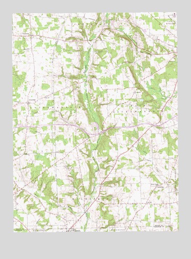
Greenfield, PA USGS Topographic Map
Click on map above to begin viewing in our Map Viewer.

This topographic map contains these locations and features:
Feature Name Type Latitude Longitude GNIS ID View Map
CharlestonPopulated PlaceN41.2370°W80.3603°1198558View Map
GreenfieldPopulated PlaceN41.1989°W80.3628°1176151View Map
Harthegig RunStreamN41.1723°W80.3120°1176602View Map
Hells HollowValleyN41.2273°W80.2791°1176795View Map
HoaglandPopulated PlaceN41.2045°W80.2820°1177146View Map
Indian RunPopulated PlaceN41.1512°W80.2642°1177772View Map
Jefferson / Clark Regional Police DeptartmentBuildingN41.2493°W80.3311°2780577View Map
Jefferson Township Volunteer Fire Department Station 88BuildingN41.2496°W80.3342°2645149View Map
Lackawannock Airport (historical)AirportN41.2064°W80.3586°1194192View Map
Lebanon ChurchChurchN41.1989°W80.3690°1179101View Map
Ligo SchoolSchoolN41.1414°W80.2737°1179328View Map
Ligo SchoolSchoolN41.1414°W80.2737°1179329View Map
LylePopulated PlaceN41.1423°W80.3406°1201647View Map
Mount Pleasant CemeteryCemeteryN41.2062°W80.2801°1181994View Map
Township of East LackawannockCivilN41.1990°W80.2770°1216797View Map
Township of LackawannockCivilN41.1946°W80.3510°1216806View Map
Township of WilmingtonCivilN41.1414°W80.3202°1216823View Map
Unity ChurchChurchN41.2026°W80.3478°1190206View Map
West Branch Little Neshannock CreekStreamN41.1359°W80.3190°1190914View Map
White ChapelChurchN41.1412°W80.2784°1206199View Map
White Chapel CemeteryCemeteryN41.1406°W80.2809°1191255View Map
White Chapel ChurchChurchN41.1512°W80.2653°1191256View Map
WWIZ-FM (Mercer)TowerN41.2028°W80.3590°1200292View Map
Zahniser CemeteryCemeteryN41.2478°W80.3353°1191934View Map
Zuver SchoolSchoolN41.1626°W80.3353°1192036View Map

Note: Coordinates in the location and feature list above are referenced to NAD83 datum.


Copyright (C) 2008-2025 Ryan Niemi / Sunset Dynamics ... All Rights Reserved