TopoQuest Logo
Do you find TopoQuest useful?
Help keep TopoQuest running and adding new maps/features by donating!
Bitcoin:  19c7KJd3qBynnjoSw5npx9KScwjBe4ifkT
Litecoin:  LXs6TkuXGGXo1vDsWCkWVdjQX94eUKd6ui
Home View Maps Find Maps Find Places Resources & Links


Edmeston, New York Topographic Map

USGS Map Title: Edmeston, NY
USGS Map MRC: 42075F2
DRG (GeoTIFF) Download: o42075f2.tif


Neighboring USGS Topographic Map Quads:


  Brookfield, NY  
42075G3
 

  Unadilla Forks, NY  
42075G2
 

  Schuyler Lake, NY  
42075G1
 

  New Berlin North, NY  
42075F3
 

  Edmeston, NY  
42075F2
 

  Hartwick, NY  
42075F1
 

  New Berlin South, NY  
42075E3
 

  Morris, NY  
42075E2
 

  Mount Vision, NY  
42075E1


Map MRC Location:

N43°
W76°
N43°
W75°
H8 H7 H6 H5 H4 H3 H2 H1
G8 G7 G6 G5 G4 G3 G2 G1
F8 F7 F6 F5 F4 F3 F2 F1
E8 E7 E6 E5 E4 E3 E2 E1
D8 D7 D6 D5 D4 D3 D2 D1
C8 C7 C6 C5 C4 C3 C2 C1
B8 B7 B6 B5 B4 B3 B2 B1
A8 A7 A6 A5 A4 A3 A2 A1
N42°
W76°
N42°
W75°

Edmeston, NY USGS 1:24K Topographic Map Preview:
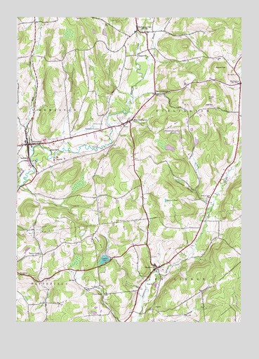
Edmeston, NY USGS Topographic Map
Click on map above to begin viewing in our Map Viewer.

This topographic map contains these locations and features:
Feature Name Type Latitude Longitude GNIS ID View Map
All Faiths ChapelChurchN42.7020°W75.2071°977511View Map
Barrett CornersPopulated PlaceN42.7187°W75.1729°943080View Map
Buckhill FarmLocaleN42.6567°W75.2175°2558721View Map
BurlingtonPopulated PlaceN42.7229°W75.1254°945222View Map
Burlington CemeteryCemeteryN42.7267°W75.1271°945223View Map
Burlington FlatsPopulated PlaceN42.7454°W75.1829°945224View Map
Burlington Flats Baptist ChurchChurchN42.7443°W75.1789°977500View Map
Burlington Flats CemeteryCemeteryN42.7445°W75.1793°977499View Map
Burlington Flats Post OfficePost OfficeN42.7458°W75.1833°2598926View Map
Butternut Valley CemeteryCemeteryN42.6756°W75.1435°945389View Map
Card PondLakeN42.6365°W75.2021°945815View Map
CardtownPopulated PlaceN42.6442°W75.2457°972298View Map
ChapinvillePopulated PlaceN42.7351°W75.1824°946388View Map
Church of ChristChurchN42.7067°W75.1879°977506View Map
Church of the NativityChurchN42.7017°W75.2449°977507View Map
Crystal LakeLakeN42.6503°W75.2016°947900View Map
Crystal Lake Park and CampgroundLocaleN42.6526°W75.2029°977513View Map
Demming CemeteryCemeteryN42.6980°W75.2457°977509View Map
EdmestonPopulated PlaceN42.6979°W75.2438°949399View Map
Edmeston Central SchoolSchoolN42.6990°W75.2452°977508View Map
Edmeston Free LibraryBuildingN42.6979°W75.2447°2598960View Map
Edmeston Post OfficePost OfficeN42.6974°W75.2445°2599216View Map
Edmeston Volunteer Fire DepartmentBuildingN42.6980°W75.2420°2735148View Map
First Baptist Church of BurlingtonChurchN42.7231°W75.1260°977502View Map
Fly BrookStreamN42.7254°W75.1796°950328View Map
Gardner PondLakeN42.6749°W75.1676°950895View Map
GarrattsvillePopulated PlaceN42.6473°W75.1718°950921View Map
Garrattsville Volunteer Fire CompanyBuildingN42.6468°W75.1736°2735149View Map
Gross HillSummitN42.6579°W75.2038°951845View Map
Gross Hill SchoolSchoolN42.6612°W75.2071°977456View Map
Jackson SchoolSchoolN42.6398°W75.1402°977459View Map
Jennings CemeteryCemeteryN42.7065°W75.2029°953992View Map
Klock HillSummitN42.7181°W75.1441°954745View Map
Methodist HollowValleyN42.6743°W75.1446°957039View Map
Mill CreekStreamN42.6951°W75.2410°957230View Map
Quaker CemeteryCemeteryN42.6665°W75.1952°977512View Map
Rice HillSummitN42.7065°W75.1643°962454View Map
Robinson CornersPopulated PlaceN42.7037°W75.2038°962663View Map
Rosa Mystica Marian CenterChurchN42.7309°W75.2113°977501View Map
Round TopSummitN42.7295°W75.1396°963025View Map
Saint Johns Lutheran ChurchChurchN42.7162°W75.1757°977505View Map
Salo's Tree FarmLocaleN42.6900°W75.1886°2557727View Map
School Number 12 (historical)SchoolN42.6745°W75.1435°977464View Map
School Number 7 (historical)SchoolN42.7140°W75.1268°977473View Map
Second Baptist Church of EdmestonChurchN42.6986°W75.2446°977504View Map
Suntime AirportAirportN42.7128°W75.1676°2443135View Map
Taylor CornersLocaleN42.6529°W75.2354°967085View Map
The United Methodist ChurchChurchN42.6981°W75.2454°977510View Map
The United Methodist ChurchChurchN42.6462°W75.1735°977514View Map
Town of BurlingtonCivilN42.7219°W75.1417°978766View Map
Union CemeteryCemeteryN42.7001°W75.2279°968158View Map
United Methodist ChurchChurchN42.7440°W75.1846°977498View Map
West BurlingtonPopulated PlaceN42.7076°W75.1877°969155View Map
West Burlington Post OfficePost OfficeN42.7075°W75.1880°2599218View Map
Wooley HillSummitN42.6634°W75.1893°971737View Map
Zimmerman PondLakeN42.7025°W75.1610°971875View Map

Note: Coordinates in the location and feature list above are referenced to NAD83 datum.


Copyright (C) 2008-2025 Ryan Niemi / Sunset Dynamics ... All Rights Reserved