TopoQuest Logo
Do you find TopoQuest useful?
Help keep TopoQuest running and adding new maps/features by donating!
Bitcoin:  19c7KJd3qBynnjoSw5npx9KScwjBe4ifkT
Litecoin:  LXs6TkuXGGXo1vDsWCkWVdjQX94eUKd6ui
Home View Maps Find Maps Find Places Resources & Links


New Berlin North, New York Topographic Map

USGS Map Title: New Berlin North, NY
USGS Map MRC: 42075F3
DRG (GeoTIFF) Download: o42075f3.tif


Neighboring USGS Topographic Map Quads:


  Hubbardsville, NY  
42075G4
 

  Brookfield, NY  
42075G3
 

  Unadilla Forks, NY  
42075G2
 

  Sherburne, NY  
42075F4
 

  New Berlin North, NY  
42075F3
 

  Edmeston, NY  
42075F2
 

  Holmesville, NY  
42075E4
 

  New Berlin South, NY  
42075E3
 

  Morris, NY  
42075E2


Map MRC Location:

N43°
W76°
N43°
W75°
H8 H7 H6 H5 H4 H3 H2 H1
G8 G7 G6 G5 G4 G3 G2 G1
F8 F7 F6 F5 F4 F3 F2 F1
E8 E7 E6 E5 E4 E3 E2 E1
D8 D7 D6 D5 D4 D3 D2 D1
C8 C7 C6 C5 C4 C3 C2 C1
B8 B7 B6 B5 B4 B3 B2 B1
A8 A7 A6 A5 A4 A3 A2 A1
N42°
W76°
N42°
W75°

New Berlin North, NY USGS 1:24K Topographic Map Preview:
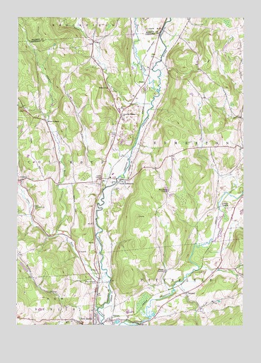
New Berlin North, NY USGS Topographic Map
Click on map above to begin viewing in our Map Viewer.

This topographic map contains these locations and features:
Feature Name Type Latitude Longitude GNIS ID View Map
Amblers CrossingPopulated PlaceN42.6734°W75.2627°972166View Map
Beaver CreekStreamN42.7204°W75.2979°943375View Map
Briggs CornersLocaleN42.6470°W75.2932°944739View Map
Button CityPopulated PlaceN42.7217°W75.3249°945391View Map
Carter School House CemeteryCemeteryN42.7096°W75.3598°2559150View Map
Center BrookStreamN42.6462°W75.3257°946190View Map
ColumbusPopulated PlaceN42.6840°W75.3727°947197View Map
Columbus Center CemeteryCemeteryN42.6737°W75.3648°947200View Map
Columbus Corners CemeteryCemeteryN42.6832°W75.3281°947202View Map
Columbus QuarterPopulated PlaceN42.7103°W75.3174°947204View Map
Edmeston Census Designated PlaceCensusN42.6989°W75.2523°2628046View Map
Fairkit FarmLocaleN42.6675°W75.3703°2556817View Map
Five CornersPopulated PlaceN42.6423°W75.3302°950201View Map
Gazlay CemeteryCemeteryN42.6807°W75.3214°950964View Map
Greenwood CemeteryCemeteryN42.6301°W75.3313°2490604View Map
HobokenPopulated PlaceN42.6270°W75.3224°952913View Map
Hoboken DamDamN42.6258°W75.3064°952914View Map
Hopestead Hill FarmLocaleN42.6672°W75.3622°2556819View Map
Lambs CornersLocaleN42.6848°W75.3282°955005View Map
Manchester CornersLocaleN42.6798°W75.2916°956337View Map
Millers CornersLocaleN42.7081°W75.3593°957329View Map
Peet Hook PasturesLocaleN42.6572°W75.2622°2557726View Map
Perkins CemeteryCemeteryN42.7032°W75.3205°960189View Map
PittsfieldPopulated PlaceN42.6387°W75.2813°960647View Map
Pittsfield Volunteer Fire DepartmentBuildingN42.6278°W75.3194°2735154View Map
Saint Theresa's Roman Catholic ChurchChurchN42.6256°W75.3322°2490609View Map
School Number 9 (historical)SchoolN42.7108°W75.3175°2123375View Map
Shawler BrookStreamN42.6617°W75.3516°964984View Map
South EdmestonPopulated PlaceN42.6842°W75.3177°965741View Map
South Edmeston Community ChurchChurchN42.6838°W75.3182°2597910View Map
SweetsPopulated PlaceN42.7234°W75.3046°973132View Map
TallettePopulated PlaceN42.7401°W75.3332°973138View Map
Tallette CreekStreamN42.7151°W75.3013°967006View Map
The Town of New Berlin Police DepartmentBuildingN42.6252°W75.3322°2766650View Map
Town of ColumbusCivilN42.6964°W75.3674°978856View Map
Town of EdmestonCivilN42.7170°W75.2519°978926View Map
Town School Number 3SchoolN42.6806°W75.3718°967713View Map
Town School Number 9SchoolN42.7112°W75.3177°967714View Map
Tri County AirwaysAirportN42.7397°W75.2993°978361View Map

Note: Coordinates in the location and feature list above are referenced to NAD83 datum.


Copyright (C) 2008-2025 Ryan Niemi / Sunset Dynamics ... All Rights Reserved