TopoQuest Logo
Do you find TopoQuest useful?
Help keep TopoQuest running and adding new maps/features by donating!
Bitcoin:  19c7KJd3qBynnjoSw5npx9KScwjBe4ifkT
Litecoin:  LXs6TkuXGGXo1vDsWCkWVdjQX94eUKd6ui
Home View Maps Find Maps Find Places Resources & Links


Brookfield, New York Topographic Map

USGS Map Title: Brookfield, NY
USGS Map MRC: 42075G3
DRG (GeoTIFF) Download: o42075g3.tif


Neighboring USGS Topographic Map Quads:


  Oriskany Falls, NY  
42075H4
 

  Cassville, NY  
42075H3
 

  West Winfield, NY  
42075H2
 

  Hubbardsville, NY  
42075G4
 

  Brookfield, NY  
42075G3
 

  Unadilla Forks, NY  
42075G2
 

  Sherburne, NY  
42075F4
 

  New Berlin North, NY  
42075F3
 

  Edmeston, NY  
42075F2


Map MRC Location:

N43°
W76°
N43°
W75°
H8 H7 H6 H5 H4 H3 H2 H1
G8 G7 G6 G5 G4 G3 G2 G1
F8 F7 F6 F5 F4 F3 F2 F1
E8 E7 E6 E5 E4 E3 E2 E1
D8 D7 D6 D5 D4 D3 D2 D1
C8 C7 C6 C5 C4 C3 C2 C1
B8 B7 B6 B5 B4 B3 B2 B1
A8 A7 A6 A5 A4 A3 A2 A1
N42°
W76°
N42°
W75°

Brookfield, NY USGS 1:24K Topographic Map Preview:
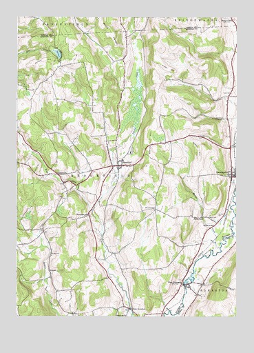
Brookfield, NY USGS Topographic Map
Click on map above to begin viewing in our Map Viewer.

This topographic map contains these locations and features:
Feature Name Type Latitude Longitude GNIS ID View Map
Beaver HillSummitN42.8128°W75.3016°943386View Map
BrookfieldPopulated PlaceN42.8128°W75.3177°944832View Map
Brookfield Central SchoolSchoolN42.8153°W75.3143°2597225View Map
Brookfield Post OfficePost OfficeN42.8132°W75.3188°2599207View Map
Brookfield Rural CemeteryCemeteryN42.8106°W75.3206°2542907View Map
Brookfield Volunteer Fire DepartmentBuildingN42.8132°W75.3184°2735037View Map
Button CreekStreamN42.7790°W75.2593°945392View Map
Button FallsFallsN42.7912°W75.2693°945393View Map
Button HillSummitN42.8181°W75.2718°945394View Map
Clarke CemeteryCemeteryN42.8434°W75.2532°946778View Map
Crumb CemeteryCemeteryN42.8331°W75.2577°947869View Map
First Baptist ChurchChurchN42.8147°W75.3173°2597854View Map
First Baptist ChurchChurchN42.7614°W75.2758°2597894View Map
Five CornersLocaleN42.7948°W75.2960°950196View Map
Giles CemeteryCemeteryN42.7690°W75.3558°951104View Map
Gorton CemeteryCemeteryN42.8576°W75.3463°951393View Map
Gorton HillSummitN42.8545°W75.3635°951395View Map
Gorton LakeLakeN42.8596°W75.3517°951396View Map
GuideboardPopulated PlaceN42.8092°W75.3516°972577View Map
Lamb CemeteryCemeteryN42.7762°W75.3548°954998View Map
LeonardsvillePopulated PlaceN42.8087°W75.2527°955217View Map
Leonardsville CemeteryCemeteryN42.8056°W75.2519°2542908View Map
Leonardsville Post OfficePost OfficeN42.8096°W75.2526°2598889View Map
Leonardsville Volunteer Fire CompanyBuildingN42.8082°W75.2505°2718480View Map
Mott CemeteryCemeteryN42.7928°W75.2571°957784View Map
School Number 2 (historical)SchoolN42.7506°W75.3127°975190View Map
School Number 28 (historical)SchoolN42.7881°W75.2632°975234View Map
School Number 7 (historical)SchoolN42.7622°W75.2761°2100870View Map
South BrookfieldPopulated PlaceN42.7534°W75.3107°965712View Map
South Brookfield Memorial Park and CemeteryCemeteryN42.7519°W75.3120°2542911View Map
Town of BrookfieldCivilN42.8079°W75.3436°978757View Map
Waterman CemeteryCemeteryN42.7919°W75.3343°2542910View Map
Waterman School (historical)SchoolN42.7926°W75.3343°968902View Map
Welch CemeteryCemeteryN42.7917°W75.2657°969019View Map
West CreekStreamN42.7953°W75.3313°969195View Map
West EdmestonPopulated PlaceN42.7634°W75.2782°969210View Map
West Edmeston CemeteryCemeteryN42.7609°W75.2833°2542909View Map
West Edmeston Post OfficePost OfficeN42.7635°W75.2773°2775369View Map
West Edmeston Volunteer Fire DepartmentBuildingN42.7640°W75.2753°2735174View Map
Witter HillSummitN42.8534°W75.2866°971530View Map

Note: Coordinates in the location and feature list above are referenced to NAD83 datum.


Copyright (C) 2008-2025 Ryan Niemi / Sunset Dynamics ... All Rights Reserved