TopoQuest Logo
Do you find TopoQuest useful?
Help keep TopoQuest running and adding new maps/features by donating!
Bitcoin:  19c7KJd3qBynnjoSw5npx9KScwjBe4ifkT
Litecoin:  LXs6TkuXGGXo1vDsWCkWVdjQX94eUKd6ui
Home View Maps Find Maps Find Places Resources & Links


Nettleton, Mississippi Topographic Map

USGS Map Title: Nettleton, MS
USGS Map MRC: 34088A5
DRG (GeoTIFF) Download: o34088a5.tif


Neighboring USGS Topographic Map Quads:


  Verona, MS  
34088B6
 

  Evergreen, MS  
34088B5
 

  Beans Ferry, MS  
34088B4
 

  Shannon, MS  
34088A6
 

  Nettleton, MS  
34088A5
 

  Smithville, MS  
34088A4
 

  Egypt, MS  
33088H6
 

  Wren, MS  
33088H5
 

  Amory, MS  
33088H4


Map MRC Location:

N35°
W89°
N35°
W88°
H8 H7 H6 H5 H4 H3 H2 H1
G8 G7 G6 G5 G4 G3 G2 G1
F8 F7 F6 F5 F4 F3 F2 F1
E8 E7 E6 E5 E4 E3 E2 E1
D8 D7 D6 D5 D4 D3 D2 D1
C8 C7 C6 C5 C4 C3 C2 C1
B8 B7 B6 B5 B4 B3 B2 B1
A8 A7 A6 A5 A4 A3 A2 A1
N34°
W89°
N34°
W88°

Nettleton, MS USGS 1:24K Topographic Map Preview:
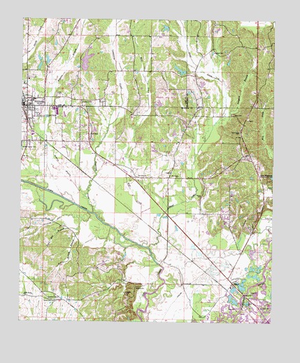
Nettleton, MS USGS Topographic Map
Click on map above to begin viewing in our Map Viewer.

This topographic map contains these locations and features:
Feature Name Type Latitude Longitude GNIS ID View Map
Aberdeen Lagoon DamDamN34.0018°W88.5067°682435View Map
Atkins CemeteryCemeteryN34.0523°W88.5356°666417View Map
B G Coggins Lake DamDamN34.1234°W88.5534°682476View Map
BigbeePopulated PlaceN34.0162°W88.5192°667157View Map
Bigbee ChurchChurchN34.0151°W88.5192°709315View Map
Bigby Fork (historical)LocaleN34.1140°W88.5084°706219View Map
Burgess Lake DamDamN34.1051°W88.5967°682465View Map
Burketts CreekStreamN34.0001°W88.5200°667810View Map
Cason Baptist ChurchChurchN34.0690°W88.5139°668138View Map
Cason School (historical)SchoolN34.0690°W88.5148°687374View Map
Central GrovePopulated PlaceN34.0090°W88.6056°687372View Map
Central Grove Baptist ChurchChurchN34.0084°W88.6078°668279View Map
City of NettletonCivilN34.0853°W88.6248°2404356View Map
Colberts Mill (historical)LocaleN34.0218°W88.5539°687378View Map
Conwill CemeteryCemeteryN34.0557°W88.5000°668775View Map
Cothers Ferry (historical)CrossingN34.0212°W88.5545°687382View Map
Cowpenna CreekStreamN34.0448°W88.5889°668913View Map
Devil Den BranchStreamN34.0379°W88.5964°669239View Map
E B Rogers Lake DamDamN34.1001°W88.5350°682460View Map
Ed Burgess Lake DamDamN34.1084°W88.6150°682470View Map
Eureka (historical)LocaleN34.1168°W88.5889°712613View Map
First Baptist ChurchChurchN34.0896°W88.6206°686992View Map
Goodwin CemeteryCemeteryN34.1115°W88.5298°670512View Map
Grey CemeteryCemeteryN34.0943°W88.6073°670736View Map
Hester CemeteryCemeteryN34.0859°W88.5198°671140View Map
John Young Lake DamDamN34.1034°W88.5500°682463View Map
Jones Chapel Baptist ChurchChurchN34.0773°W88.5909°671986View Map
Lake Whiteside DamDamN34.0601°W88.5000°682446View Map
Liberty Baptist ChurchChurchN34.0887°W88.5378°672454View Map
Liberty CemeteryCemeteryN34.0901°W88.5378°706245View Map
Little Bottom BranchStreamN34.0454°W88.5914°672554View Map
McCluney (historical)Populated PlaceN34.0348°W88.5542°709361View Map
Millhouse DitchCanalN34.0404°W88.6087°673649View Map
NettletonPopulated PlaceN34.0890°W88.6223°674562View Map
Nettleton CemeteryCemeteryN34.0823°W88.6184°687442View Map
Nettleton Church of ChristChurchN34.0887°W88.6217°687443View Map
Nettleton High SchoolSchoolN34.0918°W88.6187°706772View Map
Nettleton Police DepartmentBuildingN34.0888°W88.6230°2754157View Map
Nettleton Post OfficePost OfficeN34.0896°W88.6219°2768846View Map
Nettleton Presbyterian ChurchChurchN34.0898°W88.6200°684531View Map
Nettleton United Methodist ChurchChurchN34.0923°W88.6237°684532View Map
Nettleton Upper Elementary SchoolSchoolN34.0912°W88.6192°706773View Map
New Prospect Missionary Baptist ChurchChurchN34.0832°W88.6212°709368View Map
Pine Grove Baptist ChurchChurchN34.0598°W88.5667°675850View Map
Pine Grove Church of Jesus ChristChurchN34.0621°W88.5692°709372View Map
Pine Grove United Methodist ChurchChurchN34.0604°W88.5470°675851View Map
Pisgah CemeteryCemeteryN34.0118°W88.5717°675934View Map
Providence CemeteryCemeteryN34.0907°W88.5956°676370View Map
Roberts BranchStreamN34.0521°W88.5934°676703View Map
Shoaf CreekStreamN34.0307°W88.5612°677731View Map
Sims SchoolSchoolN34.1007°W88.6217°677839View Map
South Nettleton Baptist ChurchChurchN34.0743°W88.6217°687467View Map
Spring Hill Baptist ChurchChurchN34.0837°W88.6195°687468View Map
Standifer CreekStreamN34.0232°W88.5025°678213View Map
Tabb (historical)LocaleN34.0418°W88.5639°709393View Map
Tanyard BranchStreamN34.0854°W88.5256°678564View Map
Union Grove CemeteryCemeteryN34.0787°W88.5167°679075View Map
Union Grove Primitive Baptist ChurchChurchN34.0793°W88.5167°709402View Map
Union Grove United Methodist ChurchChurchN34.0109°W88.6228°679088View Map
Union View ChurchChurchN34.0951°W88.5081°679122View Map
Victory Baptist ChurchChurchN34.0882°W88.6206°687477View Map
Williams CemeteryCemeteryN34.0137°W88.5673°679709View Map
Wolf CreekStreamN34.0357°W88.5737°679815View Map

Note: Coordinates in the location and feature list above are referenced to NAD83 datum.


Copyright (C) 2008-2024 Ryan Niemi / Sunset Dynamics ... All Rights Reserved