TopoQuest Logo
Do you find TopoQuest useful?
Help keep TopoQuest running and adding new maps/features by donating!
Bitcoin:  19c7KJd3qBynnjoSw5npx9KScwjBe4ifkT
Litecoin:  LXs6TkuXGGXo1vDsWCkWVdjQX94eUKd6ui
Home View Maps Find Maps Find Places Resources & Links


El Paso Gap, New Mexico Topographic Map

USGS Map Title: El Paso Gap, NM
USGS Map MRC: 32104A7
DRG (GeoTIFF) Download: o32104a7.tif


Neighboring USGS Topographic Map Quads:


  La Paloma Canyon, NM  
32104B8
 

  Pickett Hill, NM  
32104B7
 

  Queen, NM  
32104B6
 

  Panther Canyon, NM  
32104A8
 

  El Paso Gap, NM  
32104A7
 

  Gunsight Canyon, NM  
32104A6
 

  P X Flat, TX  
31104H8
 

  Guadalupe Peak, TX  
31104H7
 

  Independence Spring, TX  
31104H6


Map MRC Location:

N33°
W105°
N33°
W104°
H8 H7 H6 H5 H4 H3 H2 H1
G8 G7 G6 G5 G4 G3 G2 G1
F8 F7 F6 F5 F4 F3 F2 F1
E8 E7 E6 E5 E4 E3 E2 E1
D8 D7 D6 D5 D4 D3 D2 D1
C8 C7 C6 C5 C4 C3 C2 C1
B8 B7 B6 B5 B4 B3 B2 B1
A8 A7 A6 A5 A4 A3 A2 A1
N32°
W105°
N32°
W104°

El Paso Gap, NM USGS 1:24K Topographic Map Preview:
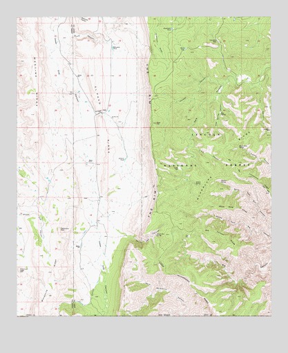
El Paso Gap, NM USGS Topographic Map
Click on map above to begin viewing in our Map Viewer.

This topographic map contains these locations and features:
Feature Name Type Latitude Longitude GNIS ID View Map
Big Canyon RidgeRidgeN32.0332°W104.7736°903784View Map
Black LakeLakeN32.1119°W104.7928°903867View Map
Black River SpringSpringN32.0710°W104.7664°903895View Map
Black River Storage TankReservoirN32.0701°W104.7672°899013View Map
Black River Water StorageReservoirN32.0743°W104.7616°923724View Map
Camp Wilderness RidgeRidgeN32.0217°W104.8083°1372893View Map
Camp Wilderness RidgeRidgeN32.0176°W104.7991°904326View Map
Deer HillSummitN32.0807°W104.8068°905693View Map
Devils Den CanyonValleyN32.0351°W104.8230°905734View Map
Devils Den Canyon Wilderness Study AreaParkN32.0326°W104.8183°935832View Map
Devils Den SpringSpringN32.0342°W104.8069°905737View Map
Dirt TankReservoirN32.1126°W104.7688°899019View Map
Effendale TankReservoirN32.1123°W104.8282°906019View Map
El Paso GapGapN32.0851°W104.8336°906069View Map
El Paso Gap ChurchChurchN32.0834°W104.8286°906070View Map
El Paso Gap Post Office (historical)Post OfficeN32.0851°W104.8336°938457View Map
El Paso RidgeRidgeN32.0771°W104.8311°906072View Map
Fir CanyonValleyN32.0968°W104.7558°906270View Map
Guadalupe Escarpment Wilderness Study AreaParkN32.0418°W104.7502°934254View Map
Guadalupe MineMineN32.0779°W104.7508°906762View Map
Guadalupe RidgeRidgeN32.0429°W104.8018°906767View Map
Hatchet SpringSpringN32.0560°W104.7753°906870View Map
Helper RanchLocaleN32.0612°W104.8636°899020View Map
Hog SpringSpringN32.0851°W104.7753°907009View Map
Hog Spring CanyonValleyN32.0926°W104.7752°907011View Map
Hollan TankReservoirN32.0352°W104.8422°936737View Map
Hooper CanyonValleyN32.0996°W104.7711°907073View Map
Hughes RanchLocaleN32.1146°W104.8255°899018View Map
Hughes RanchLocaleN32.0193°W104.8444°899021View Map
Hughes RanchLocaleN32.0646°W104.8397°907157View Map
Jackson TankReservoirN32.0657°W104.8223°907293View Map
JRC CanyonValleyN32.0721°W104.7891°907280View Map
JRC SpringSpringN32.0659°W104.7783°1983641View Map
Klondike GapGapN32.1146°W104.7761°907574View Map
Kuykendal TankReservoirN32.1202°W104.7991°907594View Map
Lonesome RidgeRidgeN32.0514°W104.7515°908148View Map
Magby RanchLocaleN32.0251°W104.8324°936742View Map
Manzanita RidgeRidgeN32.0171°W104.8552°908402View Map
Martine RidgeRidgeN32.0973°W104.8655°908431View Map
McCollum RanchLocaleN32.1001°W104.7619°899012View Map
McKittrick Canyon Wilderness Study AreaParkN32.0204°W104.8258°935851View Map
Midwater SpringSpringN32.0623°W104.7852°899014View Map
Monzarita TankReservoirN32.0152°W104.8568°936740View Map
Owens TankReservoirN32.0298°W104.8320°936738View Map
Panorama PeakSummitN32.0365°W104.8544°909469View Map
Plowman PeakSummitN32.0193°W104.8741°909757View Map
Shattuck ValleyValleyN32.1146°W104.8286°936739View Map
Soldier SpringSpringN32.0552°W104.7872°911197View Map
Soldier WellWellN32.0618°W104.7955°911199View Map
Stone CanyonValleyN32.1201°W104.8533°911428View Map
Todd TankReservoirN32.0188°W104.8678°936741View Map
Trail CanyonValleyN32.0210°W104.8340°1376490View Map
Upper McKittrick Canyon Research Natural AreaParkN32.0140°W104.8161°1983642View Map
White Mule RidgeRidgeN32.0448°W104.7691°912311View Map

Note: Coordinates in the location and feature list above are referenced to NAD83 datum.


Copyright (C) 2008-2024 Ryan Niemi / Sunset Dynamics ... All Rights Reserved