TopoQuest Logo
Do you find TopoQuest useful?
Help keep TopoQuest running and adding new maps/features by donating!
Bitcoin:  19c7KJd3qBynnjoSw5npx9KScwjBe4ifkT
Litecoin:  LXs6TkuXGGXo1vDsWCkWVdjQX94eUKd6ui
Home View Maps Find Maps Find Places Resources & Links


Pickett Hill, New Mexico Topographic Map

USGS Map Title: Pickett Hill, NM
USGS Map MRC: 32104B7
DRG (GeoTIFF) Download: o32104b7.tif


Neighboring USGS Topographic Map Quads:


  Algerita Canyon, NM  
32104C8
 

  Ares Peak, NM  
32104C7
 

  Red Bluff Draw, NM  
32104C6
 

  La Paloma Canyon, NM  
32104B8
 

  Pickett Hill, NM  
32104B7
 

  Queen, NM  
32104B6
 

  Panther Canyon, NM  
32104A8
 

  El Paso Gap, NM  
32104A7
 

  Gunsight Canyon, NM  
32104A6


Map MRC Location:

N33°
W105°
N33°
W104°
H8 H7 H6 H5 H4 H3 H2 H1
G8 G7 G6 G5 G4 G3 G2 G1
F8 F7 F6 F5 F4 F3 F2 F1
E8 E7 E6 E5 E4 E3 E2 E1
D8 D7 D6 D5 D4 D3 D2 D1
C8 C7 C6 C5 C4 C3 C2 C1
B8 B7 B6 B5 B4 B3 B2 B1
A8 A7 A6 A5 A4 A3 A2 A1
N32°
W105°
N32°
W104°

Pickett Hill, NM USGS 1:24K Topographic Map Preview:
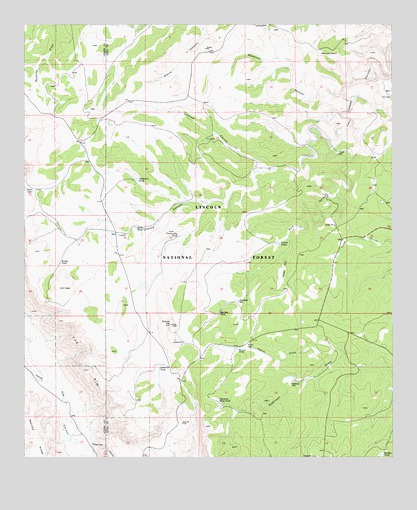
Pickett Hill, NM USGS Topographic Map
Click on map above to begin viewing in our Map Viewer.

This topographic map contains these locations and features:
Feature Name Type Latitude Longitude GNIS ID View Map
Anderson TankReservoirN32.2053°W104.8370°903161View Map
Anderson Water Storage TankReservoirN32.1898°W104.8555°899120View Map
Big Boy TankReservoirN32.1670°W104.8095°903779View Map
Bradley TankReservoirN32.1515°W104.7717°899125View Map
Brister TankReservoirN32.1816°W104.8636°904083View Map
Coats LakeLakeN32.2021°W104.8724°905226View Map
Coats Water Storage TankReservoirN32.1673°W104.8572°899119View Map
El Paso GapMineN32.1584°W104.8066°914619View Map
Game Department CabinLocaleN32.1643°W104.7766°899126View Map
Gordon TankReservoirN32.1262°W104.7540°906661View Map
Hamm DrawValleyN32.1548°W104.7669°906817View Map
Hamm Storage TankReservoirN32.1565°W104.7994°1993980View Map
Hamm TankReservoirN32.1563°W104.8030°906818View Map
Hamm WellWellN32.1565°W104.7994°906819View Map
Helper TankReservoirN32.1482°W104.7843°899124View Map
Irabarne TankReservoirN32.1509°W104.8296°907247View Map
Irabarne Water Storage TankReservoirN32.1615°W104.8302°899118View Map
Keller TankReservoirN32.1915°W104.8374°907517View Map
Knee DeepReservoirN32.1832°W104.7723°899128View Map
Last Chance Water Storage TankReservoirN32.2446°W104.7666°899132View Map
Locklear CanyonValleyN32.2079°W104.7941°900167View Map
Locklear TankReservoirN32.2189°W104.8109°899133View Map
Locklear Water Storage TankReservoirN32.2279°W104.8147°899123View Map
Mail BoxReservoirN32.1760°W104.7767°899127View Map
Middleton Storage TankReservoirN32.1704°W104.8025°908725View Map
Middleton WellWellN32.1704°W104.8025°1999033View Map
North WellWellN32.2307°W104.7530°1983842View Map
Pickett HillSummitN32.1632°W104.8257°909611View Map
Pickett TanksReservoirN32.1868°W104.7889°909612View Map
Pine CanyonValleyN32.2148°W104.7708°909648View Map
Polk TankReservoirN32.2147°W104.7822°899130View Map
Polk Water Storage TankReservoirN32.2265°W104.8183°899122View Map
Poor HouseReservoirN32.1896°W104.7755°899129View Map
Prairie Dog TankReservoirN32.1892°W104.8232°909838View Map
Price Water Storage TankReservoirN32.2257°W104.8533°899121View Map
Road TankReservoirN32.1403°W104.8177°899117View Map
Sandrock CanyonValleyN32.2309°W104.7672°910760View Map
Shattuck WellWellN32.1462°W104.7847°910975View Map
Shattuck West TankReservoirN32.1417°W104.8095°910976View Map
Sixshooter CanyonValleyN32.1282°W104.8530°911106View Map
Stone Water Storage TankReservoirN32.2184°W104.7844°899134View Map
Thayer PlaceLocaleN32.2026°W104.7736°899131View Map
Thayer WellWellN32.2132°W104.7688°911625View Map
West Water Storage TankReservoirN32.1376°W104.7947°899116View Map
Wildcat DrawValleyN32.1826°W104.7872°912382View Map

Note: Coordinates in the location and feature list above are referenced to NAD83 datum.


Copyright (C) 2008-2025 Ryan Niemi / Sunset Dynamics ... All Rights Reserved