TopoQuest Logo
Do you find TopoQuest useful?
Help keep TopoQuest running and adding new maps/features by donating!
Bitcoin:  19c7KJd3qBynnjoSw5npx9KScwjBe4ifkT
Litecoin:  LXs6TkuXGGXo1vDsWCkWVdjQX94eUKd6ui
Home View Maps Find Maps Find Places Resources & Links


Epsie NE, Montana Topographic Map

USGS Map Title: Epsie NE, MT
USGS Map MRC: 45105D5
DRG (GeoTIFF) Download: o45105d5.tif


Neighboring USGS Topographic Map Quads:


  Leslie Creek, MT  
45105E6
 

  Olive, MT  
45105E5
 

  T Creek, MT  
45105E4
 

  Epsie, MT  
45105D6
 

  Epsie NE, MT  
45105D5
 

  Broadus, MT  
45105D4
 

  Yarger Butte, MT  
45105C6
 

  Lonesome Peak, MT  
45105C5
 

  Eldon Mountain, MT  
45105C4


Map MRC Location:

N46°
W106°
N46°
W105°
H8 H7 H6 H5 H4 H3 H2 H1
G8 G7 G6 G5 G4 G3 G2 G1
F8 F7 F6 F5 F4 F3 F2 F1
E8 E7 E6 E5 E4 E3 E2 E1
D8 D7 D6 D5 D4 D3 D2 D1
C8 C7 C6 C5 C4 C3 C2 C1
B8 B7 B6 B5 B4 B3 B2 B1
A8 A7 A6 A5 A4 A3 A2 A1
N45°
W106°
N45°
W105°

Epsie NE, MT USGS 1:24K Topographic Map Preview:
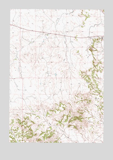
Epsie NE, MT USGS Topographic Map
Click on map above to begin viewing in our Map Viewer.

This topographic map contains these locations and features:
Feature Name Type Latitude Longitude GNIS ID View Map
04S49E13ABCC01 WellWellN45.4905°W105.6214°809760View Map
04S49E13CCCD01 WellWellN45.4819°W105.6219°809704View Map
04S49E13DBCA01 WellWellN45.4836°W105.6200°809712View Map
04S49E13DBCD01 WellWellN45.4828°W105.6197°809709View Map
04S49E13DBCD02 WellWellN45.4828°W105.6197°809710View Map
04S49E25ADCC01 WellWellN45.4575°W105.6169°809578View Map
04S49E25DABB01 WellWellN45.4567°W105.6167°809572View Map
04S50E15DABB01 WellWellN45.4853°W105.5339°809725View Map
04S50E15DABC01 WellWellN45.4850°W105.5350°809722View Map
04S50E17BDAC01 WellWellN45.4886°W105.5825°809749View Map
04S50E19ACDD01 WellWellN45.4719°W105.5964°809664View Map
04S50E19CBAC01 WellWellN45.4708°W105.6089°809652View Map
04S50E20BAAA01 WellWellN45.4750°W105.5839°809676View Map
04S50E20BAAA02 WellWellN45.4783°W105.5811°809696View Map
04S50E22DBAA01 WellWellN45.4711°W105.5358°809653View Map
04S50E23DAAA01 WellWellN45.4714°W105.5103°809657View Map
04S50E31CBCC01 WellWellN45.4397°W105.6111°809497View Map
04S50E31CC__01 WellWellN45.4375°W105.6092°809484View Map
05S50E13CCCA01 WellWellN45.3933°W105.5025°809276View Map
05S50E22CBA_01 WellWellN45.3819°W105.5464°809212View Map
Boicourt MineMineN45.3942°W105.5172°769084View Map
East Fork Wolf CreekStreamN45.4958°W105.5514°771080View Map
Gatlin MineMineN45.4172°W105.5100°771731View Map
Mathew James Number 1 DamDamN45.4467°W105.5189°797573View Map
Peerless MineMineN45.4736°W105.5192°775140View Map
Sand Creek HillSummitN45.4736°W105.5011°776194View Map
West Fork Wolf CreekStreamN45.4961°W105.5511°778289View Map

Note: Coordinates in the location and feature list above are referenced to NAD83 datum.


Copyright (C) 2008-2024 Ryan Niemi / Sunset Dynamics ... All Rights Reserved