TopoQuest Logo
Do you find TopoQuest useful?
Help keep TopoQuest running and adding new maps/features by donating!
Bitcoin:  19c7KJd3qBynnjoSw5npx9KScwjBe4ifkT
Litecoin:  LXs6TkuXGGXo1vDsWCkWVdjQX94eUKd6ui
Home View Maps Find Maps Find Places Resources & Links


Robertson Canyon, New Mexico Topographic Map

USGS Map Title: Robertson Canyon, NM
USGS Map MRC: 32105G3
DRG (GeoTIFF) Download: o32105g3.tif


Neighboring USGS Topographic Map Quads:


  Mayhill, NM  
32105H4
 

  Elk, NM  
32105H3
 

  Thimble Canyon, NM  
32105H2
 

  Woodson Canyon, NM  
32105G4
 

  Robertson Canyon, NM  
32105G3
 

  Dunken, NM  
32105G2
 

  Avis, NM  
32105F4
 

  Chimney Lake, NM  
32105F3
 

  Lewis Peak, NM  
32105F2


Map MRC Location:

N33°
W106°
N33°
W105°
H8 H7 H6 H5 H4 H3 H2 H1
G8 G7 G6 G5 G4 G3 G2 G1
F8 F7 F6 F5 F4 F3 F2 F1
E8 E7 E6 E5 E4 E3 E2 E1
D8 D7 D6 D5 D4 D3 D2 D1
C8 C7 C6 C5 C4 C3 C2 C1
B8 B7 B6 B5 B4 B3 B2 B1
A8 A7 A6 A5 A4 A3 A2 A1
N32°
W106°
N32°
W105°

Robertson Canyon, NM USGS 1:24K Topographic Map Preview:
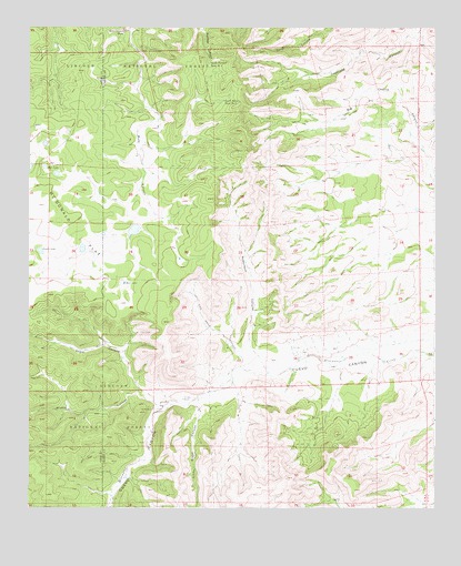
Robertson Canyon, NM USGS Topographic Map
Click on map above to begin viewing in our Map Viewer.

This topographic map contains these locations and features:
Feature Name Type Latitude Longitude GNIS ID View Map
10650 Water WellWellN32.7851°W105.3036°923114View Map
Angel CanyonValleyN32.7801°W105.3389°903165View Map
Boat LakeLakeN32.8079°W105.3459°903974View Map
Buzzard TankReservoirN32.8691°W105.3662°913280View Map
Cox CemeteryCemeteryN32.7876°W105.3077°905463View Map
Gowen LakeLakeN32.8168°W105.3716°906675View Map
Hale LakeLakeN32.8386°W105.3703°906810View Map
Jernigan RanchLocaleN32.7790°W105.3278°907352View Map
KOK RanchLocaleN32.7757°W105.3366°907585View Map
Left Hand CanyonValleyN32.7904°W105.3119°907927View Map
Little Angel CanyonValleyN32.7765°W105.3228°907981View Map
Middle CanyonValleyN32.7776°W105.3325°908681View Map
Mule Canyon TankReservoirN32.8736°W105.3462°908972View Map
Mule Canyon Trick TankReservoirN32.8469°W105.3092°1987881View Map
Mule RidgeRidgeN32.8640°W105.3200°913276View Map
Mule Ridge WellWellN32.8640°W105.3197°1987884View Map
Robertson CanyonValleyN32.7895°W105.3047°910353View Map
Skunk Canyon DrawArroyoN32.7820°W105.3305°929144View Map
South Pasture Tank Number 1ReservoirN32.8654°W105.3197°929057View Map
South Pasture Tank Number 2ReservoirN32.8557°W105.3153°929058View Map

Note: Coordinates in the location and feature list above are referenced to NAD83 datum.


Copyright (C) 2008-2025 Ryan Niemi / Sunset Dynamics ... All Rights Reserved