TopoQuest Logo
Do you find TopoQuest useful?
Help keep TopoQuest running and adding new maps/features by donating!
Bitcoin:  19c7KJd3qBynnjoSw5npx9KScwjBe4ifkT
Litecoin:  LXs6TkuXGGXo1vDsWCkWVdjQX94eUKd6ui
Home View Maps Find Maps Find Places Resources & Links


Farmington, Iowa Topographic Map

USGS Map Title: Farmington, IA
USGS Map MRC: 40091F6
DRG (GeoTIFF) Download: o40091f6.tif


Neighboring USGS Topographic Map Quads:


  Stockport, IA  
40091G7
 

  Hillsboro, IA  
40091G6
 

  Salem, IA  
40091G5
 

  Bonaparte, IA  
40091F7
 

  Farmington, IA  
40091F6
 

  Donnellson, IA  
40091F5
 

  Anson, MO  
40091E7
 

  Croton, IA  
40091E6
 

  Argyle, IA  
40091E5


Map MRC Location:

N41°
W92°
N41°
W91°
H8 H7 H6 H5 H4 H3 H2 H1
G8 G7 G6 G5 G4 G3 G2 G1
F8 F7 F6 F5 F4 F3 F2 F1
E8 E7 E6 E5 E4 E3 E2 E1
D8 D7 D6 D5 D4 D3 D2 D1
C8 C7 C6 C5 C4 C3 C2 C1
B8 B7 B6 B5 B4 B3 B2 B1
A8 A7 A6 A5 A4 A3 A2 A1
N40°
W92°
N40°
W91°

Farmington, IA USGS 1:24K Topographic Map Preview:
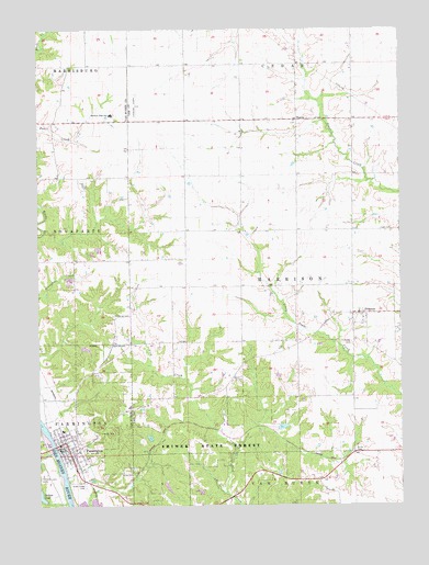
Farmington, IA USGS Topographic Map
Click on map above to begin viewing in our Map Viewer.

This topographic map contains these locations and features:
Feature Name Type Latitude Longitude GNIS ID View Map
Acklan CemeteryCemeteryN40.6586°W91.6804°454083View Map
Alfrey CemeteryCemeteryN40.6336°W91.7220°454125View Map
Assembly of God ChurchChurchN40.6375°W91.7399°1980946View Map
Big Indian CreekStreamN40.6389°W91.7471°454612View Map
Butler CemeteryCemeteryN40.6393°W91.6411°455017View Map
Christy ClinicHospitalN40.6392°W91.7429°1980938View Map
Church of the NazareneChurchN40.6403°W91.7429°1980949View Map
City of FarmingtonCivilN40.6389°W91.7390°2394748View Map
Cook CemeteryCemeteryN40.6974°W91.6321°455585View Map
FarmingtonPopulated PlaceN40.6403°W91.7429°456553View Map
Farmington (historical)LocaleN40.6425°W91.7391°1980945View Map
Farmington CemeteryCemeteryN40.6417°W91.7335°456554View Map
Farmington City HallBuildingN40.6400°W91.7421°1980942View Map
Farmington ClinicHospitalN40.6398°W91.7402°1980939View Map
Farmington Fire Department and Emergency Medical ServicesBuildingN40.6395°W91.7403°2577517View Map
Farmington Post OfficePost OfficeN40.6398°W91.7435°1980941View Map
Farmington Public LibraryBuildingN40.6400°W91.7421°1980943View Map
First Baptist ChurchChurchN40.6431°W91.7391°1980948View Map
Frost Grove CemeteryCemeteryN40.6334°W91.6668°1981321View Map
George Perkins Historical MarkerParkN40.7256°W91.6613°1981366View Map
Green Glade CemeteryCemeteryN40.6306°W91.7343°457100View Map
H Banla Grounds CemeteryCemeteryN40.6334°W91.6863°1981320View Map
Harmony High SchoolSchoolN40.7279°W91.7248°457267View Map
Harmony Middle SchoolSchoolN40.6447°W91.7418°2719919View Map
Harmony Middle SchoolSchoolN40.6448°W91.7418°1980937View Map
Indian Lake Park TrailTrailN40.6306°W91.7488°1980987View Map
Kennedy Farm CemeteryCemeteryN40.7445°W91.6668°1981364View Map
Keteban Switch (historical)Populated PlaceN40.6464°W91.6991°464343View Map
McDaniel CemeteryCemeteryN40.6751°W91.7244°458902View Map
Pioneer Historical MuseumBuildingN40.6398°W91.7404°1980940View Map
PlymouthPopulated PlaceN40.6534°W91.7452°464339View Map
PrimrosePopulated PlaceN40.6756°W91.6382°460452View Map
Primrose CemeteryCemeteryN40.6678°W91.6420°460453View Map
Primrose Post Office (historical)Post OfficeN40.6756°W91.6382°1981093View Map
Reid Farm CemeteryCemeteryN40.6334°W91.6502°1981319View Map
Riverview CampgroundLocaleN40.6681°W91.7238°1980944View Map
Sax CemeteryCemeteryN40.7028°W91.6502°1981317View Map
SharonPopulated PlaceN40.7264°W91.6604°464741View Map
Sharon CemeteryCemeteryN40.7256°W91.6613°1981367View Map
Sharon United Presbyterian ChurchChurchN40.6403°W91.7429°1980950View Map
Shimek Forest Dam ThreeDamN40.6417°W91.7121°463542View Map
Shimek Forest Pond TwoReservoirN40.6429°W91.7121°463543View Map
Shimek Forest TrailTrailN40.6431°W91.6835°1981599View Map
Shimek State Forest Wildlife Management Area - Donnellson UnitParkN40.6417°W91.6668°1981597View Map
Shimek State Forest Wildlife Management Area - Farmington UnitParkN40.6445°W91.7224°1980853View Map
Snyder CemeteryCemeteryN40.7084°W91.7474°1980998View Map
Township of HarrisonCivilN40.6826°W91.6608°468014View Map
United Methodist ChurchChurchN40.6378°W91.7388°1980947View Map

Note: Coordinates in the location and feature list above are referenced to NAD83 datum.


Copyright (C) 2008-2025 Ryan Niemi / Sunset Dynamics ... All Rights Reserved