TopoQuest Logo
Do you find TopoQuest useful?
Help keep TopoQuest running and adding new maps/features by donating!
Bitcoin:  19c7KJd3qBynnjoSw5npx9KScwjBe4ifkT
Litecoin:  LXs6TkuXGGXo1vDsWCkWVdjQX94eUKd6ui
Home View Maps Find Maps Find Places Resources & Links


Ellendale, North Carolina Topographic Map

USGS Map Title: Ellendale, NC
USGS Map MRC: 35081H3
DRG (GeoTIFF) Download: o35081h3.tif


Neighboring USGS Topographic Map Quads:


  Grandin, NC  
36081A4
 

  Boomer, NC  
36081A3
 

  Moravian Falls, NC  
36081A2
 

  Kings Creek, NC  
35081H4
 

  Ellendale, NC  
35081H3
 

  Taylorsville, NC  
35081H2
 

  Granite Falls, NC  
35081G4
 

  Bethlehem, NC  
35081G3
 

  Millersville, NC  
35081G2


Map MRC Location:

N36°
W82°
N36°
W81°
H8 H7 H6 H5 H4 H3 H2 H1
G8 G7 G6 G5 G4 G3 G2 G1
F8 F7 F6 F5 F4 F3 F2 F1
E8 E7 E6 E5 E4 E3 E2 E1
D8 D7 D6 D5 D4 D3 D2 D1
C8 C7 C6 C5 C4 C3 C2 C1
B8 B7 B6 B5 B4 B3 B2 B1
A8 A7 A6 A5 A4 A3 A2 A1
N35°
W82°
N35°
W81°

Ellendale, NC USGS 1:24K Topographic Map Preview:
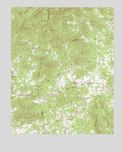
Ellendale, NC USGS Topographic Map
Click on map above to begin viewing in our Map Viewer.

This topographic map contains these locations and features:
Feature Name Type Latitude Longitude GNIS ID View Map
All Healing SpringsSpringN35.9326°W81.2640°1018791View Map
Antioch ChurchChurchN35.8935°W81.3137°980237View Map
Bald KnobSummitN35.8832°W81.2693°980470View Map
Cox KnobSummitN35.9796°W81.3598°983675View Map
Dover ChurchChurchN35.9571°W81.3331°984313View Map
Downsville (historical)Populated PlaceN35.8812°W81.3612°1001506View Map
Duck CreekStreamN35.8832°W81.3006°984381View Map
EllendalePopulated PlaceN35.9257°W81.2795°1020132View Map
Ellendale Community Volunteer Fire DepartmentBuildingN35.9212°W81.2620°2639144View Map
Ellendale Elementary SchoolSchoolN35.9268°W81.2790°1003541View Map
Ginger CreekStreamN35.9393°W81.3726°985707View Map
Hickory KnobSummitN35.9965°W81.3290°1020710View Map
Holsclaw CreekStreamN35.9612°W81.3412°986979View Map
Little Brush MountainSummitN35.9454°W81.3184°1023499View Map
Little RiverPopulated PlaceN35.8893°W81.3062°1006280View Map
Mountain Ridge ChurchChurchN35.9460°W81.2831°990705View Map
Never MountainSummitN35.9679°W81.2979°1021624View Map
Oxford Memorial ChurchChurchN35.9176°W81.3209°991762View Map
Poplar CreekStreamN35.9665°W81.2748°992688View Map
Poplar Springs ChurchChurchN35.9860°W81.2804°992710View Map
Township of EllendaleCivilN35.9183°W81.2804°1026356View Map
Township of Little RiverCivilN35.9862°W81.2537°1026358View Map
White CreekStreamN35.9354°W81.3040°997132View Map

Note: Coordinates in the location and feature list above are referenced to NAD83 datum.


Copyright (C) 2008-2025 Ryan Niemi / Sunset Dynamics ... All Rights Reserved