TopoQuest Logo
Do you find TopoQuest useful?
Help keep TopoQuest running and adding new maps/features by donating!
Bitcoin:  19c7KJd3qBynnjoSw5npx9KScwjBe4ifkT
Litecoin:  LXs6TkuXGGXo1vDsWCkWVdjQX94eUKd6ui
Home View Maps Find Maps Find Places Resources & Links


Elmer, Louisiana Topographic Map

USGS Map Title: Elmer, LA
USGS Map MRC: 31092B6
DRG (GeoTIFF) Download: o31092b6.tif


Neighboring USGS Topographic Map Quads:


  Jericho, LA  
31092C7
 

  Gardner, LA  
31092C6
 

  Rapides, LA  
31092C5
 

  Sieper, LA  
31092B7
 

  Elmer, LA  
31092B6
 

  Woodworth West, LA  
31092B5
 

  Afeman, LA  
31092A7
 

  Melder, LA  
31092A6
 

  Forest Hill, LA  
31092A5


Map MRC Location:

N32°
W93°
N32°
W92°
H8 H7 H6 H5 H4 H3 H2 H1
G8 G7 G6 G5 G4 G3 G2 G1
F8 F7 F6 F5 F4 F3 F2 F1
E8 E7 E6 E5 E4 E3 E2 E1
D8 D7 D6 D5 D4 D3 D2 D1
C8 C7 C6 C5 C4 C3 C2 C1
B8 B7 B6 B5 B4 B3 B2 B1
A8 A7 A6 A5 A4 A3 A2 A1
N31°
W93°
N31°
W92°

Elmer, LA USGS 1:24K Topographic Map Preview:
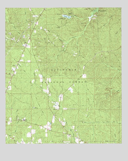
Elmer, LA USGS Topographic Map
Click on map above to begin viewing in our Map Viewer.

This topographic map contains these locations and features:
Feature Name Type Latitude Longitude GNIS ID View Map
Burrough CemeteryCemeteryN31.2357°W92.6687°547154View Map
Camp Eight ChurchChurchN31.1971°W92.7382°547173View Map
Castor School (historical)SchoolN31.1744°W92.6460°551683View Map
Darks CreekStreamN31.2399°W92.7499°547290View Map
Dias BranchStreamN31.2180°W92.6829°547300View Map
Dyer CemeteryCemeteryN31.2463°W92.7274°548250View Map
ElmerPopulated PlaceN31.1324°W92.6810°547339View Map
Elmer Post OfficePost OfficeN31.1322°W92.6813°1631726View Map
Fellowship ChurchChurchN31.1471°W92.7365°547354View Map
Fellowship CreekStreamN31.1441°W92.7385°547355View Map
Gardner Lookout TowerTowerN31.2324°W92.6910°558773View Map
Hineston Lookout TowerTowerN31.1580°W92.7196°558783View Map
Hineston Ward FiveCivilN31.1721°W92.7221°545172View Map
Lake Nature TrailTrailN31.2485°W92.6857°548204View Map
Lathe BranchStreamN31.2471°W92.6538°547565View Map
LewistonPopulated PlaceN31.2010°W92.7351°551730View Map
LissoPopulated PlaceN31.1374°W92.7026°551731View Map
Long BranchStreamN31.2238°W92.6724°547624View Map
Marler CemeteryCemeteryN31.2216°W92.7063°547649View Map
Muddy BranchStreamN31.2180°W92.6840°547763View Map
New Sunrise ChurchChurchN31.1910°W92.7410°547775View Map
North Shore CampgroundLocaleN31.2438°W92.6813°547780View Map
Oak Hill Elementary SchoolSchoolN31.1472°W92.7299°2462761View Map
Oak Hill High SchoolSchoolN31.1472°W92.7310°547786View Map
Oak Hill Volunteer Fire Department Station 2BuildingN31.1881°W92.7419°2672997View Map
Oak Hill Volunteer Fire Department Station 3BuildingN31.1351°W92.6869°2672988View Map
OtisPopulated PlaceN31.2155°W92.7279°547804View Map
Otis Post OfficePost OfficeN31.2154°W92.7281°1631760View Map
Palustruis Experimental Forest Johnson TractParkN31.1807°W92.6757°548203View Map
Rougeau CemeteryCemeteryN31.1566°W92.6940°547915View Map
Saint Clair Baptist ChurchChurchN31.2380°W92.7215°555884View Map
Saint Clair School (historical)SchoolN31.2371°W92.7215°551772View Map
Saint Peter CemeteryCemeteryN31.1377°W92.6807°547939View Map
Spring Creek School (historical)SchoolN31.1877°W92.7135°551785View Map
Stracener BranchStreamN31.2407°W92.6593°548041View Map
Swann CemeteryCemeteryN31.1277°W92.6668°548057View Map
Valentine LakeReservoirN31.2420°W92.6838°556318View Map
Valentine Lake DamDamN31.2002°W92.6835°556796View Map
Valentine Recreation AreaParkN31.2402°W92.6868°548115View Map
Wild Azalea Trail Kincaid SpurTrailN31.2377°W92.6254°548263View Map

Note: Coordinates in the location and feature list above are referenced to NAD83 datum.


Copyright (C) 2008-2025 Ryan Niemi / Sunset Dynamics ... All Rights Reserved