TopoQuest Logo
Do you find TopoQuest useful?
Help keep TopoQuest running and adding new maps/features by donating!
Bitcoin:  19c7KJd3qBynnjoSw5npx9KScwjBe4ifkT
Litecoin:  LXs6TkuXGGXo1vDsWCkWVdjQX94eUKd6ui
Home View Maps Find Maps Find Places Resources & Links


Jericho, Louisiana Topographic Map

USGS Map Title: Jericho, LA
USGS Map MRC: 31092C7
DRG (GeoTIFF) Download: o31092c7.tif


Neighboring USGS Topographic Map Quads:


  Gorum, LA  
31092D8
 

  Lena, LA  
31092D7
 

  Boyce, LA  
31092D6
 

  Temple, LA  
31092C8
 

  Jericho, LA  
31092C7
 

  Gardner, LA  
31092C6
 

  Lacamp, LA  
31092B8
 

  Sieper, LA  
31092B7
 

  Elmer, LA  
31092B6


Map MRC Location:

N32°
W93°
N32°
W92°
H8 H7 H6 H5 H4 H3 H2 H1
G8 G7 G6 G5 G4 G3 G2 G1
F8 F7 F6 F5 F4 F3 F2 F1
E8 E7 E6 E5 E4 E3 E2 E1
D8 D7 D6 D5 D4 D3 D2 D1
C8 C7 C6 C5 C4 C3 C2 C1
B8 B7 B6 B5 B4 B3 B2 B1
A8 A7 A6 A5 A4 A3 A2 A1
N31°
W93°
N31°
W92°

Jericho, LA USGS 1:24K Topographic Map Preview:
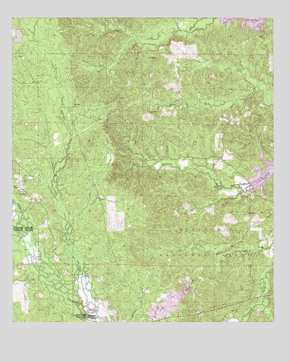
Jericho, LA USGS Topographic Map
Click on map above to begin viewing in our Map Viewer.

This topographic map contains these locations and features:
Feature Name Type Latitude Longitude GNIS ID View Map
Ball CemeteryCemeteryN31.2949°W92.7588°546994View Map
Campbell CreekStreamN31.3699°W92.7938°547178View Map
Canal BayouStreamN31.3474°W92.7565°547181View Map
CliftonPopulated PlaceN31.3052°W92.8713°547231View Map
Clifton Choctaw State Designated Tribal Statistical AreaCensusN31.2960°W92.8563°2418840View Map
Clifton School (historical)SchoolN31.3030°W92.8679°551690View Map
Cypress School (historical)SchoolN31.3549°W92.8693°551698View Map
Dough HillsSummitN31.3366°W92.8099°547306View Map
Dry ProngStreamN31.2796°W92.7676°547326View Map
Hill CemeteryCemeteryN31.3588°W92.8060°547465View Map
JerichoPopulated PlaceN31.2674°W92.8665°547522View Map
Little Indian CreekStreamN31.2577°W92.7560°547606View Map
Noel CemeteryCemeteryN31.3055°W92.8740°547779View Map
Odom (historical)Populated PlaceN31.3660°W92.7543°551751View Map
Pisgah ChurchChurchN31.3030°W92.8679°547851View Map
Rocky CreekStreamN31.3049°W92.7599°547906View Map
Waldon Church (historical)ChurchN31.2613°W92.7538°551799View Map
Williamson CreekStreamN31.3074°W92.7621°548151View Map

Note: Coordinates in the location and feature list above are referenced to NAD83 datum.


Copyright (C) 2008-2024 Ryan Niemi / Sunset Dynamics ... All Rights Reserved