TopoQuest Logo
Do you find TopoQuest useful?
Help keep TopoQuest running and adding new maps/features by donating!
Bitcoin:  19c7KJd3qBynnjoSw5npx9KScwjBe4ifkT
Litecoin:  LXs6TkuXGGXo1vDsWCkWVdjQX94eUKd6ui
Home View Maps Find Maps Find Places Resources & Links


Emerson SE, Arkansas Topographic Map

USGS Map Title: Emerson SE, AR
USGS Map MRC: 33093A1
DRG (GeoTIFF) Download: o33093a1.tif


Neighboring USGS Topographic Map Quads:


  Calhoun, AR  
33093B2
 

  Spotville, AR  
33093B1
 

  Marysville, AR  
33092B8
 

  Emerson, AR  
33093A2
 

  Emerson SE, AR  
33093A1
 

  Wesson SW, AR  
33092A8
 

  Haynesville West, LA  
32093H2
 

  Haynesville East, LA  
32093H1
 

  Colquitt, LA  
32092H8


Map MRC Location:

N34°
W94°
N34°
W93°
H8 H7 H6 H5 H4 H3 H2 H1
G8 G7 G6 G5 G4 G3 G2 G1
F8 F7 F6 F5 F4 F3 F2 F1
E8 E7 E6 E5 E4 E3 E2 E1
D8 D7 D6 D5 D4 D3 D2 D1
C8 C7 C6 C5 C4 C3 C2 C1
B8 B7 B6 B5 B4 B3 B2 B1
A8 A7 A6 A5 A4 A3 A2 A1
N33°
W94°
N33°
W93°

Emerson SE, AR USGS 1:24K Topographic Map Preview:
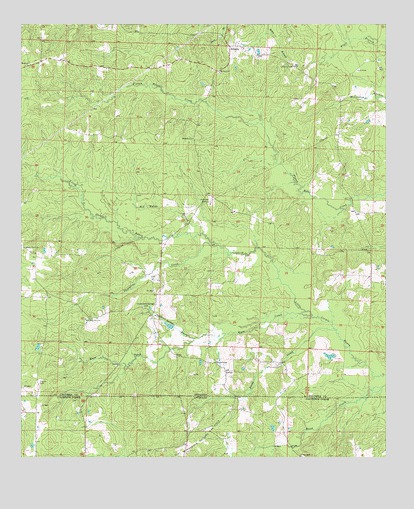
Emerson SE, AR USGS Topographic Map
Click on map above to begin viewing in our Map Viewer.

This topographic map contains these locations and features:
Feature Name Type Latitude Longitude GNIS ID View Map
AtlantaPopulated PlaceN33.1187°W93.0527°57286View Map
Beene CreekStreamN33.0368°W93.0178°46336View Map
Calico Neck (historical)Populated PlaceN33.0596°W93.0054°60265View Map
Calico Neck School (historical)SchoolN33.0601°W93.0074°60264View Map
Chalybeate Springs BranchStreamN33.0346°W93.0657°47674View Map
Chalybeate Springs CemeteryCemeteryN33.0437°W93.0832°47675View Map
Chalybeate Springs Church (historical)ChurchN33.0435°W93.0821°60260View Map
East Haynesville Oil and Gas FieldOilfieldN33.0068°W93.0629°546953View Map
Mount Bethel ChurchChurchN33.0921°W93.0660°52260View Map
Mount Israel ChurchChurchN33.1112°W93.0566°52307View Map
Mount Pleasant School (historical)SchoolN33.0182°W93.0682°60262View Map
New Hope Number 1 ChurchChurchN33.0404°W93.1027°82519View Map
OwensPopulated PlaceN33.0254°W93.0546°57147View Map
Piney Grove ChurchChurchN33.0610°W93.1232°78019View Map
Rasberry LakeReservoirN33.0381°W93.0740°80449View Map
Rasberry Lake DamDamN33.0385°W93.0718°80448View Map
Red Water BranchStreamN33.0651°W93.0624°53960View Map
Roadside ChurchChurchN33.1132°W93.1235°54061View Map
Sassafras CreekStreamN33.0615°W93.0579°54597View Map
Sobers Chapel (historical)ChurchN33.0240°W93.0199°60263View Map
Township of Brown (historical)CivilN33.0876°W93.0627°59961View Map
Traylor CemeteryCemeteryN33.0224°W93.1185°55641View Map
WarePopulated PlaceN33.0296°W93.0713°78696View Map
Ware CreekStreamN33.0412°W93.0257°56056View Map
Wares Chapel United Methodist ChurchChurchN33.0276°W93.0577°78697View Map
Woodward Chapel (historical)ChurchN33.0182°W93.0713°60261View Map

Note: Coordinates in the location and feature list above are referenced to NAD83 datum.


Copyright (C) 2008-2024 Ryan Niemi / Sunset Dynamics ... All Rights Reserved