TopoQuest Logo
Do you find TopoQuest useful?
Help keep TopoQuest running and adding new maps/features by donating!
Bitcoin:  19c7KJd3qBynnjoSw5npx9KScwjBe4ifkT
Litecoin:  LXs6TkuXGGXo1vDsWCkWVdjQX94eUKd6ui
Home View Maps Find Maps Find Places Resources & Links


Waterville, Pennsylvania Topographic Map

USGS Map Title: Waterville, PA
USGS Map MRC: 41077C3
DRG (GeoTIFF) Download: o41077c3.tif


Neighboring USGS Topographic Map Quads:


  Cammal, PA  
41077D4
 

  English Center, PA  
41077D3
 

  White Pine, PA  
41077D2
 

  Jersey Mills, PA  
41077C4
 

  Waterville, PA  
41077C3
 

  Salladasburg, PA  
41077C2
 

  Lock Haven, PA  
41077B4
 

  Jersey Shore, PA  
41077B3
 

  Linden, PA  
41077B2


Map MRC Location:

N42°
W78°
N42°
W77°
H8 H7 H6 H5 H4 H3 H2 H1
G8 G7 G6 G5 G4 G3 G2 G1
F8 F7 F6 F5 F4 F3 F2 F1
E8 E7 E6 E5 E4 E3 E2 E1
D8 D7 D6 D5 D4 D3 D2 D1
C8 C7 C6 C5 C4 C3 C2 C1
B8 B7 B6 B5 B4 B3 B2 B1
A8 A7 A6 A5 A4 A3 A2 A1
N41°
W78°
N41°
W77°

Waterville, PA USGS 1:24K Topographic Map Preview:
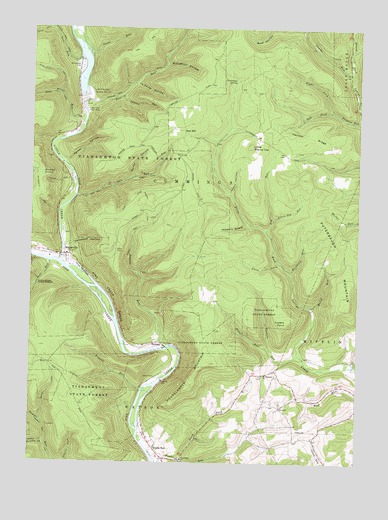
Waterville, PA USGS Topographic Map
Click on map above to begin viewing in our Map Viewer.

This topographic map contains these locations and features:
Feature Name Type Latitude Longitude GNIS ID View Map
Baldwin TrailTrailN41.3237°W77.3316°1168662View Map
Bear Path TrailTrailN41.3726°W77.3230°1205735View Map
Blackwell SwampSwampN41.3327°W77.3711°1169779View Map
Bonnell RunStreamN41.2706°W77.3319°1169979View Map
Boone RunStreamN41.3492°W77.3550°1169995View Map
Broughton HollowValleyN41.3646°W77.3240°1170355View Map
Brown TrailTrailN41.2709°W77.3672°1170379View Map
Buckhorn RunStreamN41.3048°W77.2755°1170566View Map
Bull RunStreamN41.3076°W77.3672°1192217View Map
Bush RunStreamN41.3423°W77.3669°1212694View Map
Buttonwood RunStreamN41.3006°W77.3539°1195892View Map
Camp KlineLocaleN41.2742°W77.3255°1171043View Map
Canoe Run School (historical)SchoolN41.2551°W77.2644°1197471View Map
Carson RunStreamN41.3556°W77.3408°1171273View Map
CCC CampLocaleN41.3534°W77.3539°1197470View Map
Cemetery HollowValleyN41.3125°W77.3600°1171414View Map
Centennial ChurchChurchN41.2509°W77.3161°1171419View Map
Clark Hollow TrailTrailN41.3317°W77.3230°1205733View Map
Cold Spring HollowValleyN41.3538°W77.2502°1172155View Map
Conner TrailTrailN41.3306°W77.3644°1172350View Map
Cummings SpringSpringN41.3599°W77.2970°1172834View Map
Dam RunStreamN41.3265°W77.3575°1172911View Map
Dog RunStreamN41.3167°W77.2850°1173345View Map
Eagle TrailTrailN41.3698°W77.3269°1205734View Map
East HillPopulated PlaceN41.3456°W77.3166°1203475View Map
English MillsPopulated PlaceN41.3459°W77.3580°1201886View Map
English RunStreamN41.3540°W77.3544°1174265View Map
Fishery PointCliffN41.2904°W77.2769°1174835View Map
Flow Dam TrailTrailN41.3698°W77.3336°1198747View Map
Frieden Church (historical)ChurchN41.2559°W77.2647°1197472View Map
Gamble ForkStreamN41.2553°W77.3686°1175400View Map
Gamble Run TrailTrailN41.2623°W77.3725°1175402View Map
Hell HollowValleyN41.3663°W77.3561°1198867View Map
Henson RidgeRidgeN41.3417°W77.2591°1176851View Map
Hickory SwaleValleyN41.3188°W77.2923°1176980View Map
Houselander MountainSummitN41.2715°W77.3147°1177509View Map
Jacobs HollowValleyN41.3278°W77.2990°1177964View Map
La Porte HollowValleyN41.3593°W77.3351°1178731View Map
Lawshe RunStreamN41.3620°W77.2525°1179060View Map
Left Fork Funston RunStreamN41.3515°W77.2600°1179142View Map
Little Dog RunStreamN41.3201°W77.2822°1179528View Map
Little Pine CreekStreamN41.3076°W77.3636°1217359View Map
Little Pine Creek State Park ReservoirReservoirN41.3551°W77.3597°1195495View Map
Little Pine DamDamN41.3553°W77.3555°1179636View Map
Little Pine Picnic AreaLocaleN41.3520°W77.3541°1179637View Map
Little Round TopSummitN41.3412°W77.2916°1179663View Map
Love RunStreamN41.3665°W77.3558°1199090View Map
Marsh RunStreamN41.2948°W77.2672°1180456View Map
Mount Pleasant ChurchChurchN41.2756°W77.2855°1181824View Map
Naval RunStreamN41.3676°W77.3533°1182187View Map
Naval TrailTrailN41.3706°W77.3447°1205732View Map
North Fork Tombs RunStreamN41.2512°W77.3175°1182590View Map
Parker HollowValleyN41.3366°W77.3615°1183316View Map
Pesto TrailTrailN41.3737°W77.3714°1183616View Map
Pond Lick CoveValleyN41.3076°W77.2806°1184239View Map
Puterbaugh MountainSummitN41.2951°W77.2536°1184506View Map
RamseyPopulated PlaceN41.2845°W77.3244°1184630View Map
Ramsey RunStreamN41.2837°W77.3208°1184636View Map
Ramsey TrailTrailN41.3131°W77.3361°1184639View Map
Right Fork Funston RunStreamN41.3515°W77.2600°1185075View Map
Ritter RunStreamN41.2831°W77.2836°1185120View Map
Spike Buck TrailTrailN41.3628°W77.3680°1188172View Map
Tarkiln RunStreamN41.2812°W77.2719°1189284View Map
Thompson HollowValleyN41.3687°W77.2529°1189503View Map
Tiadaghton TrailTrailN41.2776°W77.3414°1205729View Map
Tombs RunPopulated PlaceN41.2526°W77.3255°1189634View Map
Tombs RunStreamN41.2503°W77.3261°1189635View Map
Township of CummingsCivilN41.3356°W77.3439°1216746View Map
Township of WatsonCivilN41.2527°W77.3374°1216776View Map
WatervillePopulated PlaceN41.3098°W77.3614°1190685View Map
Waterville Post OfficePost OfficeN41.3102°W77.3621°2773280View Map
Waterville Volunteer Fire CompanyBuildingN41.3102°W77.3678°2653144View Map

Note: Coordinates in the location and feature list above are referenced to NAD83 datum.


Copyright (C) 2008-2024 Ryan Niemi / Sunset Dynamics ... All Rights Reserved