TopoQuest Logo
Do you find TopoQuest useful?
Help keep TopoQuest running and adding new maps/features by donating!
Bitcoin:  19c7KJd3qBynnjoSw5npx9KScwjBe4ifkT
Litecoin:  LXs6TkuXGGXo1vDsWCkWVdjQX94eUKd6ui
Home View Maps Find Maps Find Places Resources & Links


Nauvoo, Pennsylvania Topographic Map

USGS Map Title: Nauvoo, PA
USGS Map MRC: 41077E2
DRG (GeoTIFF) Download: o41077e2.tif


Neighboring USGS Topographic Map Quads:


  Antrim, PA  
41077F3
 

  Cherry Flats, PA  
41077F2
 

  Blossburg, PA  
41077F1
 

  Morris, PA  
41077E3
 

  Nauvoo, PA  
41077E2
 

  Liberty, PA  
41077E1
 

  English Center, PA  
41077D3
 

  White Pine, PA  
41077D2
 

  Trout Run, PA  
41077D1


Map MRC Location:

N42°
W78°
N42°
W77°
H8 H7 H6 H5 H4 H3 H2 H1
G8 G7 G6 G5 G4 G3 G2 G1
F8 F7 F6 F5 F4 F3 F2 F1
E8 E7 E6 E5 E4 E3 E2 E1
D8 D7 D6 D5 D4 D3 D2 D1
C8 C7 C6 C5 C4 C3 C2 C1
B8 B7 B6 B5 B4 B3 B2 B1
A8 A7 A6 A5 A4 A3 A2 A1
N41°
W78°
N41°
W77°

Nauvoo, PA USGS 1:24K Topographic Map Preview:
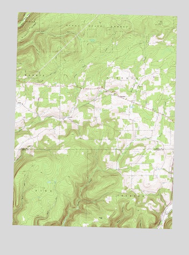
Nauvoo, PA USGS Topographic Map
Click on map above to begin viewing in our Map Viewer.

This topographic map contains these locations and features:
Feature Name Type Latitude Longitude GNIS ID View Map
Beuter SchoolSchoolN41.5837°W77.1536°1197377View Map
Beuters ChurchChurchN41.5834°W77.1536°1169456View Map
Blacks MillLocaleN41.5529°W77.1441°1197379View Map
Bloss Lookout TowerTowerN41.6204°W77.1369°1213145View Map
Bloss Mountain TrailTrailN41.6217°W77.1322°1205900View Map
Buttonwood Covered BridgeBridgeN41.5097°W77.1300°2709851View Map
HartsfieldPopulated PlaceN41.5759°W77.1650°1202938View Map
Hickory RidgeRidgeN41.6087°W77.2472°1176969View Map
Hickory Ridge TrailTrailN41.6112°W77.2178°1176973View Map
Link School (historical)SchoolN41.5559°W77.2280°1197381View Map
Little Fall CreekStreamN41.5692°W77.2039°1179540View Map
NauvooPopulated PlaceN41.5645°W77.2091°1182186View Map
PlankPopulated PlaceN41.5712°W77.2461°1183995View Map
Plank SchoolSchoolN41.5709°W77.2444°1197382View Map
Reed SchoolSchoolN41.5312°W77.1578°1197392View Map
Reed School (historical)SchoolN41.5679°W77.1375°1197378View Map
Salem ChurchChurchN41.5776°W77.1722°1186854View Map
Salem Lutheran CemeteryCemeteryN41.5779°W77.1741°2774821View Map
Schoolhouse RunStreamN41.5006°W77.1372°1199962View Map
Sugar HillSummitN41.5056°W77.1783°1188942View Map

Note: Coordinates in the location and feature list above are referenced to NAD83 datum.


Copyright (C) 2008-2024 Ryan Niemi / Sunset Dynamics ... All Rights Reserved