TopoQuest Logo
Do you find TopoQuest useful?
Help keep TopoQuest running and adding new maps/features by donating!
Bitcoin:  19c7KJd3qBynnjoSw5npx9KScwjBe4ifkT
Litecoin:  LXs6TkuXGGXo1vDsWCkWVdjQX94eUKd6ui
Home View Maps Find Maps Find Places Resources & Links


Epsie, Montana Topographic Map

USGS Map Title: Epsie, MT
USGS Map MRC: 45105D6
DRG (GeoTIFF) Download: o45105d6.tif


Neighboring USGS Topographic Map Quads:


  Samuelson Ranch, MT  
45105E7
 

  Leslie Creek, MT  
45105E6
 

  Olive, MT  
45105E5
 

  Sonnette, MT  
45105D7
 

  Epsie, MT  
45105D6
 

  Epsie NE, MT  
45105D5
 

  Hodsdon Flats, MT  
45105C7
 

  Yarger Butte, MT  
45105C6
 

  Lonesome Peak, MT  
45105C5


Map MRC Location:

N46°
W106°
N46°
W105°
H8 H7 H6 H5 H4 H3 H2 H1
G8 G7 G6 G5 G4 G3 G2 G1
F8 F7 F6 F5 F4 F3 F2 F1
E8 E7 E6 E5 E4 E3 E2 E1
D8 D7 D6 D5 D4 D3 D2 D1
C8 C7 C6 C5 C4 C3 C2 C1
B8 B7 B6 B5 B4 B3 B2 B1
A8 A7 A6 A5 A4 A3 A2 A1
N45°
W106°
N45°
W105°

Epsie, MT USGS 1:24K Topographic Map Preview:
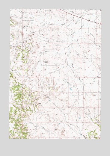
Epsie, MT USGS Topographic Map
Click on map above to begin viewing in our Map Viewer.

This topographic map contains these locations and features:
Feature Name Type Latitude Longitude GNIS ID View Map
04S48E24ABDB01 WellWellN45.4758°W105.7394°809680View Map
04S49E08DCBD01 WellWellN45.4983°W105.7022°809801View Map
04S49E09DDDB01 WellWellN45.4980°W105.6756°809797View Map
04S49E14BABB01 WellWellN45.4953°W105.6472°809782View Map
04S49E14BCBD01 WellWellN45.4922°W105.6511°809770View Map
04S49E14CBCD01 WellWellN45.4858°W105.6514°809730View Map
04S49E14DBBD01 WellWellN45.4880°W105.6408°809743View Map
04S49E15ADCC01 WellWellN45.4897°W105.6581°809755View Map
04S49E15BDDC01 WellWellN45.4897°W105.6631°809756View Map
04S49E15BDDD01 WellWellN45.4897°W105.6636°809757View Map
04S49E16CCBB01 WellWellN45.4853°W105.6931°809726View Map
04S49E17CDAA01 WellWellN45.4844°W105.7050°809717View Map
04S49E18DAAA01 WellWellN45.4883°W105.7158°809745View Map
04S49E22ACBA01 WellWellN45.4775°W105.6619°809687View Map
04S49E22ACBB01 WellWellN45.4775°W105.6625°809688View Map
04S49E22ACBB02 WellWellN45.4775°W105.6631°809689View Map
04S49E22BADD01 WellWellN45.4758°W105.6631°809679View Map
04S49E22DCAB01 WellWellN45.4700°W105.6603°809647View Map
04S49E23ACAC01 WellWellN45.4764°W105.6403°809682View Map
04S49E23CADD01 WellWellN45.4714°W105.6597°809658View Map
04S49E25BBDD01 WellWellN45.4644°W105.6281°809623View Map
04S49E31CCCC01 WellWellN45.4353°W105.7317°809472View Map
04S49E31DAAA01 WellWellN45.4439°W105.7153°809516View Map
04S49E31DCDA01 SpringSpringN45.4372°W105.7186°809483View Map
04S49E33BBDA01 WellWellN45.4478°W105.6892°809527View Map
04S49E34BACA01 WellWellN45.4469°W105.6667°809524View Map
05S49E03ABDB01 WellWellN45.4322°W105.6578°809451View Map
05S49E05BABD01 WellWellN45.4330°W105.7036°809456View Map
05S49E10DAAA01 WellWellN45.4125°W105.6503°809370View Map
05S49E15ACCC01 WellWellN45.3989°W105.6589°809302View Map
05S49E19ADBA01 WellWellN45.3886°W105.7136°809243View Map
Castle RockSummitN45.4092°W105.7106°769658View Map
EpsiePopulated PlaceN45.4917°W105.6511°771234View Map
Mc Allister ButteSummitN45.4494°W105.6981°773950View Map
North Fork Rock Springs CreekStreamN45.3808°W105.6533°774794View Map
North Fork Two Tree CreekStreamN45.4900°W105.7186°788272View Map
Powder River CountyCivilN45.3950°W105.6302°1719584View Map
Rattlesnake ButteSummitN45.4180°W105.6358°775569View Map
Serviceberry CreekStreamN45.4600°W105.6686°776348View Map
South Fork Rock Springs CreekStreamN45.3805°W105.6536°776864View Map
Two Tree CreekStreamN45.4997°W105.6328°792563View Map
Wiser CreekStreamN45.4969°W105.6494°778612View Map

Note: Coordinates in the location and feature list above are referenced to NAD83 datum.


Copyright (C) 2008-2025 Ryan Niemi / Sunset Dynamics ... All Rights Reserved