TopoQuest Logo
Do you find TopoQuest useful?
Help keep TopoQuest running and adding new maps/features by donating!
Bitcoin:  19c7KJd3qBynnjoSw5npx9KScwjBe4ifkT
Litecoin:  LXs6TkuXGGXo1vDsWCkWVdjQX94eUKd6ui
Home View Maps Find Maps Find Places Resources & Links


Yarger Butte, Montana Topographic Map

USGS Map Title: Yarger Butte, MT
USGS Map MRC: 45105C6
DRG (GeoTIFF) Download: o45105c6.tif


Neighboring USGS Topographic Map Quads:


  Sonnette, MT  
45105D7
 

  Epsie, MT  
45105D6
 

  Epsie NE, MT  
45105D5
 

  Hodsdon Flats, MT  
45105C7
 

  Yarger Butte, MT  
45105C6
 

  Lonesome Peak, MT  
45105C5
 

  Bloom Creek, MT  
45105B7
 

  Huckins School, MT  
45105B6
 

  Baldy Peak, MT  
45105B5


Map MRC Location:

N46°
W106°
N46°
W105°
H8 H7 H6 H5 H4 H3 H2 H1
G8 G7 G6 G5 G4 G3 G2 G1
F8 F7 F6 F5 F4 F3 F2 F1
E8 E7 E6 E5 E4 E3 E2 E1
D8 D7 D6 D5 D4 D3 D2 D1
C8 C7 C6 C5 C4 C3 C2 C1
B8 B7 B6 B5 B4 B3 B2 B1
A8 A7 A6 A5 A4 A3 A2 A1
N45°
W106°
N45°
W105°

Yarger Butte, MT USGS 1:24K Topographic Map Preview:
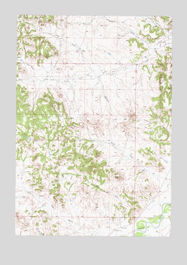
Yarger Butte, MT USGS Topographic Map
Click on map above to begin viewing in our Map Viewer.

This topographic map contains these locations and features:
Feature Name Type Latitude Longitude GNIS ID View Map
05S49E32ADCD01 WellWellN45.3583°W105.7006°809078View Map
06S49E02CABB01 WellWellN45.3397°W105.6903°809007View Map
06S50E07BCBA01 WellWellN45.3294°W105.6539°808957View Map
06S50E31CDD_01 WellWellN45.2614°W105.6450°808625View Map
06S50E31DCC_02 WellWellN45.2617°W105.6400°808628View Map
06S50E31DCCD01 WellWellN45.2608°W105.6431°808623View Map
06S50E31DD__01 WellWellN45.2605°W105.6319°808622View Map
07S49E01BDDA01 WellWellN45.2547°W105.6653°808595View Map
07S49E13ABBB01 WellWellN45.2672°W105.6639°808647View Map
Buck CreekStreamN45.3417°W105.6867°780505View Map
Dry CreekStreamN45.2775°W105.6258°770765View Map
Dry Fork Fire GulchValleyN45.2536°W105.6953°770822View Map
E B Ranch Number 1 DamDamN45.3600°W105.6472°796927View Map
Fire GulchValleyN45.2536°W105.6953°783406View Map
Rock Springs CreekStreamN45.3630°W105.6256°775864View Map
Salt CreekStreamN45.3380°W105.7319°789976View Map
Sanders CreekStreamN45.3580°W105.6425°790007View Map
Yarger ButteSummitN45.2833°W105.6675°778724View Map
Yarger CemeteryCemeteryN45.2532°W105.6700°778725View Map
Yarger CreekStreamN45.2614°W105.6636°778726View Map

Note: Coordinates in the location and feature list above are referenced to NAD83 datum.


Copyright (C) 2008-2025 Ryan Niemi / Sunset Dynamics ... All Rights Reserved