TopoQuest Logo
Do you find TopoQuest useful?
Help keep TopoQuest running and adding new maps/features by donating!
Bitcoin:  19c7KJd3qBynnjoSw5npx9KScwjBe4ifkT
Litecoin:  LXs6TkuXGGXo1vDsWCkWVdjQX94eUKd6ui
Home View Maps Find Maps Find Places Resources & Links


Erastus, Ohio Topographic Map

USGS Map Title: Erastus, OH
USGS Map MRC: 40084E6
DRG (GeoTIFF) Download: o40084e6.tif


Neighboring USGS Topographic Map Quads:


  Willshire, OH  
40084F7
 

  Rockford, OH  
40084F6
 

  Mendon, OH  
40084F5
 

  New Corydon, IN  
40084E7
 

  Erastus, OH  
40084E6
 

  Celina, OH  
40084E5
 

  Fort Recovery, OH  
40084D7
 

  Coldwater, OH  
40084D6
 

  Montezuma, OH  
40084D5


Map MRC Location:

N41°
W85°
N41°
W84°
H8 H7 H6 H5 H4 H3 H2 H1
G8 G7 G6 G5 G4 G3 G2 G1
F8 F7 F6 F5 F4 F3 F2 F1
E8 E7 E6 E5 E4 E3 E2 E1
D8 D7 D6 D5 D4 D3 D2 D1
C8 C7 C6 C5 C4 C3 C2 C1
B8 B7 B6 B5 B4 B3 B2 B1
A8 A7 A6 A5 A4 A3 A2 A1
N40°
W85°
N40°
W84°

Erastus, OH USGS 1:24K Topographic Map Preview:
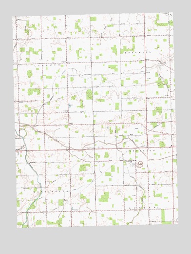
Erastus, OH USGS Topographic Map
Click on map above to begin viewing in our Map Viewer.

This topographic map contains these locations and features:
Feature Name Type Latitude Longitude GNIS ID View Map
Beaver ChapelChurchN40.5378°W84.6572°1037748View Map
Bennett School (historical)SchoolN40.5092°W84.6291°1053610View Map
Big RunStreamN40.5473°W84.7108°1060873View Map
Brehm (historical)Populated PlaceN40.6223°W84.7466°1067340View Map
Brehm Post Office (historical)Post OfficeN40.6223°W84.7472°2036716View Map
Brock School (historical)SchoolN40.5312°W84.6283°1053913View Map
Brocks RunStreamN40.5389°W84.6355°1067341View Map
Brush RunStreamN40.5456°W84.6986°1038422View Map
Buck CemeteryCemeteryN40.5950°W84.6333°1038450View Map
Buck RunStreamN40.5514°W84.6622°1065941View Map
Buck School (historical)SchoolN40.5567°W84.6477°1053612View Map
Bunge ParkParkN40.5475°W84.6591°1054882View Map
Celina QuarryMineN40.5347°W84.6528°2567609View Map
Center School (historical)SchoolN40.5092°W84.7464°1053599View Map
Center School (historical)SchoolN40.5970°W84.7472°1053601View Map
Chesser DairyLocaleN40.5097°W84.6864°2567627View Map
Crab BranchStreamN40.5489°W84.7422°1039430View Map
Crouch School (historical)SchoolN40.5087°W84.6663°1053606View Map
DurbinPopulated PlaceN40.5600°W84.7083°1062740View Map
Durbin Post Office (historical)Post OfficeN40.5598°W84.7083°2037085View Map
Eden Haven ParkParkN40.6050°W84.6272°1054896View Map
ErastusPopulated PlaceN40.5089°W84.7077°1040222View Map
Erastus Post Office (historical)Post OfficeN40.5084°W84.7083°2037123View Map
Friends Home ChurchChurchN40.5456°W84.6886°1040693View Map
Ham School (historical)SchoolN40.5964°W84.6280°1053614View Map
HintonPopulated PlaceN40.6114°W84.7086°1062814View Map
Hinton Post Office (historical)Post OfficeN40.6112°W84.7083°2037125View Map
Hope ChurchChurchN40.5895°W84.6472°1041763View Map
Joint School Number 1 (historical)SchoolN40.5817°W84.6888°1053607View Map
Joint School Number 10 (historical)SchoolN40.6114°W84.6897°1053609View Map
Karch Stone QuarryMineN40.5353°W84.6538°1054909View Map
Landfair CemeteryCemeteryN40.5970°W84.7083°1961375View Map
Landfair ChurchChurchN40.5970°W84.7088°1064967View Map
Landfair School (historical)SchoolN40.5967°W84.7080°1053604View Map
Little Beaver CreekStreamN40.5475°W84.6727°1042620View Map
Live Oak CemeteryCemeteryN40.5478°W84.7458°1961397View Map
Mercer CountyCivilN40.5400°W84.6294°1074066View Map
Miller School (historical)SchoolN40.5745°W84.6575°1053613View Map
Mount Carmel ChurchChurchN40.5675°W84.7088°1043555View Map
Pearstof School (historical)SchoolN40.5970°W84.6661°1053615View Map
Pleasant View ChurchChurchN40.5745°W84.6475°1044620View Map
Prairie CreekStreamN40.5589°W84.7366°1044745View Map
Prospect School (historical)SchoolN40.5381°W84.7077°1053602View Map
Saint John ChurchChurchN40.6117°W84.6480°1065268View Map
Saint Paul ChurchChurchN40.5087°W84.7416°1045745View Map
Saint Pauls ChurchChurchN40.6112°W84.7464°1045764View Map
Saint Pauls ChurchChurchN40.6225°W84.7466°1045765View Map
Saint Pauls Lutheran CemeteryCemeteryN40.6228°W84.7472°1961403View Map
Saint Pauls United Church of Christ CemeteryCemeteryN40.6109°W84.7464°1961404View Map
School Number 7 (historical)SchoolN40.5673°W84.7080°1053603View Map
School Number 8 (historical)SchoolN40.5384°W84.6669°1053605View Map
ScudderPopulated PlaceN40.5748°W84.7464°1063005View Map
Scudder Post Office (historical)Post OfficeN40.5750°W84.7458°2037137View Map
Scudder School (historical)SchoolN40.5673°W84.7461°1053600View Map
ShivelyPopulated PlaceN40.5967°W84.6477°1063015View Map
Striptown (historical)Populated PlaceN40.5892°W84.6894°1053608View Map
Swamp College CemeteryCemeteryN40.5373°W84.6586°1046887View Map
Township of HopewellCivilN40.6041°W84.6301°1086627View Map
Township of LibertyCivilN40.5966°W84.7458°1086629View Map
Township of WashingtonCivilN40.5090°W84.7459°1086633View Map
Union School (historical)SchoolN40.5228°W84.6480°1053611View Map
WabashPopulated PlaceN40.5456°W84.7500°1056559View Map

Note: Coordinates in the location and feature list above are referenced to NAD83 datum.


Copyright (C) 2008-2024 Ryan Niemi / Sunset Dynamics ... All Rights Reserved