TopoQuest Logo
Do you find TopoQuest useful?
Help keep TopoQuest running and adding new maps/features by donating!
Bitcoin:  19c7KJd3qBynnjoSw5npx9KScwjBe4ifkT
Litecoin:  LXs6TkuXGGXo1vDsWCkWVdjQX94eUKd6ui
Home View Maps Find Maps Find Places Resources & Links


Erhard, Minnesota Topographic Map

USGS Map Title: Erhard, MN
USGS Map MRC: 46096D1
DRG (GeoTIFF) Download: o46096d1.tif


Neighboring USGS Topographic Map Quads:


  Lake Olaf, MN  
46096E2
 

  Pelican Rapids, MN  
46096E1
 

  Lake Lida, MN  
46095E8
 

  Elizabeth, MN  
46096D2
 

  Erhard, MN  
46096D1
 

  Heilberger Lake, MN  
46095D8
 

  Carlisle, MN  
46096C2
 

  Fergus Falls, MN  
46096C1
 

  Wall Lake, MN  
46095C8


Map MRC Location:

N47°
W97°
N47°
W96°
H8 H7 H6 H5 H4 H3 H2 H1
G8 G7 G6 G5 G4 G3 G2 G1
F8 F7 F6 F5 F4 F3 F2 F1
E8 E7 E6 E5 E4 E3 E2 E1
D8 D7 D6 D5 D4 D3 D2 D1
C8 C7 C6 C5 C4 C3 C2 C1
B8 B7 B6 B5 B4 B3 B2 B1
A8 A7 A6 A5 A4 A3 A2 A1
N46°
W97°
N46°
W96°

Erhard, MN USGS 1:24K Topographic Map Preview:
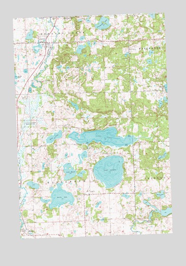
Erhard, MN USGS Topographic Map
Click on map above to begin viewing in our Map Viewer.

This topographic map contains these locations and features:
Feature Name Type Latitude Longitude GNIS ID View Map
City of ErhardCivilN46.4836°W96.0966°2394697View Map
Devils LakeLakeN46.3975°W96.0908°642786View Map
Elizabeth (historical)LocaleN46.3797°W96.1200°2073081View Map
ErhardPopulated PlaceN46.4855°W96.0987°643391View Map
Erhard (historical)LocaleN46.4833°W96.0953°2073080View Map
Erhard Post Office (historical)Post OfficeN46.4856°W96.0983°2073079View Map
Friberg Dam-Taplin GorgeDamN46.3816°W96.1220°1776237View Map
Grace Lutheran ChurchChurchN46.4864°W96.0978°2073078View Map
Grandrud LakeLakeN46.4949°W96.0513°644339View Map
Lake JewettLakeN46.4117°W96.0502°645644View Map
Lake MasonLakeN46.4126°W96.0832°647606View Map
Lake View School (historical)SchoolN46.4853°W96.0733°2126778View Map
Long LakeLakeN46.4305°W96.0545°647088View Map
McCoy LakeLakeN46.4190°W96.0063°647671View Map
Otter Tail County Waterfowl Production AreaParkN46.4691°W96.0884°2765436View Map
Red River LakeReservoirN46.3816°W96.1220°1776238View Map
Reed CreekStreamN46.4255°W96.1206°649904View Map
Reed LakeLakeN46.4319°W96.0945°649906View Map
School Number 203 (historical)SchoolN46.4375°W96.0603°2126779View Map
School Number 230 (historical)SchoolN46.4039°W96.0967°2126798View Map
School Number 278 (historical)SchoolN46.4853°W96.1153°2126777View Map
School Number 36 (historical)SchoolN46.3989°W96.0567°2126799View Map
Sverre Post Office (historical)Post OfficeN46.4375°W96.0597°2072974View Map
Taplin Gorge DamDamN46.3830°W96.0178°653037View Map
Township of ElizabethCivilN46.4133°W96.0928°664066View Map
Township of Erhards GroveCivilN46.4998°W96.0934°664105View Map
Wolf LakeLakeN46.3971°W96.0090°654313View Map

Note: Coordinates in the location and feature list above are referenced to NAD83 datum.


Copyright (C) 2008-2025 Ryan Niemi / Sunset Dynamics ... All Rights Reserved