TopoQuest Logo
Do you find TopoQuest useful?
Help keep TopoQuest running and adding new maps/features by donating!
Bitcoin:  19c7KJd3qBynnjoSw5npx9KScwjBe4ifkT
Litecoin:  LXs6TkuXGGXo1vDsWCkWVdjQX94eUKd6ui
Home View Maps Find Maps Find Places Resources & Links


Wall Lake, Minnesota Topographic Map

USGS Map Title: Wall Lake, MN
USGS Map MRC: 46095C8
DRG (GeoTIFF) Download: o46095c8.tif


Neighboring USGS Topographic Map Quads:


  Erhard, MN  
46096D1
 

  Heilberger Lake, MN  
46095D8
 

  Phelps, MN  
46095D7
 

  Fergus Falls, MN  
46096C1
 

  Wall Lake, MN  
46095C8
 

  Underwood, MN  
46095C7
 

  Dayton Hollow Dam, MN  
46096B1
 

  Dalton, MN  
46095B8
 

  Stalker Lake, MN  
46095B7


Map MRC Location:

N47°
W96°
N47°
W95°
H8 H7 H6 H5 H4 H3 H2 H1
G8 G7 G6 G5 G4 G3 G2 G1
F8 F7 F6 F5 F4 F3 F2 F1
E8 E7 E6 E5 E4 E3 E2 E1
D8 D7 D6 D5 D4 D3 D2 D1
C8 C7 C6 C5 C4 C3 C2 C1
B8 B7 B6 B5 B4 B3 B2 B1
A8 A7 A6 A5 A4 A3 A2 A1
N46°
W96°
N46°
W95°

Wall Lake, MN USGS 1:24K Topographic Map Preview:
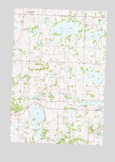
Wall Lake, MN USGS Topographic Map
Click on map above to begin viewing in our Map Viewer.

This topographic map contains these locations and features:
Feature Name Type Latitude Longitude GNIS ID View Map
Aas LakeLakeN46.3032°W95.9437°639181View Map
Aurdal CemeteryCemeteryN46.3002°W95.9151°2072729View Map
Aurdal ChurchChurchN46.2997°W95.9151°639527View Map
Bass LakeLakeN46.2889°W95.8915°639708View Map
Birch LakeLakeN46.3368°W95.9950°640171View Map
Brekke LakeLakeN46.3430°W95.9669°640456View Map
Drexel Post Office (historical)Post OfficeN46.3375°W95.9972°2073019View Map
Fish LakeLakeN46.3572°W95.9296°643688View Map
Friberg Post Office (historical)Post OfficeN46.3694°W95.9583°2073010View Map
Glorvigan LakeLakeN46.2537°W95.9372°644190View Map
Holtz LakeLakeN46.3628°W95.9580°645110View Map
KBRF-AM (Fergus Falls)TowerN46.2980°W95.9787°662915View Map
Lake AunieLakeN46.2964°W95.9486°639525View Map
Little LakeLakeN46.3128°W95.9482°646834View Map
Loon LakeLakeN46.3533°W95.9701°647168View Map
Moen LakeLakeN46.2963°W95.9283°648011View Map
Mud LakeLakeN46.3543°W95.9791°648294View Map
Nelson LakeLakeN46.3172°W95.9245°648457View Map
North Stang LakeLakeN46.2609°W95.9258°648695View Map
Norway LakeLakeN46.3124°W95.8907°648747View Map
Pleasant LakeLakeN46.3524°W95.8908°649557View Map
School Number 12 (historical)SchoolN46.3069°W95.9283°2128752View Map
School Number 143 (historical)SchoolN46.3119°W95.9769°2128751View Map
School Number 207 (historical)SchoolN46.3694°W95.9528°2128746View Map
School Number 214 (historical)SchoolN46.2561°W95.9892°2128760View Map
School Number 247 (historical)SchoolN46.3333°W95.9347°2128750View Map
School Number 43 (historical)SchoolN46.2581°W95.9364°2128759View Map
Spring LakeLakeN46.2932°W95.9676°652464View Map
Stavanger ChurchChurchN46.3555°W95.9845°652593View Map
Stavanger Lutheran Church CemeteryCemeteryN46.3555°W95.9847°2072722View Map
Swedish Baptist Church CemeteryCemeteryN46.3692°W95.9358°2072721View Map
Swedish ChurchChurchN46.3688°W95.9353°652934View Map
Township of AurdalCivilN46.3266°W95.9659°663480View Map
Vang CemeteryCemeteryN46.3255°W95.9781°653615View Map
Wall LakePopulated PlaceN46.2908°W95.9648°654993View Map
Wall LakeLakeN46.2732°W95.9641°653737View Map
Wall Lake (historical)LocaleN46.2908°W95.9644°2072967View Map
Wall Lake Post Office (historical)Post OfficeN46.2908°W95.9644°2072966View Map

Note: Coordinates in the location and feature list above are referenced to NAD83 datum.


Copyright (C) 2008-2025 Ryan Niemi / Sunset Dynamics ... All Rights Reserved