TopoQuest Logo
Do you find TopoQuest useful?
Help keep TopoQuest running and adding new maps/features by donating!
Bitcoin:  19c7KJd3qBynnjoSw5npx9KScwjBe4ifkT
Litecoin:  LXs6TkuXGGXo1vDsWCkWVdjQX94eUKd6ui
Home View Maps Find Maps Find Places Resources & Links


Heilberger Lake, Minnesota Topographic Map

USGS Map Title: Heilberger Lake, MN
USGS Map MRC: 46095D8
DRG (GeoTIFF) Download: o46095d8.tif


Neighboring USGS Topographic Map Quads:


  Pelican Rapids, MN  
46096E1
 

  Lake Lida, MN  
46095E8
 

  Star Lake, MN  
46095E7
 

  Erhard, MN  
46096D1
 

  Heilberger Lake, MN  
46095D8
 

  Phelps, MN  
46095D7
 

  Fergus Falls, MN  
46096C1
 

  Wall Lake, MN  
46095C8
 

  Underwood, MN  
46095C7


Map MRC Location:

N47°
W96°
N47°
W95°
H8 H7 H6 H5 H4 H3 H2 H1
G8 G7 G6 G5 G4 G3 G2 G1
F8 F7 F6 F5 F4 F3 F2 F1
E8 E7 E6 E5 E4 E3 E2 E1
D8 D7 D6 D5 D4 D3 D2 D1
C8 C7 C6 C5 C4 C3 C2 C1
B8 B7 B6 B5 B4 B3 B2 B1
A8 A7 A6 A5 A4 A3 A2 A1
N46°
W96°
N46°
W95°

Heilberger Lake, MN USGS 1:24K Topographic Map Preview:
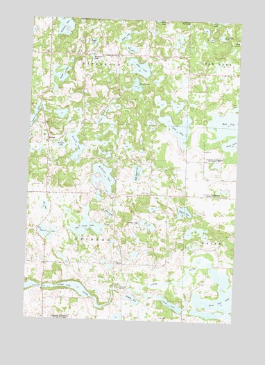
Heilberger Lake, MN USGS Topographic Map
Click on map above to begin viewing in our Map Viewer.

This topographic map contains these locations and features:
Feature Name Type Latitude Longitude GNIS ID View Map
Anderson LakeLakeN46.4574°W95.9984°639356View Map
Big Stone LakeLakeN46.4140°W95.9640°640134View Map
Bon LakeLakeN46.4878°W95.9413°640357View Map
Bracket LakeLakeN46.4726°W95.9370°640411View Map
Bray LakeLakeN46.4495°W95.8775°640445View Map
Campers CoveLocaleN46.4561°W95.9806°2108708View Map
Crystal LakeLakeN46.4757°W95.9830°642534View Map
Eddy LakeLakeN46.4799°W95.9354°643158View Map
EdwardsPopulated PlaceN46.4488°W95.9889°654686View Map
Edwards Post Office (historical)Post OfficeN46.4489°W95.9886°2073017View Map
Edwards School (historical)SchoolN46.4483°W95.9886°2128743View Map
Elliott School (historical)SchoolN46.4128°W95.9928°2128744View Map
Erhard-Maplewood ChurchChurchN46.4852°W95.9487°643392View Map
Evans LakeLakeN46.4193°W95.9511°643444View Map
Fogard LakeLakeN46.4204°W95.9064°643769View Map
Heilberger LakeLakeN46.4343°W95.9549°644844View Map
High Island LakeLakeN46.4364°W95.9347°644941View Map
Horseshoe LakeLakeN46.4933°W95.8860°645232View Map
Johnson LakeLakeN46.4147°W95.9274°645697View Map
Jorgenson Structure DamDamN46.4666°W95.9670°1776410View Map
Kempfer LakeLakeN46.4474°W95.9810°646086View Map
Kepple LakeLakeN46.4903°W95.9633°646115View Map
Leeper LakeLakeN46.4591°W95.9566°646582View Map
Long LakeLakeN46.3821°W95.9124°647083View Map
Long LakeLakeN46.4553°W95.9111°647089View Map
Mud LakeLakeN46.4597°W95.8777°648362View Map
Railroad LakeLakeN46.4840°W95.9637°649796View Map
Rice LakeLakeN46.4214°W95.9895°650002View Map
Rumsey Post Office (historical)Post OfficeN46.3861°W95.9889°2072982View Map
Saint Paul CemeteryCemeteryN46.3986°W95.9444°2072689View Map
Saint Paul ChurchChurchN46.3988°W95.9448°650966View Map
Schmidt LakeLakeN46.3839°W95.9359°651294View Map
School Number 120 (historical)SchoolN46.3978°W95.8789°2128747View Map
School Number 145 (historical)SchoolN46.4853°W95.9469°2128736View Map
School Number 161 (historical)SchoolN46.4847°W95.9989°2128735View Map
School Number 169 (historical)SchoolN46.4008°W95.9417°2128745View Map
School Number 193 (historical)SchoolN46.4389°W95.9261°2128742View Map
School Number 24 (historical)SchoolN46.4347°W95.8819°2128741View Map
Sproul LakeLakeN46.4107°W95.9893°652496View Map
Tonseth LakeLakeN46.4471°W95.9724°653235View Map
Tonseth Lutheran Church CemeteryCemeteryN46.4519°W95.9880°2072690View Map
Township of FribergCivilN46.4127°W95.9679°664232View Map
Township of MaplewoodCivilN46.4995°W95.9685°664910View Map
Twentyone LakeLakeN46.4969°W95.9808°653405View Map
Waterstreet BridgeBridgeN46.3978°W95.8892°2073140View Map
Weggeland Post Office (historical)Post OfficeN46.3764°W95.9333°2072964View Map
West Lost LakeLakeN46.3855°W95.8798°653984View Map
Wilson LakeLakeN46.4930°W95.9441°654227View Map
Worden Post Office (historical)Post OfficeN46.4917°W95.9583°2072962View Map

Note: Coordinates in the location and feature list above are referenced to NAD83 datum.


Copyright (C) 2008-2025 Ryan Niemi / Sunset Dynamics ... All Rights Reserved