TopoQuest Logo
Do you find TopoQuest useful?
Help keep TopoQuest running and adding new maps/features by donating!
Bitcoin:  19c7KJd3qBynnjoSw5npx9KScwjBe4ifkT
Litecoin:  LXs6TkuXGGXo1vDsWCkWVdjQX94eUKd6ui
Home View Maps Find Maps Find Places Resources & Links


Carlisle, Minnesota Topographic Map

USGS Map Title: Carlisle, MN
USGS Map MRC: 46096C2
DRG (GeoTIFF) Download: o46096c2.tif


Neighboring USGS Topographic Map Quads:


  Rothsay, MN  
46096D3
 

  Elizabeth, MN  
46096D2
 

  Erhard, MN  
46096D1
 

  Foxhome, MN  
46096C3
 

  Carlisle, MN  
46096C2
 

  Fergus Falls, MN  
46096C1
 

  Campbell NE, MN  
46096B3
 

  Orwell Lake, MN  
46096B2
 

  Dayton Hollow Dam, MN  
46096B1


Map MRC Location:

N47°
W97°
N47°
W96°
H8 H7 H6 H5 H4 H3 H2 H1
G8 G7 G6 G5 G4 G3 G2 G1
F8 F7 F6 F5 F4 F3 F2 F1
E8 E7 E6 E5 E4 E3 E2 E1
D8 D7 D6 D5 D4 D3 D2 D1
C8 C7 C6 C5 C4 C3 C2 C1
B8 B7 B6 B5 B4 B3 B2 B1
A8 A7 A6 A5 A4 A3 A2 A1
N46°
W97°
N46°
W96°

Carlisle, MN USGS 1:24K Topographic Map Preview:
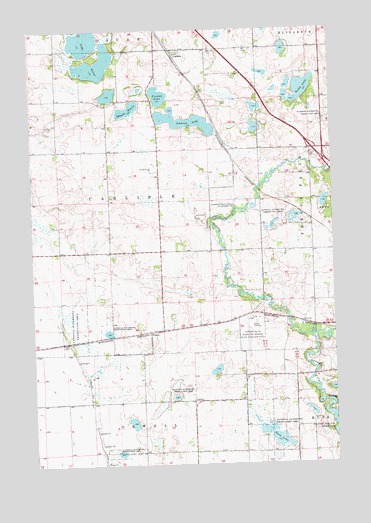
Carlisle, MN USGS Topographic Map
Click on map above to begin viewing in our Map Viewer.

This topographic map contains these locations and features:
Feature Name Type Latitude Longitude GNIS ID View Map
CarlisleLocaleN46.3681°W96.1911°2073028View Map
CarlislePopulated PlaceN46.3683°W96.1898°640898View Map
Carlisle Post Office (historical)Post OfficeN46.3683°W96.1894°2073027View Map
Fergus Falls Municipal Airport-Einar Mickelson FieldAirportN46.2862°W96.1524°660162View Map
Fjestad LakeLakeN46.3560°W96.1965°643721View Map
FrenchPopulated PlaceN46.2880°W96.2017°654714View Map
French Post Office (historical)Post OfficeN46.2881°W96.2014°2073011View Map
Haarstick State Wildlife Management AreaParkN46.3241°W96.1631°644547View Map
Interchange 50CrossingN46.3375°W96.1278°2073161View Map
Johnson LakeLakeN46.3484°W96.1857°645693View Map
Lake OscarLakeN46.3718°W96.2275°649017View Map
Pelican RiverStreamN46.2866°W96.1345°649247View Map
Rush LakeLakeN46.2580°W96.1516°650400View Map
School Number 222 (historical)SchoolN46.2686°W96.1847°2126806View Map
School Number 226 (historical)SchoolN46.3108°W96.2178°2126805View Map
School Number 29 (historical)SchoolN46.2606°W96.1342°2126807View Map
School Number 34 (historical)SchoolN46.3472°W96.1289°2126797View Map
School Number 86 (historical)SchoolN46.3497°W96.1869°2126796View Map
School Number 96 (historical)SchoolN46.3114°W96.1331°2126804View Map
Skogen MarshLakeN46.3524°W96.2090°652119View Map
Swedish Lutheran ChurchChurchN46.3708°W96.1319°2072730View Map
Township of CarlisleCivilN46.3263°W96.2185°663750View Map
Wedel LakeLakeN46.3581°W96.1366°653889View Map

Note: Coordinates in the location and feature list above are referenced to NAD83 datum.


Copyright (C) 2008-2025 Ryan Niemi / Sunset Dynamics ... All Rights Reserved