TopoQuest Logo
Do you find TopoQuest useful?
Help keep TopoQuest running and adding new maps/features by donating!
Bitcoin:  19c7KJd3qBynnjoSw5npx9KScwjBe4ifkT
Litecoin:  LXs6TkuXGGXo1vDsWCkWVdjQX94eUKd6ui
Home View Maps Find Maps Find Places Resources & Links


Bunnell, Florida Topographic Map

USGS Map Title: Bunnell, FL
USGS Map MRC: 29081D3
DRG (GeoTIFF) Download: o29081d3.tif


Neighboring USGS Topographic Map Quads:


  Dinner Island, FL  
29081E4
 

  Espanola, FL  
29081E3
 

  Beverly Beach, FL  
29081E2
 

  Saint Johns Park, FL  
29081D4
 

  Bunnell, FL  
29081D3
 

  Flagler Beach West, FL  
29081D2
 

  Seville, FL  
29081C4
 

  Codys Corner, FL  
29081C3
 

  Favoretta, FL  
29081C2


Map MRC Location:

N30°
W82°
N30°
W81°
H8 H7 H6 H5 H4 H3 H2 H1
G8 G7 G6 G5 G4 G3 G2 G1
F8 F7 F6 F5 F4 F3 F2 F1
E8 E7 E6 E5 E4 E3 E2 E1
D8 D7 D6 D5 D4 D3 D2 D1
C8 C7 C6 C5 C4 C3 C2 C1
B8 B7 B6 B5 B4 B3 B2 B1
A8 A7 A6 A5 A4 A3 A2 A1
N29°
W82°
N29°
W81°

Bunnell, FL USGS 1:24K Topographic Map Preview:
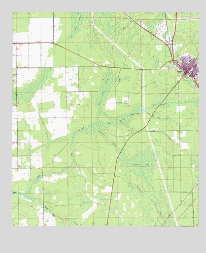
Bunnell, FL USGS Topographic Map
Click on map above to begin viewing in our Map Viewer.

This topographic map contains these locations and features:
Feature Name Type Latitude Longitude GNIS ID View Map
Belle Terre Middle SchoolSchoolN29.4725°W81.2553°297894View Map
Big Cypress SwampSwampN29.4933°W81.3328°278663View Map
BiminiPopulated PlaceN29.4825°W81.3556°294685View Map
Black BranchStreamN29.4355°W81.3201°278880View Map
Black Branch CanalCanalN29.4372°W81.3028°278881View Map
Black PointPopulated PlaceN29.4472°W81.3051°294686View Map
Black Point SwampSwampN29.4554°W81.3123°278930View Map
BunnellPopulated PlaceN29.4661°W81.2578°279682View Map
Bunnell DivisionCivilN29.4496°W81.3311°1935707View Map
Bunnell Elementary SchoolSchoolN29.4717°W81.2558°297893View Map
Bunnell Police DepartmentBuildingN29.4658°W81.2555°2333119View Map
Bunnell Post OfficePost OfficeN29.4696°W81.2547°2447919View Map
Bunnell Wastewater Treatment PlantLocaleN29.4644°W81.2642°2447916View Map
Childrens CenterSchoolN29.4633°W81.2526°300618View Map
City of BunnellCivilN29.4198°W81.3235°2403953View Map
Flagler CountyCivilN29.4711°W81.2930°308547View Map
Flagler County Detention FacilityBuildingN29.4525°W81.2563°2753104View Map
Flagler County Historical Society MuseumBuildingN29.4662°W81.2565°2447918View Map
Flagler County Sheriff's Office Operations CenterBuildingN29.4535°W81.2562°2333173View Map
Hope CemeteryCemeteryN29.4669°W81.2553°298225View Map
Hunter BranchStreamN29.4250°W81.3503°284399View Map
Little Black BranchStreamN29.4425°W81.2856°285606View Map
Memorial Hospital-Flagler HelistopAirportN29.4686°W81.2528°309301View Map
Middle Haw CreekStreamN29.3930°W81.3670°286795View Map
Saint Johns Park Volunteer Fire Department Station 71BuildingN29.4242°W81.3697°2644334View Map
Sweetwater BranchStreamN29.4319°W81.3178°291949View Map
Sweetwater SwampSwampN29.4044°W81.2862°291959View Map

Note: Coordinates in the location and feature list above are referenced to NAD83 datum.


Copyright (C) 2008-2025 Ryan Niemi / Sunset Dynamics ... All Rights Reserved