TopoQuest Logo
Do you find TopoQuest useful?
Help keep TopoQuest running and adding new maps/features by donating!
Bitcoin:  19c7KJd3qBynnjoSw5npx9KScwjBe4ifkT
Litecoin:  LXs6TkuXGGXo1vDsWCkWVdjQX94eUKd6ui
Home View Maps Find Maps Find Places Resources & Links


Etoile South, Texas Topographic Map

USGS Map Title: Etoile South, TX
USGS Map MRC: 31094C4
DRG (GeoTIFF) Download: o31094c4.tif


Neighboring USGS Topographic Map Quads:


  Platt, TX  
31094D5
 

  Etoile North, TX  
31094D4
 

  Chireno South, TX  
31094D3
 

  Huntington, TX  
31094C5
 

  Etoile South, TX  
31094C4
 

  Broaddus, TX  
31094C3
 

  Manning, TX  
31094B5
 

  Zavalla, TX  
31094B4
 

  Cassells-Boykin Park, TX  
31094B3


Map MRC Location:

N32°
W95°
N32°
W94°
H8 H7 H6 H5 H4 H3 H2 H1
G8 G7 G6 G5 G4 G3 G2 G1
F8 F7 F6 F5 F4 F3 F2 F1
E8 E7 E6 E5 E4 E3 E2 E1
D8 D7 D6 D5 D4 D3 D2 D1
C8 C7 C6 C5 C4 C3 C2 C1
B8 B7 B6 B5 B4 B3 B2 B1
A8 A7 A6 A5 A4 A3 A2 A1
N31°
W95°
N31°
W94°

Etoile South, TX USGS 1:24K Topographic Map Preview:
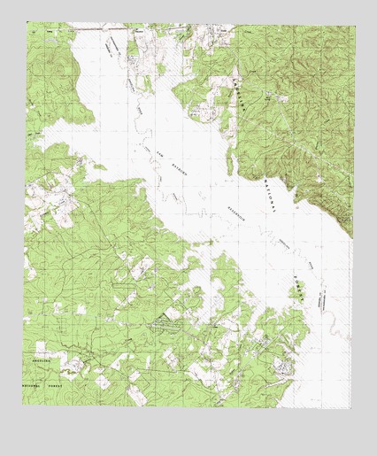
Etoile South, TX USGS Topographic Map
Click on map above to begin viewing in our Map Viewer.

This topographic map contains these locations and features:
Feature Name Type Latitude Longitude GNIS ID View Map
Baron CemeteryCemeteryN31.3588°W94.4863°1381357View Map
Beech CreekStreamN31.3282°W94.4483°1381384View Map
Big SloughGutN31.3169°W94.4163°1381433View Map
Blue SpringSpringN31.3507°W94.4060°1381466View Map
Blue Spring CemeteryCemeteryN31.3530°W94.4083°1381467View Map
Brown CemeteryCemeteryN31.2677°W94.4330°1381520View Map
Brush CreekStreamN31.3552°W94.4444°1381528View Map
Brushy CreekStreamN31.3405°W94.4921°1381536View Map
Cochran CemeteryCemeteryN31.2621°W94.4041°1381673View Map
Duranzo CreekStreamN31.3691°W94.4424°1383083View Map
Etoile LookoutLocaleN31.3610°W94.3885°1381850View Map
Etoile Post OfficePost OfficeN31.3748°W94.4305°2732338View Map
Etoile Volunteer Fire DepartmentBuildingN31.3747°W94.4305°2655164View Map
EwingPopulated PlaceN31.3727°W94.4905°1381855View Map
Gilliland CreekStreamN31.3260°W94.4502°1381914View Map
Hanks CreekStreamN31.2977°W94.3938°1381963View Map
Hanks Creek Park CampgroundLocaleN31.2721°W94.4033°1383718View Map
Harnington CemeteryCemeteryN31.2521°W94.4263°1381969View Map
NacalinaLocaleN31.3738°W94.4591°1382371View Map
Odell CreekStreamN31.3282°W94.4516°1382418View Map
OraPopulated PlaceN31.2774°W94.4277°1382441View Map
Ora Volunteer Fire DepartmentBuildingN31.2756°W94.4432°2655598View Map
Patterson CemeteryCemeteryN31.3394°W94.4244°1382463View Map
Shirley CreekStreamN31.2744°W94.3769°1382758View Map
Shirley CreekPopulated PlaceN31.3149°W94.3838°2034892View Map
Shofner CemeteryCemeteryN31.2924°W94.4541°1382759View Map
Stanley CreekStreamN31.3094°W94.4177°1382805View Map
Wooten CemeteryCemeteryN31.3216°W94.3816°1382996View Map

Note: Coordinates in the location and feature list above are referenced to NAD83 datum.


Copyright (C) 2008-2025 Ryan Niemi / Sunset Dynamics ... All Rights Reserved