TopoQuest Logo
Do you find TopoQuest useful?
Help keep TopoQuest running and adding new maps/features by donating!
Bitcoin:  19c7KJd3qBynnjoSw5npx9KScwjBe4ifkT
Litecoin:  LXs6TkuXGGXo1vDsWCkWVdjQX94eUKd6ui
Home View Maps Find Maps Find Places Resources & Links


Factoryville, Pennsylvania Topographic Map

USGS Map Title: Factoryville, PA
USGS Map MRC: 41075E7
DRG (GeoTIFF) Download: o41075e7.tif


Neighboring USGS Topographic Map Quads:


  Springville, PA  
41075F8
 

  Hop Bottom, PA  
41075F7
 

  Lenoxville, PA  
41075F6
 

  Tunkhannock, PA  
41075E8
 

  Factoryville, PA  
41075E7
 

  Dalton, PA  
41075E6
 

  Center Moreland, PA  
41075D8
 

  Ransom, PA  
41075D7
 

  Scranton, PA  
41075D6


Map MRC Location:

N42°
W76°
N42°
W75°
H8 H7 H6 H5 H4 H3 H2 H1
G8 G7 G6 G5 G4 G3 G2 G1
F8 F7 F6 F5 F4 F3 F2 F1
E8 E7 E6 E5 E4 E3 E2 E1
D8 D7 D6 D5 D4 D3 D2 D1
C8 C7 C6 C5 C4 C3 C2 C1
B8 B7 B6 B5 B4 B3 B2 B1
A8 A7 A6 A5 A4 A3 A2 A1
N41°
W76°
N41°
W75°

Factoryville, PA USGS 1:24K Topographic Map Preview:
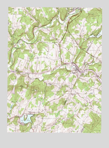
Factoryville, PA USGS Topographic Map
Click on map above to begin viewing in our Map Viewer.

This topographic map contains these locations and features:
Feature Name Type Latitude Longitude GNIS ID View Map
Academic Affairs CenterBuildingN41.5583°W75.7767°2114539View Map
Alumni Hall - Keystone CollegeBuildingN41.5594°W75.7778°2114540View Map
BardwellPopulated PlaceN41.5612°W75.8621°1168701View Map
Borough of FactoryvilleCivilN41.5602°W75.7822°1215731View Map
Broadbent SwampSwampN41.5759°W75.8428°1170295View Map
Bunker HillSummitN41.5809°W75.8202°1170679View Map
Capwell Science HallBuildingN41.5586°W75.7756°2114543View Map
Carpenter HollowPopulated PlaceN41.5481°W75.8166°1203225View Map
Casterline HillSummitN41.6020°W75.7557°1171316View Map
Christy Mathewson FieldParkN41.5603°W75.7714°2114544View Map
Community GroveLocaleN41.5608°W75.7689°2114545View Map
Creekside GroveLocaleN41.5597°W75.7728°2114546View Map
East LemonPopulated PlaceN41.5862°W75.8658°1173835View Map
East Lemon CemeteryCemeteryN41.5809°W75.8646°1173836View Map
East MountainSummitN41.5420°W75.8396°1173847View Map
FactoryvillePopulated PlaceN41.5631°W75.7827°1174404View Map
Factoryville Fire CompanyBuildingN41.5648°W75.7828°2653132View Map
Factoryville Post OfficePost OfficeN41.5641°W75.7825°2772696View Map
Factoryville StationLocaleN41.5837°W75.7755°1174405View Map
Fairview CemeteryCemeteryN41.5048°W75.8385°1174502View Map
Field BrookStreamN41.6134°W75.8066°1174737View Map
Flow PondReservoirN41.5255°W75.8691°1174918View Map
Frear/Reynolds Residence HallBuildingN41.5583°W75.7786°2114548View Map
Gambal Athletic CenterBuildingN41.5600°W75.7753°2114549View Map
Glen SchoolSchoolN41.5681°W75.7957°1175709View Map
Greenwood HillSummitN41.5081°W75.8696°1192559View Map
Hedgewood HouseBuildingN41.5600°W75.7786°2114552View Map
Hibbard Campus CenterBuildingN41.5589°W75.7775°2114553View Map
Hillover/Sekol Airport (historical)AirportN41.5501°W75.7663°1194254View Map
Hollinshead Residence HallBuildingN41.5589°W75.7783°2114554View Map
Holman Design StudioBuildingN41.5583°W75.7739°2114555View Map
Horton CreekStreamN41.6173°W75.7932°1192044View Map
Keystone CollegeSchoolN41.5590°W75.7741°1178436View Map
Keystone Commons Residence HallBuildingN41.5594°W75.7800°2114557View Map
Koelsch HouseBuildingN41.5606°W75.7725°2114558View Map
La PlumePopulated PlaceN41.5567°W75.7538°1178738View Map
La Plume Post OfficePost OfficeN41.5573°W75.7537°2772781View Map
Lackawanna HallBuildingN41.5578°W75.7775°2114559View Map
Lake SheridanLakeN41.5964°W75.7573°1193343View Map
Lake Sheridan DamDamN41.5951°W75.7680°1195692View Map
Lake Sheridan HillSummitN41.5917°W75.7621°1178787View Map
Lake WinolaReservoirN41.5058°W75.8415°1193678View Map
Lake WinolaPopulated PlaceN41.5067°W75.8530°1214219View Map
Lake Winola Census Designated PlaceCensusN41.5106°W75.8509°2633880View Map
Lake Winola ChurchChurchN41.5156°W75.8585°1178792View Map
Lake Winola Post OfficePost OfficeN41.5094°W75.8589°1214077View Map
Lake Winola Volunteer Fire Company 1BuildingN41.5070°W75.8429°2653119View Map
Lithia ValleyValleyN41.5523°W75.8285°1179454View Map
Martins CreekStreamN41.6201°W75.7835°1192899View Map
Middle MountainSummitN41.5451°W75.8563°1181038View Map
Moffat Residence HallBuildingN41.5597°W75.7631°2114561View Map
Monroe CreekStreamN41.6040°W75.8324°1192954View Map
Moore Hall Alumni GardenParkN41.5586°W75.7756°2114562View Map
Ned Boehm FieldParkN41.5586°W75.7714°2114563View Map
Oakley CemeteryCemeteryN41.6067°W75.8246°1182839View Map
Oxbow CreekStreamN41.5876°W75.8616°1183163View Map
Patrick HallBuildingN41.5603°W75.7792°2114564View Map
Pedrick CemeteryCemeteryN41.5970°W75.7777°1183440View Map
Pedrick PondReservoirN41.6137°W75.7627°1183441View Map
Ross DamDamN41.5217°W75.8680°1195637View Map
Sabiston HallBuildingN41.5592°W75.7775°2114565View Map
Saddle Lake DamDamN41.6217°W75.8646°1195707View Map
Seaman's FarmhouseBuildingN41.5583°W75.7700°2114566View Map
Seamans FieldAirportN41.5883°W75.7554°2442919View Map
Shibley PondReservoirN41.6217°W75.8583°1187505View Map
Sickler HallBuildingN41.5597°W75.7778°2114567View Map
South Branch Tunkhannock CreekStreamN41.5631°W75.8749°1188041View Map
Spencer PondReservoirN41.6081°W75.7781°1188163View Map
Stantontown SwampSwampN41.5183°W75.8079°1188402View Map
Stark CemeteryCemeteryN41.5915°W75.8466°1188412View Map
Stark SwampSwampN41.5873°W75.8545°1188414View Map
StarkvillePopulated PlaceN41.6059°W75.8344°1188416View Map
Sweeney DamDamN41.5393°W75.7630°1195647View Map
Sweeny PondReservoirN41.5399°W75.7621°1189166View Map
Tewksbury Residence HallBuildingN41.5592°W75.7781°2114569View Map
The Sugar ShackBuildingN41.5581°W75.7700°2114570View Map
Thomas HillSummitN41.5998°W75.7752°1189481View Map
Township of ClintonCivilN41.5697°W75.8147°1217263View Map
Township of La PlumeCivilN41.5579°W75.7581°1216601View Map
Township of NicholsonCivilN41.6197°W75.8082°1217272View Map
Township of OverfieldCivilN41.5215°W75.8326°1217276View Map
Township of West AbingtonCivilN41.5264°W75.7742°1216611View Map
Trout BrookStreamN41.5526°W75.8288°1202092View Map
Tunnel HillSummitN41.5915°W75.8088°1189925View Map
Tunnel Hill SchoolSchoolN41.5895°W75.8121°1189926View Map
Union ChapelChurchN41.5942°W75.7682°1190126View Map
Walls CornersPopulated PlaceN41.5390°W75.7885°1190530View Map
Wilbur HillSummitN41.5067°W75.7630°1191387View Map
Winola Mill Pond DamDamN41.5051°W75.8413°1195628View Map
Wright HillSummitN41.5756°W75.7624°1191802View Map
Wyoming HallBuildingN41.5578°W75.7778°2114572View Map

Note: Coordinates in the location and feature list above are referenced to NAD83 datum.


Copyright (C) 2008-2024 Ryan Niemi / Sunset Dynamics ... All Rights Reserved