TopoQuest Logo
Do you find TopoQuest useful?
Help keep TopoQuest running and adding new maps/features by donating!
Bitcoin:  19c7KJd3qBynnjoSw5npx9KScwjBe4ifkT
Litecoin:  LXs6TkuXGGXo1vDsWCkWVdjQX94eUKd6ui
Home View Maps Find Maps Find Places Resources & Links


Hop Bottom, Pennsylvania Topographic Map

USGS Map Title: Hop Bottom, PA
USGS Map MRC: 41075F7
DRG (GeoTIFF) Download: o41075f7.tif


Neighboring USGS Topographic Map Quads:


  Montrose West, PA  
41075G8
 

  Montrose East, PA  
41075G7
 

  Harford, PA  
41075G6
 

  Springville, PA  
41075F8
 

  Hop Bottom, PA  
41075F7
 

  Lenoxville, PA  
41075F6
 

  Tunkhannock, PA  
41075E8
 

  Factoryville, PA  
41075E7
 

  Dalton, PA  
41075E6


Map MRC Location:

N42°
W76°
N42°
W75°
H8 H7 H6 H5 H4 H3 H2 H1
G8 G7 G6 G5 G4 G3 G2 G1
F8 F7 F6 F5 F4 F3 F2 F1
E8 E7 E6 E5 E4 E3 E2 E1
D8 D7 D6 D5 D4 D3 D2 D1
C8 C7 C6 C5 C4 C3 C2 C1
B8 B7 B6 B5 B4 B3 B2 B1
A8 A7 A6 A5 A4 A3 A2 A1
N41°
W76°
N41°
W75°

Hop Bottom, PA USGS 1:24K Topographic Map Preview:
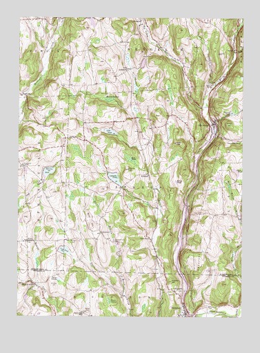
Hop Bottom, PA USGS Topographic Map
Click on map above to begin viewing in our Map Viewer.

This topographic map contains these locations and features:
Feature Name Type Latitude Longitude GNIS ID View Map
Borough of Hop BottomCivilN41.7053°W75.7674°1215611View Map
Borough of NicholsonCivilN41.6270°W75.7862°1215734View Map
Brown SwampSwampN41.6316°W75.8234°1170378View Map
Burdick CreekStreamN41.7179°W75.8710°1198050View Map
Button CemeteryCemeteryN41.6742°W75.8591°1170819View Map
Carpenter PondLakeN41.6985°W75.7533°1171246View Map
Clark PondLakeN41.6855°W75.7530°1171916View Map
Coon HillSummitN41.6979°W75.7866°1172406View Map
Cord PondLakeN41.6526°W75.8484°1172450View Map
Dam HillSummitN41.6287°W75.8649°1172905View Map
DeckertownPopulated PlaceN41.6601°W75.8274°1173050View Map
Deckertown CemeteryCemeteryN41.6567°W75.8207°1173051View Map
Dennis CemeteryCemeteryN41.7351°W75.7632°1173154View Map
Dry CreekStreamN41.7192°W75.7688°1173498View Map
East Branch Field BrookStreamN41.6342°W75.8149°1173743View Map
Foster StationBuildingN41.7034°W75.7624°1212962View Map
Grace Lutheran ChurchChurchN41.7029°W75.7671°2760416View Map
HillsdalePopulated PlaceN41.6842°W75.8021°1177108View Map
Holley PondLakeN41.6830°W75.7868°1177212View Map
Hop BottomPopulated PlaceN41.7059°W75.7663°1177376View Map
Hop Bottom CreekStreamN41.7137°W75.7699°1177377View Map
Hop Bottom Hose CompanyBuildingN41.7039°W75.7654°2653018View Map
Hop Bottom Post OfficePost OfficeN41.7055°W75.7660°2780026View Map
Kinney SwampSwampN41.7161°W75.8268°1178518View Map
Lakeside PondLakeN41.6829°W75.8208°1178801View Map
Lakeside Pond DamDamN41.6801°W75.8163°1195733View Map
LindavillePopulated PlaceN41.7279°W75.8144°1179403View Map
Lord PondLakeN41.7023°W75.8238°1179949View Map
Miller HillSummitN41.6629°W75.8341°1181217View Map
Mud PondLakeN41.6909°W75.8122°1199207View Map
Mulligan HillSummitN41.6559°W75.8444°1182073View Map
NicholsonPopulated PlaceN41.6262°W75.7805°1193024View Map
Nicholson Fire Company 1BuildingN41.6269°W75.7810°2653129View Map
Nicholson HillSummitN41.6401°W75.7888°1182441View Map
Nicholson Post OfficePost OfficeN41.6263°W75.7804°2772882View Map
Niven CornersLocaleN41.6562°W75.8691°1182485View Map
OakleyPopulated PlaceN41.7367°W75.7544°1205071View Map
ParkvalePopulated PlaceN41.7179°W75.8721°1204365View Map
Phelps SwampSwampN41.6406°W75.8516°1183655View Map
Pine GrovePopulated PlaceN41.6579°W75.8005°1183796View Map
Pompey HillSummitN41.6376°W75.8538°1184224View Map
Prospect HillSummitN41.6506°W75.7719°1184447View Map
Round HillSummitN41.7059°W75.7571°1185520View Map
Saint Patricks CemeteryCemeteryN41.6365°W75.7832°1186534View Map
Schooley PondReservoirN41.6855°W75.8579°1187106View Map
Squier Hill SchoolSchoolN41.6262°W75.8380°1188368View Map
Squiers CemeteryCemeteryN41.7223°W75.7677°1188369View Map
Squire HillSummitN41.6276°W75.8352°1188370View Map
Strickland CemeteryCemeteryN41.6878°W75.8713°1188874View Map
Strickland HillSummitN41.6865°W75.8132°1188875View Map
Tanner PondLakeN41.7104°W75.7558°1189262View Map
Thayer HillSummitN41.6781°W75.7902°1189383View Map
Township of LathropCivilN41.6823°W75.8096°1217090View Map
Union ChurchChurchN41.7001°W75.8463°1190145View Map
Utley BrookStreamN41.6301°W75.7502°1190275View Map
West NicholsonPopulated PlaceN41.6379°W75.8646°1191082View Map

Note: Coordinates in the location and feature list above are referenced to NAD83 datum.


Copyright (C) 2008-2025 Ryan Niemi / Sunset Dynamics ... All Rights Reserved