TopoQuest Logo
Do you find TopoQuest useful?
Help keep TopoQuest running and adding new maps/features by donating!
Bitcoin:  19c7KJd3qBynnjoSw5npx9KScwjBe4ifkT
Litecoin:  LXs6TkuXGGXo1vDsWCkWVdjQX94eUKd6ui
Home View Maps Find Maps Find Places Resources & Links


Anson, Missouri Topographic Map

USGS Map Title: Anson, MO
USGS Map MRC: 40091E7
DRG (GeoTIFF) Download: o40091e7.tif


Neighboring USGS Topographic Map Quads:


  Keosauqua, IA  
40091F8
 

  Bonaparte, IA  
40091F7
 

  Farmington, IA  
40091F6
 

  Mount Sterling, IA  
40091E8
 

  Anson, MO  
40091E7
 

  Croton, IA  
40091E6
 

  Wyaconda, MO  
40091D8
 

  Medill, MO  
40091D7
 

  Kahoka, MO  
40091D6


Map MRC Location:

N41°
W92°
N41°
W91°
H8 H7 H6 H5 H4 H3 H2 H1
G8 G7 G6 G5 G4 G3 G2 G1
F8 F7 F6 F5 F4 F3 F2 F1
E8 E7 E6 E5 E4 E3 E2 E1
D8 D7 D6 D5 D4 D3 D2 D1
C8 C7 C6 C5 C4 C3 C2 C1
B8 B7 B6 B5 B4 B3 B2 B1
A8 A7 A6 A5 A4 A3 A2 A1
N40°
W92°
N40°
W91°

Anson, MO USGS 1:24K Topographic Map Preview:
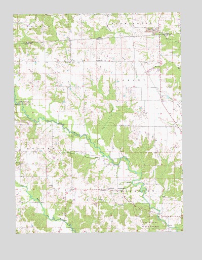
Anson, MO USGS Topographic Map
Click on map above to begin viewing in our Map Viewer.

This topographic map contains these locations and features:
Feature Name Type Latitude Longitude GNIS ID View Map
AcastoPopulated PlaceN40.5981°W91.8341°740283View Map
Acasto Post OfficePost OfficeN40.5981°W91.8341°759808View Map
Anderson CemeteryCemeteryN40.6167°W91.8585°1980999View Map
AnsonPopulated PlaceN40.5773°W91.7660°740627View Map
Bethlehem ChurchChurchN40.5392°W91.8716°714106View Map
Burnt Shirt BranchStreamN40.5743°W91.8743°715091View Map
Burrier CemeteryCemeteryN40.6148°W91.7588°1981039View Map
ChambersburgPopulated PlaceN40.5239°W91.7993°740733View Map
Chambersburg ChurchChurchN40.5242°W91.8063°715710View Map
Christy CemeteryCemeteryN40.5972°W91.8318°715825View Map
Collins School (historical)SchoolN40.5592°W91.7718°731700View Map
Community ChurchChurchN40.5820°W91.7682°716159View Map
Duncan SchoolSchoolN40.5978°W91.8129°717184View Map
Fairview School (historical)SchoolN40.6009°W91.7616°731699View Map
Fehlhaber BridgeBridgeN40.5103°W91.7688°731701View Map
Herring Lake DamDamN40.5634°W91.8668°762227View Map
Hogan School (historical)SchoolN40.5398°W91.8566°731697View Map
Jordan School (historical)SchoolN40.5028°W91.8010°731698View Map
Kaylor BranchStreamN40.5156°W91.7757°720483View Map
Mantle BranchStreamN40.5436°W91.8102°735709View Map
Nixon BranchStreamN40.5486°W91.8132°723381View Map
Saint Thomas CemeteryCemeteryN40.5239°W91.8068°725909View Map
Spencer CemeteryCemeteryN40.5389°W91.8718°731702View Map
Township of GrantCivilN40.5843°W91.7650°766494View Map
Township of JeffersonCivilN40.5164°W91.7758°766496View Map
Troxel CemeteryCemeteryN40.5823°W91.7596°727809View Map
Union ChapelChurchN40.5978°W91.8324°727981View Map
Upp School (historical)SchoolN40.5975°W91.8518°731696View Map

Note: Coordinates in the location and feature list above are referenced to NAD83 datum.


Copyright (C) 2008-2025 Ryan Niemi / Sunset Dynamics ... All Rights Reserved