TopoQuest Logo
Do you find TopoQuest useful?
Help keep TopoQuest running and adding new maps/features by donating!
Bitcoin:  19c7KJd3qBynnjoSw5npx9KScwjBe4ifkT
Litecoin:  LXs6TkuXGGXo1vDsWCkWVdjQX94eUKd6ui
Home View Maps Find Maps Find Places Resources & Links


Farmington, North Carolina Topographic Map

USGS Map Title: Farmington, NC
USGS Map MRC: 36080A5
DRG (GeoTIFF) Download: o36080a5.tif


Neighboring USGS Topographic Map Quads:


  Yadkinville, NC  
36080B6
 

  East Bend, NC  
36080B5
 

  Vienna, NC  
36080B4
 

  Lone Hickory, NC  
36080A6
 

  Farmington, NC  
36080A5
 

  Clemmons, NC  
36080A4
 

  Calahaln, NC  
35080H6
 

  Mocksville, NC  
35080H5
 

  Advance, NC  
35080H4


Map MRC Location:

N37°
W81°
N37°
W80°
H8 H7 H6 H5 H4 H3 H2 H1
G8 G7 G6 G5 G4 G3 G2 G1
F8 F7 F6 F5 F4 F3 F2 F1
E8 E7 E6 E5 E4 E3 E2 E1
D8 D7 D6 D5 D4 D3 D2 D1
C8 C7 C6 C5 C4 C3 C2 C1
B8 B7 B6 B5 B4 B3 B2 B1
A8 A7 A6 A5 A4 A3 A2 A1
N36°
W81°
N36°
W80°

Farmington, NC USGS 1:24K Topographic Map Preview:
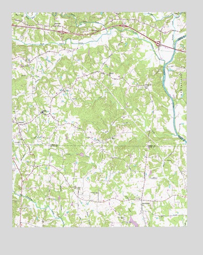
Farmington, NC USGS Topographic Map
Click on map above to begin viewing in our Map Viewer.

This topographic map contains these locations and features:
Feature Name Type Latitude Longitude GNIS ID View Map
Caudle BranchStreamN36.0687°W80.5087°1805893View Map
Cedar Creek Baptist ChurchChurchN36.0054°W80.5456°982823View Map
Cedar Creek CemeteryCemeteryN36.0032°W80.5442°982821View Map
Cedar Creek LakeReservoirN36.0025°W80.5380°999883View Map
Cedar Creek School (historical)SchoolN36.0043°W80.5459°1805890View Map
Cedar Forest EstatesPopulated PlaceN36.0115°W80.5270°1002200View Map
Chinquapin CemeteryCemeteryN36.0499°W80.6198°1731722View Map
Chinquapin ChurchChurchN36.0496°W80.6192°983150View Map
Chinquapin CreekStreamN36.0212°W80.6240°983151View Map
CourtneyPopulated PlaceN36.0601°W80.6206°1019806View Map
Courtney Baptist ChurchChurchN36.0579°W80.6187°1731805View Map
Courtney CemeteryCemeteryN36.0576°W80.6201°1731724View Map
Courtney High SchoolSchoolN36.0671°W80.6028°983614View Map
Courtney Volunteer Fire DepartmentBuildingN36.0665°W80.5974°2638993View Map
Danials-Davis DamDamN36.0001°W80.5348°999884View Map
Deep CreekStreamN36.0943°W80.5156°1019935View Map
Deep Creek Baptist ChurchChurchN36.0965°W80.6120°984066View Map
Deep Creek CemeteryCemeteryN36.0965°W80.6128°1731726View Map
Deep Creek Community CenterLocaleN36.0943°W80.6120°984069View Map
Dixon MineMineN36.0590°W80.5756°1731807View Map
FarmingtonPopulated PlaceN36.0157°W80.5323°1020220View Map
Farmington BaptistChurchN36.0154°W80.5334°1008052View Map
Farmington CemeteriesCemeteryN36.0176°W80.5364°1008053View Map
Farmington MethodistChurchN36.0168°W80.5334°1018751View Map
Farmington Volunteer Fire DepartmentBuildingN36.0145°W80.5319°2638837View Map
Forbush Baptist ChurchChurchN36.0893°W80.5581°985261View Map
Forbush Baptist ChurchChurchN36.1243°W80.5495°985262View Map
Forbush CemeteryCemeteryN36.1246°W80.5495°1731736View Map
Forbush CreekStreamN36.1068°W80.5081°985263View Map
Forbush Volunteer Fire DepartmentBuildingN36.1148°W80.5190°2638877View Map
Four CornersPopulated PlaceN36.0362°W80.6081°1008050View Map
Green Meadows BaptistChurchN36.0185°W80.5045°1008054View Map
Gross MineMineN36.0821°W80.6040°1731818View Map
Harmon CreekStreamN36.1068°W80.5731°986415View Map
Hartman Store (historical)LocaleN36.0918°W80.5381°1731819View Map
Hauser CreekStreamN36.0493°W80.5009°986503View Map
Haw BranchStreamN36.1235°W80.6142°986511View Map
HuntsvillePopulated PlaceN36.0824°W80.5295°987275View Map
Huntsville Baptist ChurchChurchN36.0826°W80.5356°1731821View Map
Huntsville CemeteryCemeteryN36.0829°W80.5356°1731751View Map
Liberty Township (historical)CivilN36.1096°W80.6128°1027359View Map
Logan CreekStreamN36.1221°W80.5076°988863View Map
Marshall DamDamN36.0451°W80.5381°999973View Map
Marshall LakeReservoirN36.0451°W80.5381°999974View Map
Mount Olive CemeteryCemeteryN36.0504°W80.5614°1731763View Map
Mount Olive Methodist ChurchChurchN36.0504°W80.5620°990484View Map
Nestor Post OfficePost OfficeN36.0021°W80.6187°1008049View Map
North Deep CreekStreamN36.1124°W80.5564°991214View Map
PinoPopulated PlaceN36.0235°W80.5792°1805892View Map
Pino Post OfficePost OfficeN36.0237°W80.5787°1008051View Map
Roby CreekStreamN36.0587°W80.5295°993477View Map
Sawmill BranchStreamN36.0057°W80.5906°994392View Map
ShacktownPopulated PlaceN36.1168°W80.5937°1006367View Map
Shacktown CemeteryCemeteryN36.1176°W80.5942°1731781View Map
Shacktown Church of ChristChurchN36.1174°W80.5942°1731829View Map
Shallow FordCrossingN36.0851°W80.5164°1731831View Map
Shallowford Airport (historical)AirportN36.0865°W80.5137°998026View Map
South Deep CreekStreamN36.1124°W80.5567°995139View Map
Spiker CreekStreamN36.0871°W80.6031°995303View Map
Sportsmans Park Drag StripLocaleN36.0196°W80.5631°995313View Map
Tabernacle CemeteryCemeteryN36.0887°W80.5556°1731793View Map
Tabernacle United Church of ChristChurchN36.0890°W80.5551°987279View Map
Township of South LibertyCivilN36.0756°W80.6008°2405116View Map
Turner CreekStreamN36.0532°W80.5067°996361View Map
Turners Creek Baptist ChurchChurchN36.0796°W80.5876°996362View Map
Turners Creek CemeteryCemeteryN36.0801°W80.5876°1731794View Map
Wesley Chapel Methodist ChurchChurchN36.0232°W80.5789°996967View Map
Whip-O-Will Farms Number One DamDamN36.0335°W80.5248°999944View Map
Whip-O-Will Farms Number One LakeReservoirN36.0335°W80.5248°999943View Map
WyoPopulated PlaceN36.0493°W80.5637°1731841View Map
Wyo ChapelChurchN36.0524°W80.5528°997672View Map

Note: Coordinates in the location and feature list above are referenced to NAD83 datum.


Copyright (C) 2008-2025 Ryan Niemi / Sunset Dynamics ... All Rights Reserved