TopoQuest Logo
Do you find TopoQuest useful?
Help keep TopoQuest running and adding new maps/features by donating!
Bitcoin:  19c7KJd3qBynnjoSw5npx9KScwjBe4ifkT
Litecoin:  LXs6TkuXGGXo1vDsWCkWVdjQX94eUKd6ui
Home View Maps Find Maps Find Places Resources & Links


Calahaln, North Carolina Topographic Map

USGS Map Title: Calahaln, NC
USGS Map MRC: 35080H6
DRG (GeoTIFF) Download: o35080h6.tif


Neighboring USGS Topographic Map Quads:


  Brooks Crossroads, NC  
36080A7
 

  Lone Hickory, NC  
36080A6
 

  Farmington, NC  
36080A5
 

  Harmony, NC  
35080H7
 

  Calahaln, NC  
35080H6
 

  Mocksville, NC  
35080H5
 

  Statesville East, NC  
35080G7
 

  Cool Springs, NC  
35080G6
 

  Cooleemee, NC  
35080G5


Map MRC Location:

N36°
W81°
N36°
W80°
H8 H7 H6 H5 H4 H3 H2 H1
G8 G7 G6 G5 G4 G3 G2 G1
F8 F7 F6 F5 F4 F3 F2 F1
E8 E7 E6 E5 E4 E3 E2 E1
D8 D7 D6 D5 D4 D3 D2 D1
C8 C7 C6 C5 C4 C3 C2 C1
B8 B7 B6 B5 B4 B3 B2 B1
A8 A7 A6 A5 A4 A3 A2 A1
N35°
W81°
N35°
W80°

Calahaln, NC USGS 1:24K Topographic Map Preview:
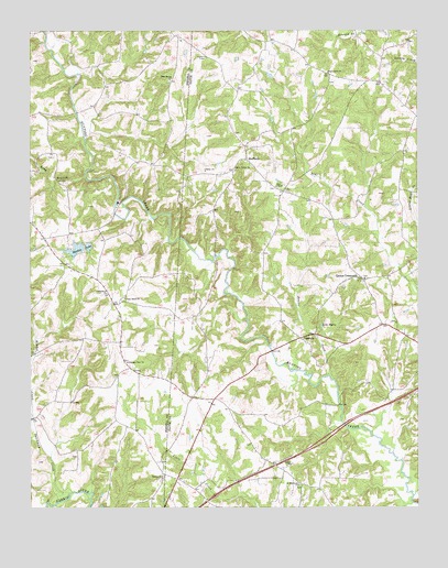
Calahaln, NC USGS Topographic Map
Click on map above to begin viewing in our Map Viewer.

This topographic map contains these locations and features:
Feature Name Type Latitude Longitude GNIS ID View Map
Bear Creek ChurchChurchN35.9890°W80.6540°980717View Map
Beaver CreekStreamN35.9093°W80.6542°980789View Map
Bones StoreLocaleN35.9974°W80.6423°1008063View Map
CalahalnPopulated PlaceN35.9196°W80.6628°1019470View Map
Calahaln MountainSummitN35.9249°W80.6695°1008057View Map
Clarksbury ChurchChurchN35.9307°W80.7251°983235View Map
Clement Grove Church of GodChurchN35.9282°W80.6340°1008061View Map
County Line Post Office (historical)Post OfficeN35.9260°W80.7028°1008058View Map
County Line Volunteer Fire DepartmentBuildingN35.8817°W80.7011°2639554View Map
Davie Center Volunteer Fire Department Station 13BuildingN35.9221°W80.6335°2638231View Map
Dutchman CreekStreamN35.8790°W80.7370°984454View Map
Gather (historical)Populated PlaceN35.9115°W80.7481°1001717View Map
Houstonville (historical)Populated PlaceN35.9615°W80.6990°1002195View Map
Ijames CrossroadsPopulated PlaceN35.9354°W80.6426°987319View Map
Ijames Crossroads BaptistChurchN35.9349°W80.6417°1008062View Map
Kinder CreekStreamN35.8987°W80.7490°987973View Map
Lake MyersLakeN35.9228°W80.6558°990825View Map
Lake Myers Family CampgroundLocaleN35.9237°W80.6553°1008060View Map
Liberty ChurchChurchN35.9635°W80.6934°988417View Map
Long BranchStreamN35.9624°W80.7320°988925View Map
New Union ChurchChurchN35.9646°W80.6837°991106View Map
Oakland HeightsPopulated PlaceN35.9012°W80.6895°1002196View Map
Piney Grove ChurchChurchN35.9299°W80.7195°992358View Map
Pleasant View ChurchChurchN35.9132°W80.7184°992580View Map
Rock Spring ChurchChurchN35.9871°W80.7048°993523View Map
Saint Matthews ChurchChurchN35.8810°W80.6631°994065View Map
Salem ChurchChurchN35.8862°W80.6656°994175View Map
Schneider Haven AirstripAirportN35.8983°W80.7203°2679190View Map
SheffieldPopulated PlaceN35.9662°W80.6801°1022584View Map
Sheffield - Calahaln Volunteer Fire DepartmentBuildingN35.9708°W80.6786°2638939View Map
Skyview LakeReservoirN35.9428°W80.7349°994896View Map
Skyview Lake Dam UpperDamN35.9435°W80.7315°999773View Map
Skyview Lake LowerReservoirN35.9435°W80.7309°999771View Map
Skyview Lake Lower DamDamN35.9435°W80.7298°999770View Map
Skyview Lake UpperReservoirN35.9428°W80.7349°999772View Map
Smith Grove QuarryMineN35.9653°W80.6442°2649280View Map
Society ChurchChurchN35.8832°W80.7076°995091View Map
Township of CalahalnCivilN35.9015°W80.6596°1026632View Map
V PointPopulated PlaceN35.9118°W80.7184°1001752View Map
Zion ChapelChurchN35.9593°W80.6706°997754View Map

Note: Coordinates in the location and feature list above are referenced to NAD83 datum.


Copyright (C) 2008-2025 Ryan Niemi / Sunset Dynamics ... All Rights Reserved