TopoQuest Logo
Do you find TopoQuest useful?
Help keep TopoQuest running and adding new maps/features by donating!
Bitcoin:  19c7KJd3qBynnjoSw5npx9KScwjBe4ifkT
Litecoin:  LXs6TkuXGGXo1vDsWCkWVdjQX94eUKd6ui
Home View Maps Find Maps Find Places Resources & Links


Fellowsville, West Virginia Topographic Map

USGS Map Title: Fellowsville, WV
USGS Map MRC: 39079C7
DRG (GeoTIFF) Download: o39079c7.tif


Neighboring USGS Topographic Map Quads:


  Gladesville, WV  
39079D8
 

  Newburg, WV  
39079D7
 

  Kingwood, WV  
39079D6
 

  Thornton, WV  
39079C8
 

  Fellowsville, WV  
39079C7
 

  Rowlesburg, WV  
39079C6
 

  Nestorville, WV  
39079B8
 

  Colebank, WV  
39079B7
 

  Saint George, WV  
39079B6


Map MRC Location:

N40°
W80°
N40°
W79°
H8 H7 H6 H5 H4 H3 H2 H1
G8 G7 G6 G5 G4 G3 G2 G1
F8 F7 F6 F5 F4 F3 F2 F1
E8 E7 E6 E5 E4 E3 E2 E1
D8 D7 D6 D5 D4 D3 D2 D1
C8 C7 C6 C5 C4 C3 C2 C1
B8 B7 B6 B5 B4 B3 B2 B1
A8 A7 A6 A5 A4 A3 A2 A1
N39°
W80°
N39°
W79°

Fellowsville, WV USGS 1:24K Topographic Map Preview:
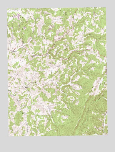
Fellowsville, WV USGS Topographic Map
Click on map above to begin viewing in our Map Viewer.

This topographic map contains these locations and features:
Feature Name Type Latitude Longitude GNIS ID View Map
Blackwood CemeteryCemeteryN39.3640°W79.8131°1536070View Map
Bolyard CemeteryCemeteryN39.3140°W79.7528°1536205View Map
Brocum RunStreamN39.3387°W79.8559°1536383View Map
EvansvillePopulated PlaceN39.3332°W79.8687°1538761View Map
Evansville United Methodist ChurchChurchN39.3357°W79.8748°1538762View Map
Fairview School (historical)SchoolN39.3332°W79.7665°1560099View Map
FellowsvillePopulated PlaceN39.3307°W79.8245°1538915View Map
Fellowsville Assembly of God ChurchChurchN39.3301°W79.8262°1558516View Map
Fellowsville Elementary SchoolSchoolN39.3296°W79.8230°1558517View Map
Fellowsville United Methodist ChurchChurchN39.3320°W79.8237°1558519View Map
Fellowsville Volunteer Fire DepartmentBuildingN39.3290°W79.8274°2577920View Map
Flag Run ChurchChurchN39.3004°W79.7573°1539035View Map
Frog RunStreamN39.3462°W79.7778°1551188View Map
Green Valley School (historical)SchoolN39.2559°W79.7576°1560102View Map
Green Valley United Methodist ChurchChurchN39.2554°W79.7551°1539693View Map
Halpritter School (historical)SchoolN39.3595°W79.7640°1560103View Map
IsraelPopulated PlaceN39.3182°W79.8109°1558570View Map
Jeffry ForkStreamN39.3454°W79.8431°1540854View Map
KanetownPopulated PlaceN39.3665°W79.7642°1549768View Map
Left Fork Little Sandy CreekStreamN39.3298°W79.8248°1551772View Map
Left Fork Sandy CreekStreamN39.2904°W79.8676°1541718View Map
Lyon District (historical)CivilN39.3723°W79.8403°1928307View Map
MarquessPopulated PlaceN39.2984°W79.8509°1549809View Map
Mount Israel United Methodist ChurchChurchN39.3184°W79.8115°1540752View Map
Mount Zion United Methodist ChurchChurchN39.2937°W79.8484°1543839View Map
Mountaineer Ambulance ServiceBuildingN39.3289°W79.8263°2581061View Map
Nazareth CemeteryCemeteryN39.3209°W79.7620°1544063View Map
Nazareth Church (historical)ChurchN39.3209°W79.7626°1560109View Map
Negro HollowValleyN39.2982°W79.8326°1544083View Map
Pleasant ValleyPopulated PlaceN39.3423°W79.7815°1558637View Map
Pleasant Valley ChurchChurchN39.3420°W79.7820°1545034View Map
Red Oak CemeteryCemeteryN39.3223°W79.7556°1545458View Map
Redoak School (historical)SchoolN39.3229°W79.7553°1560110View Map
Ridenour School (historical)SchoolN39.3123°W79.8265°1560111View Map
Right Fork Little Sandy CreekStreamN39.3298°W79.8251°1545668View Map
School Number 16 (historical)SchoolN39.2820°W79.8334°1560114View Map
Scotch HillPopulated PlaceN39.3743°W79.8659°1549916View Map
Scotch Hill School (historical)SchoolN39.3743°W79.8623°1560115View Map
Shays Chapel United Methodist ChurchChurchN39.3698°W79.8017°1546650View Map
Sigley School (historical)SchoolN39.3001°W79.7528°1546769View Map
SinclairPopulated PlaceN39.2682°W79.8206°1549930View Map
Sinclair United Methodist ChurchChurchN39.2668°W79.8237°1558673View Map
StevensburgPopulated PlaceN39.3009°W79.7956°1555710View Map
Sugarcamp RunStreamN39.2609°W79.7545°1553134View Map
Summer School (historical)SchoolN39.3107°W79.8628°1560116View Map
Tibbs RunStreamN39.3268°W79.8145°1548083View Map
Union Church (historical)ChurchN39.3482°W79.7787°1558696View Map
York RunStreamN39.3370°W79.8570°1549460View Map
York Run Pavillion United Methodist ChurchChurchN39.3490°W79.8331°1558719View Map
York Run School (historical)SchoolN39.3551°W79.8312°1560119View Map

Note: Coordinates in the location and feature list above are referenced to NAD83 datum.


Copyright (C) 2008-2025 Ryan Niemi / Sunset Dynamics ... All Rights Reserved