TopoQuest Logo
Do you find TopoQuest useful?
Help keep TopoQuest running and adding new maps/features by donating!
Bitcoin:  19c7KJd3qBynnjoSw5npx9KScwjBe4ifkT
Litecoin:  LXs6TkuXGGXo1vDsWCkWVdjQX94eUKd6ui
Home View Maps Find Maps Find Places Resources & Links


Field Ranch, New Mexico Topographic Map

USGS Map Title: Field Ranch, NM
USGS Map MRC: 34107E4
DRG (GeoTIFF) Download: o34107e4.tif


Neighboring USGS Topographic Map Quads:


  Broom Mountain, NM  
34107F5
 

  Cerro Del Oro, NM  
34107F4
 

  Chicken Mountain, NM  
34107F3
 

  Pueblo Viejo Mesa, NM  
34107E5
 

  Field Ranch, NM  
34107E4
 

  Puerto De Los Cavadores, NM  
34107E3
 

  Table Mountain, NM  
34107D5
 

  Puertecito, NM  
34107D4
 

  La Jara Peak, NM  
34107D3


Map MRC Location:

N35°
W108°
N35°
W107°
H8 H7 H6 H5 H4 H3 H2 H1
G8 G7 G6 G5 G4 G3 G2 G1
F8 F7 F6 F5 F4 F3 F2 F1
E8 E7 E6 E5 E4 E3 E2 E1
D8 D7 D6 D5 D4 D3 D2 D1
C8 C7 C6 C5 C4 C3 C2 C1
B8 B7 B6 B5 B4 B3 B2 B1
A8 A7 A6 A5 A4 A3 A2 A1
N34°
W108°
N34°
W107°

Field Ranch, NM USGS 1:24K Topographic Map Preview:
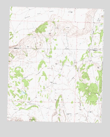
Field Ranch, NM USGS Topographic Map
Click on map above to begin viewing in our Map Viewer.

This topographic map contains these locations and features:
Feature Name Type Latitude Longitude GNIS ID View Map
Bull SpringSpringN34.5803°W107.4209°886894View Map
Cerro PelonSummitN34.5603°W107.3823°898742View Map
Chicken Mountain DrawValleyN34.5789°W107.3928°887503View Map
Coal Oil Johnnie TankReservoirN34.5090°W107.4209°887712View Map
Dog HoleLocaleN34.5428°W107.4412°888425View Map
Dog Hole Water WellWellN34.5426°W107.4417°925565View Map
East TankReservoirN34.6034°W107.4250°888714View Map
Elias SpringSpringN34.5427°W107.4401°888843View Map
Field RanchLocaleN34.5206°W107.4703°889014View Map
Flowing Water WellWellN34.5328°W107.4862°925564View Map
Friday SpringSpringN34.5637°W107.4353°889237View Map
Gag MesaSummitN34.5081°W107.4373°906434View Map
Gag SpringSpringN34.5244°W107.4378°889277View Map
Hippy DrawValleyN34.6103°W107.3814°890031View Map
Middle TankReservoirN34.5967°W107.4476°891982View Map
Ojo Palo BlancoSpringN34.5324°W107.3787°898099View Map
Paint TankReservoirN34.5118°W107.3913°893024View Map
Payne PlaceLocaleN34.5667°W107.3950°898834View Map
Pino PlaceLocaleN34.5703°W107.4456°898838View Map
Ranchito WellWellN34.5139°W107.4025°893649View Map
Red SpringSpringN34.6028°W107.4352°893788View Map
School Section TankReservoirN34.6208°W107.4168°894638View Map
Snake TankReservoirN34.5815°W107.4763°894968View Map
The LakeLakeN34.5128°W107.4879°898175View Map
Tin Can Water WellWellN34.5676°W107.3928°925567View Map
Tin Can WellWellN34.5676°W107.3925°895683View Map
Waterbury DrawValleyN34.5445°W107.4203°896276View Map
Y TankReservoirN34.5922°W107.4680°896796View Map

Note: Coordinates in the location and feature list above are referenced to NAD83 datum.


Copyright (C) 2008-2025 Ryan Niemi / Sunset Dynamics ... All Rights Reserved