TopoQuest Logo
Do you find TopoQuest useful?
Help keep TopoQuest running and adding new maps/features by donating!
Bitcoin:  19c7KJd3qBynnjoSw5npx9KScwjBe4ifkT
Litecoin:  LXs6TkuXGGXo1vDsWCkWVdjQX94eUKd6ui
Home View Maps Find Maps Find Places Resources & Links


Broom Mountain, New Mexico Topographic Map

USGS Map Title: Broom Mountain, NM
USGS Map MRC: 34107F5
DRG (GeoTIFF) Download: o34107f5.tif


Neighboring USGS Topographic Map Quads:


  Blue Mesa, NM  
34107G6
 

  East Mesa, NM  
34107G5
 

  Marmon Ranch, NM  
34107G4
 

  Mecate Meadow, NM  
34107F6
 

  Broom Mountain, NM  
34107F5
 

  Cerro Del Oro, NM  
34107F4
 

  Wiley Mesa, NM  
34107E6
 

  Pueblo Viejo Mesa, NM  
34107E5
 

  Field Ranch, NM  
34107E4


Map MRC Location:

N35°
W108°
N35°
W107°
H8 H7 H6 H5 H4 H3 H2 H1
G8 G7 G6 G5 G4 G3 G2 G1
F8 F7 F6 F5 F4 F3 F2 F1
E8 E7 E6 E5 E4 E3 E2 E1
D8 D7 D6 D5 D4 D3 D2 D1
C8 C7 C6 C5 C4 C3 C2 C1
B8 B7 B6 B5 B4 B3 B2 B1
A8 A7 A6 A5 A4 A3 A2 A1
N34°
W108°
N34°
W107°

Broom Mountain, NM USGS 1:24K Topographic Map Preview:
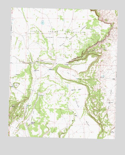
Broom Mountain, NM USGS Topographic Map
Click on map above to begin viewing in our Map Viewer.

This topographic map contains these locations and features:
Feature Name Type Latitude Longitude GNIS ID View Map
AAA TankReservoirN34.6555°W107.6035°885527View Map
Alcon TankReservoirN34.6828°W107.5460°885665View Map
Antelope TankReservoirN34.6723°W107.5443°885793View Map
Apache SpringSpringN34.6833°W107.5047°885842View Map
Bates TankReservoirN34.6853°W107.6179°886110View Map
Blue Water CanyonValleyN34.7103°W107.5234°886527View Map
Blue Water MesaSummitN34.7426°W107.5303°886528View Map
Blue Water TankReservoirN34.6960°W107.5565°886531View Map
Broom MountainSummitN34.6556°W107.6203°923571View Map
Bull Pasture TankReservoirN34.6601°W107.5088°886885View Map
Carter TankReservoirN34.6736°W107.6209°887233View Map
Henderson ReservoirReservoirN34.6390°W107.5981°889902View Map
Henderson Water WellWellN34.6384°W107.5984°918729View Map
Henderson WindmillLocaleN34.6384°W107.5984°889903View Map
North Sanchez TankReservoirN34.6910°W107.5785°892653View Map
Red Windmill TankReservoirN34.6715°W107.5524°893836View Map
Rim TankReservoirN34.6423°W107.5507°893908View Map
Sanchez TankReservoirN34.6657°W107.5899°894492View Map
Seven Cedar Trees MesaSummitN34.6726°W107.6175°894726View Map
Sheep TankReservoirN34.6468°W107.5452°894784View Map
The AlconValleyN34.6828°W107.5456°898160View Map
Upper Boulder Detention DamDamN34.6834°W107.5456°923838View Map
Ward Canyon TankReservoirN34.6895°W107.5963°896250View Map
Ward MesaSummitN34.6942°W107.5853°898706View Map
Ward WindmillLocaleN34.6984°W107.5945°896256View Map
Wiley TankReservoirN34.6858°W107.5156°896612View Map

Note: Coordinates in the location and feature list above are referenced to NAD83 datum.


Copyright (C) 2008-2025 Ryan Niemi / Sunset Dynamics ... All Rights Reserved