TopoQuest Logo
Do you find TopoQuest useful?
Help keep TopoQuest running and adding new maps/features by donating!
Bitcoin:  19c7KJd3qBynnjoSw5npx9KScwjBe4ifkT
Litecoin:  LXs6TkuXGGXo1vDsWCkWVdjQX94eUKd6ui
Home View Maps Find Maps Find Places Resources & Links


Finley Butte, California Topographic Map

USGS Map Title: Finley Butte, CA
USGS Map MRC: 40121C7
DRG (GeoTIFF) Download: o40121c7.tif


Neighboring USGS Topographic Map Quads:


  Shingletown, CA  
40121D8
 

  Manton, CA  
40121D7
 

  Grays Peak, CA  
40121D6
 

  Inskip Hill, CA  
40121C8
 

  Finley Butte, CA  
40121C7
 

  Lyonsville, CA  
40121C6
 

  Dewitt Peak, CA  
40121B8
 

  Panther Spring, CA  
40121B7
 

  Barkley Mountain, CA  
40121B6


Map MRC Location:

N41°
W122°
N41°
W121°
H8 H7 H6 H5 H4 H3 H2 H1
G8 G7 G6 G5 G4 G3 G2 G1
F8 F7 F6 F5 F4 F3 F2 F1
E8 E7 E6 E5 E4 E3 E2 E1
D8 D7 D6 D5 D4 D3 D2 D1
C8 C7 C6 C5 C4 C3 C2 C1
B8 B7 B6 B5 B4 B3 B2 B1
A8 A7 A6 A5 A4 A3 A2 A1
N40°
W122°
N40°
W121°

Finley Butte, CA USGS 1:24K Topographic Map Preview:
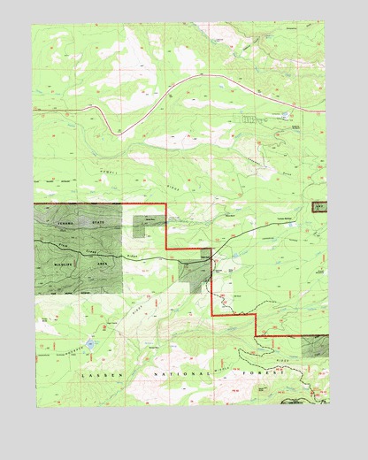
Finley Butte, CA USGS Topographic Map
Click on map above to begin viewing in our Map Viewer.

This topographic map contains these locations and features:
Feature Name Type Latitude Longitude GNIS ID View Map
Black ButteSummitN40.2563°W121.7792°257101View Map
Chapman GulchValleyN40.3332°W121.7905°258208View Map
Dantuma PlacePopulated PlaceN40.2935°W121.8000°1655948View Map
Deadhorse CreekStreamN40.2810°W121.7611°259124View Map
Finley ButteSummitN40.2788°W121.8683°260112View Map
Finley LakeLakeN40.2703°W121.8525°260114View Map
Finley PlacePopulated PlaceN40.2932°W121.7930°1656015View Map
Grapevine CanyonValleyN40.3643°W121.7869°260774View Map
Grapevine SpringSpringN40.3700°W121.7766°260781View Map
High TrestleBridgeN40.2777°W121.8455°261337View Map
HillhouseLocaleN40.2846°W121.7919°261356View Map
Howell RidgeRidgeN40.3260°W121.8342°261580View Map
Judd CreekStreamN40.2693°W121.8225°262033View Map
Lyman SpringsPopulated PlaceN40.3093°W121.7678°1682340View Map
Lyman SpringsSpringN40.3086°W121.7630°263080View Map
Marian PlacePopulated PlaceN40.3099°W121.8214°1656150View Map
McClure PlacePopulated PlaceN40.2674°W121.8253°1656152View Map
Middle Fork Antelope CreekStreamN40.2738°W121.7950°263518View Map
Middle RidgeRidgeN40.2621°W121.7553°263548View Map
Paynes Creek Rod and Gun ClubLocaleN40.3107°W121.8125°1654369View Map
Ponderosa Sky RanchLocaleN40.3435°W121.7686°264925View Map
Ponderosa Sky Ranch AirportAirportN40.3440°W121.7706°1653815View Map
Shake HouseLocaleN40.2979°W121.8005°266033View Map
Snoqualmie GulchValleyN40.3704°W121.7780°267302View Map
South Antelope CampgroundLocaleN40.2535°W121.7586°267402View Map
Wilson RanchLocaleN40.3124°W121.7972°269212View Map

Note: Coordinates in the location and feature list above are referenced to NAD83 datum.


Copyright (C) 2008-2025 Ryan Niemi / Sunset Dynamics ... All Rights Reserved