TopoQuest Logo
Do you find TopoQuest useful?
Help keep TopoQuest running and adding new maps/features by donating!
Bitcoin:  19c7KJd3qBynnjoSw5npx9KScwjBe4ifkT
Litecoin:  LXs6TkuXGGXo1vDsWCkWVdjQX94eUKd6ui
Home View Maps Find Maps Find Places Resources & Links


Manton, California Topographic Map

USGS Map Title: Manton, CA
USGS Map MRC: 40121D7
DRG (GeoTIFF) Download: o40121d7.tif


Neighboring USGS Topographic Map Quads:


  Inwood, CA  
40121E8
 

  Hagaman Gulch, CA  
40121E7
 

  Viola, CA  
40121E6
 

  Shingletown, CA  
40121D8
 

  Manton, CA  
40121D7
 

  Grays Peak, CA  
40121D6
 

  Inskip Hill, CA  
40121C8
 

  Finley Butte, CA  
40121C7
 

  Lyonsville, CA  
40121C6


Map MRC Location:

N41°
W122°
N41°
W121°
H8 H7 H6 H5 H4 H3 H2 H1
G8 G7 G6 G5 G4 G3 G2 G1
F8 F7 F6 F5 F4 F3 F2 F1
E8 E7 E6 E5 E4 E3 E2 E1
D8 D7 D6 D5 D4 D3 D2 D1
C8 C7 C6 C5 C4 C3 C2 C1
B8 B7 B6 B5 B4 B3 B2 B1
A8 A7 A6 A5 A4 A3 A2 A1
N40°
W122°
N40°
W121°

Manton, CA USGS 1:24K Topographic Map Preview:
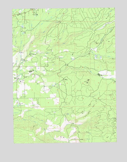
Manton, CA USGS Topographic Map
Click on map above to begin viewing in our Map Viewer.

This topographic map contains these locations and features:
Feature Name Type Latitude Longitude GNIS ID View Map
Bailey CreekStreamN40.4571°W121.8553°256431View Map
Berry CreekStreamN40.4810°W121.8519°219076View Map
Bluff SpringsSpringN40.4021°W121.8131°219548View Map
Brush CreekStreamN40.4588°W121.8686°219926View Map
Camp Digger Butte (historical)LocaleN40.4588°W121.8178°1682370View Map
Canyon CreekStreamN40.4590°W121.7833°257948View Map
Carobe LakeLakeN40.4525°W121.8022°220628View Map
Cross Country DitchCanalN40.4365°W121.8650°221856View Map
Devils GulchValleyN40.3779°W121.8075°222309View Map
Digger ButteSummitN40.4315°W121.7858°222374View Map
Dry GulchValleyN40.4335°W121.7561°259570View Map
Grace LakeLakeN40.4834°W121.8636°224373View Map
Hogs BackRidgeN40.3799°W121.8169°225431View Map
Initial GulchValleyN40.3796°W121.8080°225934View Map
Keswick DitchCanalN40.4868°W121.8364°226540View Map
Long Hay FlatFlatN40.4807°W121.7680°227569View Map
Long RidgeRidgeN40.4071°W121.7878°227603View Map
Love BranchStreamN40.4377°W121.7747°1655130View Map
MantonPopulated PlaceN40.4352°W121.8700°1659048View Map
Manton Census Designated PlaceCensusN40.4202°W121.8540°2408168View Map
Manton Elementary SchoolSchoolN40.4325°W121.8667°1692751View Map
Manton Fire Control StationLocaleN40.4338°W121.8133°228032View Map
Manton Post OfficePost OfficeN40.4346°W121.8710°2760078View Map
Nora LakeLakeN40.4777°W121.8624°229580View Map
Null 1221 DamDamN40.4532°W121.7711°1664258View Map
Rock CreekStreamN40.4552°W121.8575°265493View Map
Rockland School (historical)SchoolN40.4496°W121.7603°1682391View Map
Sand Spring CanyonValleyN40.3943°W121.8003°265815View Map
Sierra SchoolSchoolN40.4943°W121.8672°233095View Map
Soap CreekStreamN40.3857°W121.8189°234799View Map
Spring CreekStreamN40.4660°W121.8217°235238View Map
Tehama County Fire Department Station 18 MantonBuildingN40.4332°W121.8740°2621894View Map
The BurnAreaN40.3952°W121.7528°268177View Map
Union CanalCanalN40.3982°W121.8464°236782View Map
Volta PowerhouseLocaleN40.4590°W121.8655°1654507View Map

Note: Coordinates in the location and feature list above are referenced to NAD83 datum.


Copyright (C) 2008-2025 Ryan Niemi / Sunset Dynamics ... All Rights Reserved