TopoQuest Logo
Do you find TopoQuest useful?
Help keep TopoQuest running and adding new maps/features by donating!
Bitcoin:  19c7KJd3qBynnjoSw5npx9KScwjBe4ifkT
Litecoin:  LXs6TkuXGGXo1vDsWCkWVdjQX94eUKd6ui
Home View Maps Find Maps Find Places Resources & Links


Shingletown, California Topographic Map

USGS Map Title: Shingletown, CA
USGS Map MRC: 40121D8
DRG (GeoTIFF) Download: o40121d8.tif


Neighboring USGS Topographic Map Quads:


  Clough Gulch, CA  
40122E1
 

  Inwood, CA  
40121E8
 

  Hagaman Gulch, CA  
40121E7
 

  Tuscan Buttes NE, CA  
40122D1
 

  Shingletown, CA  
40121D8
 

  Manton, CA  
40121D7
 

  Dales, CA  
40122C1
 

  Inskip Hill, CA  
40121C8
 

  Finley Butte, CA  
40121C7


Map MRC Location:

N41°
W122°
N41°
W121°
H8 H7 H6 H5 H4 H3 H2 H1
G8 G7 G6 G5 G4 G3 G2 G1
F8 F7 F6 F5 F4 F3 F2 F1
E8 E7 E6 E5 E4 E3 E2 E1
D8 D7 D6 D5 D4 D3 D2 D1
C8 C7 C6 C5 C4 C3 C2 C1
B8 B7 B6 B5 B4 B3 B2 B1
A8 A7 A6 A5 A4 A3 A2 A1
N40°
W122°
N40°
W121°

Shingletown, CA USGS 1:24K Topographic Map Preview:
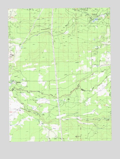
Shingletown, CA USGS Topographic Map
Click on map above to begin viewing in our Map Viewer.

This topographic map contains these locations and features:
Feature Name Type Latitude Longitude GNIS ID View Map
Black ButteSummitN40.4568°W121.9989°233506View Map
Chicken HollowValleyN40.4157°W121.9717°220977View Map
Coleman DamDamN40.4015°W121.9684°1666114View Map
Darrah SpringsSpringN40.4322°W121.9828°1682165View Map
Darrah Springs State Fish HatcheryLocaleN40.4324°W121.9964°222030View Map
Digger CreekStreamN40.4249°W121.9153°222379View Map
Double Creek Ranch AirportAirportN40.4460°W121.8793°1653723View Map
Eagle CanyonValleyN40.4185°W121.9297°222799View Map
Eagle Canyon DamDamN40.4241°W121.9190°1682166View Map
Eagle Canyon DitchCanalN40.4079°W121.9444°222800View Map
Inskip DamDamN40.3955°W121.8832°1666122View Map
Inskip PowerhouseLocaleN40.4010°W121.9639°1654285View Map
Jackass ButteSummitN40.3796°W121.9172°226045View Map
Juniper GulchValleyN40.4202°W121.9739°226390View Map
Long RanchLocaleN40.4046°W121.9880°227593View Map
Macam School (historical)SchoolN40.4060°W121.9797°1682341View Map
Macon SpringsSpringN40.3907°W121.9614°252316View Map
Millseat CreekStreamN40.4418°W121.8769°228773View Map
North Fork Battle CreekStreamN40.4227°W121.9969°229640View Map
Ripley CreekStreamN40.3952°W121.9328°231624View Map
ShingletownPopulated PlaceN40.4924°W121.8892°1659646View Map
Shingletown Post OfficePost OfficeN40.4926°W121.8887°2760052View Map
Shingletown RidgeRidgeN40.4779°W121.9461°233024View Map
Shingletown Sheriff's OfficeBuildingN40.4913°W121.8909°2751024View Map
Sierra School (historical)SchoolN40.4952°W121.9108°1682393View Map
South DitchCanalN40.3990°W121.9214°234955View Map
South Fork Battle CreekStreamN40.4227°W121.9972°234966View Map
South PowerhouseLocaleN40.3954°W121.8794°1654457View Map
Spring CreekStreamN40.3957°W121.9197°235244View Map
Spring GardensSwampN40.4127°W121.9283°235253View Map
Truett 2221 DamDamN40.4865°W121.8978°1664352View Map
Wildcat DamDamN40.4202°W121.9609°237795View Map
Wildcat DitchCanalN40.4221°W121.9708°237796View Map
Willow SpringsSpringN40.4001°W121.9613°1666132View Map
Woodridge LakeReservoirN40.4885°W121.8942°1682169View Map

Note: Coordinates in the location and feature list above are referenced to NAD83 datum.


Copyright (C) 2008-2025 Ryan Niemi / Sunset Dynamics ... All Rights Reserved