TopoQuest Logo
Do you find TopoQuest useful?
Help keep TopoQuest running and adding new maps/features by donating!
Bitcoin:  19c7KJd3qBynnjoSw5npx9KScwjBe4ifkT
Litecoin:  LXs6TkuXGGXo1vDsWCkWVdjQX94eUKd6ui
Home View Maps Find Maps Find Places Resources & Links


Beehive, Montana Topographic Map

USGS Map Title: Beehive, MT
USGS Map MRC: 45109D6
DRG (GeoTIFF) Download: o45109d6.tif


Neighboring USGS Topographic Map Quads:


  Wildcat Draw, MT  
45109E7
 

  Cow Face Hill, MT  
45109E6
 

  Sandborn Creek, MT  
45109E5
 

  Nye, MT  
45109D7
 

  Beehive, MT  
45109D6
 

  Fishtail, MT  
45109D5
 

  Mount Wood, MT  
45109C7
 

  Emerald Lake, MT  
45109C6
 

  Mackay Ranch, MT  
45109C5


Map MRC Location:

N46°
W110°
N46°
W109°
H8 H7 H6 H5 H4 H3 H2 H1
G8 G7 G6 G5 G4 G3 G2 G1
F8 F7 F6 F5 F4 F3 F2 F1
E8 E7 E6 E5 E4 E3 E2 E1
D8 D7 D6 D5 D4 D3 D2 D1
C8 C7 C6 C5 C4 C3 C2 C1
B8 B7 B6 B5 B4 B3 B2 B1
A8 A7 A6 A5 A4 A3 A2 A1
N45°
W110°
N45°
W109°

Beehive, MT USGS 1:24K Topographic Map Preview:
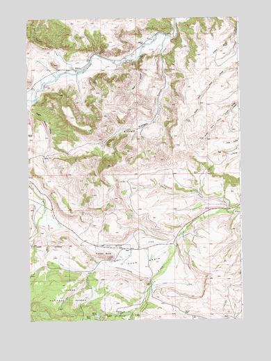
Beehive, MT USGS Topographic Map
Click on map above to begin viewing in our Map Viewer.

This topographic map contains these locations and features:
Feature Name Type Latitude Longitude GNIS ID View Map
04S16E14DCAB01 WellWellN45.4819°W109.7132°809705View Map
04S16E22CABB01 WellWellN45.4713°W109.7413°809659View Map
04S16E23BABA01 WellWellN45.4780°W109.7196°809694View Map
04S17E07DCDD01 WellWellN45.4936°W109.6707°809776View Map
04S17E08CCAC01 WellWellN45.4963°W109.6624°809793View Map
04S17E18AABB01 WellWellN45.4955°W109.6693°809784View Map
04S17E18AADD01 WellWellN45.4908°W109.6660°809761View Map
04S17E18ACAD01 WellWellN45.4883°W109.6707°809747View Map
05S16E03BDCC01 SpringSpringN45.4319°W109.7443°809449View Map
05S16E13AACB01 WellWellN45.4044°W109.6896°809334View Map
05S16E14CDBC01 WellWellN45.3944°W109.7207°809282View Map
05S16E24CDDA01 WellWellN45.3788°W109.6971°809191View Map
Bad Canyon CreekStreamN45.4780°W109.7207°779232View Map
BeehivePopulated PlaceN45.4791°W109.7207°802020View Map
Beehive Post Office (historical)Post OfficeN45.4791°W109.7207°1726877View Map
Beehive RockSummitN45.4924°W109.7185°779654View Map
Beehive School (historical)SchoolN45.4894°W109.6805°779655View Map
Castle Rock CampgroundLocaleN45.4713°W109.7410°794843View Map
Castle Rock Fishing Access SiteLocaleN45.4730°W109.7410°1744524View Map
Dale CreekStreamN45.4255°W109.7418°782060View Map
Dale Creek BridgeBridgeN45.4222°W109.7396°1726917View Map
Dark CanyonValleyN45.4819°W109.6852°782082View Map
DeanPopulated PlaceN45.4047°W109.6905°782167View Map
Dean BasinBasinN45.4008°W109.6824°782168View Map
Dean Post Office (historical)Post OfficeN45.4047°W109.6905°1726880View Map
East Fishtail CreekStreamN45.3783°W109.6896°782796View Map
Fishtail ButteSummitN45.4013°W109.7032°783463View Map
Heart LakeLakeN45.3766°W109.7143°784692View Map
Island LakeLakeN45.3771°W109.7104°785354View Map
Lewis-Hudson-Fowler DitchCanalN45.3924°W109.6796°786079View Map
Magpie CanyonValleyN45.4636°W109.7488°786776View Map
Meadow CreekStreamN45.4088°W109.6629°787131View Map
Midnight CanyonValleyN45.4855°W109.6705°787329View Map
Midnight CreekStreamN45.4919°W109.6655°787330View Map
Sheep CreekStreamN45.4199°W109.6335°790316View Map
West Fishtail CreekStreamN45.3786°W109.6902°792971View Map

Note: Coordinates in the location and feature list above are referenced to NAD83 datum.


Copyright (C) 2008-2025 Ryan Niemi / Sunset Dynamics ... All Rights Reserved