TopoQuest Logo
Do you find TopoQuest useful?
Help keep TopoQuest running and adding new maps/features by donating!
Bitcoin:  19c7KJd3qBynnjoSw5npx9KScwjBe4ifkT
Litecoin:  LXs6TkuXGGXo1vDsWCkWVdjQX94eUKd6ui
Home View Maps Find Maps Find Places Resources & Links


Youngsville, New Mexico Topographic Map

USGS Map Title: Youngsville, NM
USGS Map MRC: 36106B5
DRG (GeoTIFF) Download: o36106b5.tif


Neighboring USGS Topographic Map Quads:


  Laguna Peak, NM  
36106C6
 

  Echo Amphitheater, NM  
36106C5
 

  Ghost Ranch, NM  
36106C4
 

  Arroyo Del Agua, NM  
36106B6
 

  Youngsville, NM  
36106B5
 

  Canones, NM  
36106B4
 

  Jarosa, NM  
36106A6
 

  Cerro del Grant, NM  
36106A5
 

  Polvadera Peak, NM  
36106A4


Map MRC Location:

N37°
W107°
N37°
W106°
H8 H7 H6 H5 H4 H3 H2 H1
G8 G7 G6 G5 G4 G3 G2 G1
F8 F7 F6 F5 F4 F3 F2 F1
E8 E7 E6 E5 E4 E3 E2 E1
D8 D7 D6 D5 D4 D3 D2 D1
C8 C7 C6 C5 C4 C3 C2 C1
B8 B7 B6 B5 B4 B3 B2 B1
A8 A7 A6 A5 A4 A3 A2 A1
N36°
W107°
N36°
W106°

Youngsville, NM USGS 1:24K Topographic Map Preview:
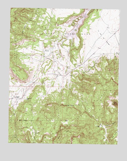
Youngsville, NM USGS Topographic Map
Click on map above to begin viewing in our Map Viewer.

This topographic map contains these locations and features:
Feature Name Type Latitude Longitude GNIS ID View Map
Arroyo HondoStreamN36.2175°W106.5003°903383View Map
Banco LargoRidgeN36.1331°W106.5645°886034View Map
C Serrano CabinLocaleN36.1464°W106.5575°887018View Map
Cedro TankReservoirN36.1908°W106.5213°913991View Map
Cerro PedernalSummitN36.1631°W106.5036°904987View Map
CoyotePopulated PlaceN36.1675°W106.6164°928718View Map
Coyote Census Designated PlaceCensusN36.1616°W106.6067°2584083View Map
Coyote CreekStreamN36.1775°W106.6056°923587View Map
Coyote Post OfficePost OfficeN36.1656°W106.6168°938153View Map
Coyote Ranger StationLocaleN36.1659°W106.6045°900259View Map
Coyote Volunteer Fire DepartmentBuildingN36.1661°W106.6065°2658237View Map
E Serrano CabinLocaleN36.1414°W106.5211°888608View Map
El CerritoSummitN36.1817°W106.5867°888800View Map
El RitoStreamN36.1292°W106.5142°906092View Map
Encino CorralLocaleN36.1417°W106.5206°913994View Map
Encino TrailTrailN36.1350°W106.5717°2038459View Map
Health centers of northern New Mexico Coyote ClinicHospitalN36.1675°W106.6164°901312View Map
La Jolla Trick TankReservoirN36.1959°W106.5173°913990View Map
Mesa NaranjaSummitN36.1945°W106.6220°900260View Map
Pedernal Trick TankReservoirN36.1611°W106.5098°913993View Map
Pinta TankReservoirN36.1662°W106.5317°913992View Map
Rio PuercoPopulated PlaceN36.2109°W106.5845°899876View Map
Rito de las SillasLocaleN36.1353°W106.5936°893977View Map
Rito de las SillasStreamN36.1395°W106.6164°910268View Map
Rito EncinoStreamN36.2128°W106.5745°910299View Map
Temolime CanyonValleyN36.1411°W106.5175°911599View Map
WassonMineN36.1953°W106.5142°916720View Map
YoungsvillePopulated PlaceN36.1875°W106.5564°900007View Map
Youngsville CemeteryCemeteryN36.1952°W106.5588°896836View Map
Youngsville Census Designated PlaceCensusN36.1928°W106.5659°2584242View Map
Youngsville Post OfficePost OfficeN36.1885°W106.5596°2781354View Map
Youngsville Post Office (historical)Post OfficeN36.1875°W106.5564°937579View Map
Youngsville ProspectsMineN36.1820°W106.5131°916762View Map

Note: Coordinates in the location and feature list above are referenced to NAD83 datum.


Copyright (C) 2008-2024 Ryan Niemi / Sunset Dynamics ... All Rights Reserved